US Route 61: The Historic Blues Highway of the Mississippi River
Running as a vital artery through the heart of the American Midwest and South, U.S. Route 61 is more than just a stretch of asphalt. Spanning approximately 1,400 miles (2,300 km), this major highway connects New Orleans, Louisiana, to Wyoming, Minnesota. For much of its journey, the route mirrors the winding path of the Mississippi River and is designated as the Great River Road, offering a scenic and cultural voyage through eight different states.
Before the rise of the modern interstate highway system, US 61 served as a primary north-south connection for travelers and commerce. Today, it remains a symbol of American musical heritage and colonial history, blending the grit of the Delta blues with the natural beauty of the river valley.
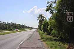
Key Facts
- Total Length: Approximately 1,406.99 miles (2,264.33 km).
- Route Span: From New Orleans, LA, to Wyoming, MN.
- States Traversed: Louisiana, Mississippi, Tennessee, Arkansas, Missouri, Iowa, Wisconsin, and Minnesota.
- Cultural Moniker: Widely known as the "Blues Highway."
- Historical Precursor: Much of the Missouri section follows the Spanish colonial road El Camino Real.
The Cultural Heart of the Blues
US 61 is inextricably linked to the birth and evolution of the blues. Nowhere is this more evident than in Clarksdale, Mississippi. The former junction of US 61 and US 49 is legendary as the "crossroads" where folklore suggests the musician Robert Johnson sold his soul to the Devil in exchange for his extraordinary guitar skills.
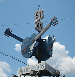
The highway's tragic history also includes the loss of blues icon Bessie Smith, who died in a car crash on this route on September 26, 1937. Because of these deep ties to music, the iconic US 61 road sign has become a powerful marketing symbol for the Clarksdale region, similar to the cultural status of Route 66 in the West.
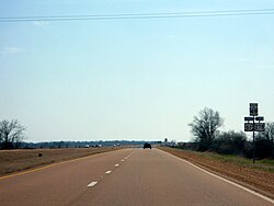
Regional Route Breakdown
The Deep South: Louisiana, Mississippi, and Tennessee
Starting at US 90 in New Orleans, the highway heads north through Louisiana, passing through LaPlace and Baton Rouge. In Mississippi, it traverses the Delta, eventually entering Memphis, Tennessee. In Memphis, the route follows South 3rd Street and E.H. Crump Boulevard before joining I-55 to cross the Mississippi River into Arkansas.
The Heartland: Arkansas and Missouri
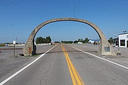
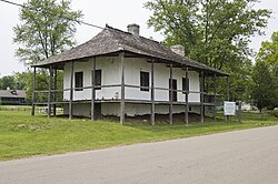
In Arkansas, US 61 runs for 76 miles, overlapping with I-55 for a portion of the trip before branching east near Turrell. Upon entering Missouri, the road passes under a historic 1924 concrete arch. In Missouri, the highway passes through Ste. Genevieve, one of the oldest French Colonial settlements west of the Mississippi (established 1735), and continues through St. Louis via Lindbergh Boulevard.
The North: Iowa, Wisconsin, and Minnesota
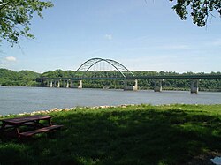
After crossing into Iowa near Keokuk, the highway undergoes various upgrades, including a four-lane freeway bypass around Fort Madison completed in 2011. It crosses the Mississippi River into Wisconsin via the Dubuque-Wisconsin Bridge. In Wisconsin, it travels through Lancaster and Fennimore before reaching La Crosse.
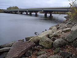
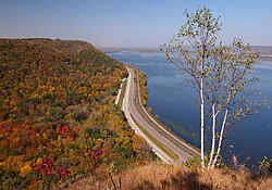
The final leg in Minnesota follows the river through Winona and Red Wing, eventually crossing the Hastings Bridge into St. Paul. The route concludes at an intersection with I-35 in Wyoming, Minnesota. A 120-mile stretch from La Crescent to Cottage Grove is officially named the Disabled American Veterans Highway.
Historical Evolution
The highway was originally longer, extending 1,714 miles from New Orleans to the Canada-US border. However, in 1991, the section north of Duluth was decommissioned as a US highway and redesignated as Minnesota State Highway 61 (MN 61). This northern segment continues into Canada as Ontario Highway 61, ending in Thunder Bay.
In Missouri, the road's path is deeply historical, following the 1776 El Camino Real, a Spanish military road designed to connect district posts for defense and administration. Over the decades, the route has been refined, with many sections replaced by interstates or upgraded to four-lane expressways to accommodate modern traffic.
Route Summary Table
| Feature | Details |
|---|---|
| Southern Terminus | US 90, New Orleans, Louisiana |
| Northern Terminus | I-35, Wyoming, Minnesota |
| Total Distance | ~1,407 miles |
| Primary Geographic Feature | Mississippi River |
| Key Historical Road | El Camino Real (Missouri) |
Frequently Asked Questions
Why is US 61 called the "Blues Highway"?
It is called the Blues Highway because it passes through the heart of the Mississippi Delta, the birthplace of the blues, and is associated with legendary musicians like Robert Johnson and Bessie Smith.
Where is the famous "Crossroads" located?
The legendary crossroads is located in Clarksdale, Mississippi, at the former junction of US 61 and US 49 (North State Street and Desoto Avenue).
Does US 61 still go to Canada?
No. Since 1991, the portion north of Duluth is designated as Minnesota State Highway 61. However, the road continues into Canada as Ontario Highway 61 toward Thunder Bay.
What is the Great River Road?
The Great River Road is a designated scenic route that follows the Mississippi River; US 61 serves as the primary highway for much of this route.
How has the route changed in recent years?
The highway has been shortened from its original 1,714 miles to roughly 1,400 miles, and many sections in Iowa and Missouri have been upgraded from two-lane roads to four-lane freeways or expressways.