TorontoOntario capitalToronto demographicsToronto historyToronto economy

Toronto: The Dynamic Heart of Ontario

Toronto: The Dynamic Heart of Ontario Toronto is the provincial capital of Ontario and the largest city in Canada. A global hub of finance, culture, and diversity, it serves as a critical...

Toronto: The Dynamic Heart of Ontario

Toronto is the provincial capital of Ontario and the largest city in Canada. A global hub of finance, culture, and diversity, it serves as a critical economic engine for North America. From its origins as a strategic military outpost to its current status as a "megacity," Toronto has evolved into a sprawling metropolis known for its skyline, multicultural population, and vibrant urban life.

The city is defined by its motto, Diversity Our Strength, reflecting a population where more than half of the residents identify as visible minorities. This inclusivity is mirrored in its diverse neighborhoods, ranging from the historic Distillery District to the modern high-rises of the Financial District.

Key Facts
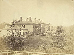
The second Parliament of Upper Canada building on Front Street, 1856
  • Population: Approximately 2,794,356 (2021 Census), with a CMA population of over 6.2 million.
  • Status: Largest city in Canada and 4th largest in North America.
  • Economy: A nominal CMA GDP of CA$ 522.4 billion (2022).
  • Climate: Hot-summer humid continental climate (Dfa).
  • Governance: Single-tier municipality led by a mayor and city council.

History and Evolution
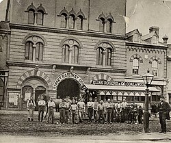
A group in front of a horse-drawn streetcar in front of Yorkville Town Hall 1870. A gas streetlamp is visible in the right foreground.

Toronto was established on August 27, 1793, originally known as the Town of York. Its early years were marked by strategic military importance, including conflicts such as the Battle of York in 1813.

An American squadron exchanging fire with Fort York during the Battle of York, 1813. The American landing is depicted to the west (left foreground).

By 1834, the settlement was incorporated as the City of Toronto. Throughout the 19th century, it became a primary destination for immigrants, fueling rapid growth and the development of early urban infrastructure.
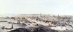
Toronto in 1854. The city was a major destination for immigrants to Canada in the second half of the 19th century.

The city's administrative landscape shifted significantly over time. In 1953, it transitioned from York County to Metropolitan Toronto, and finally, on January 1, 1998, it underwent amalgamation to create the current "megacity," merging the former municipalities of East York, Etobicoke, North York, Old Toronto, Scarborough, and York.
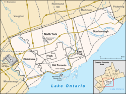
Map of Toronto with major traffic routes. Also shown are the limits of six former municipalities, which form the current City of Toronto.

Geography and Urban Landscape

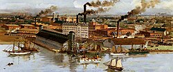
The Gooderham and Worts buildings, 1896

Toronto is situated on the northwestern shore of Lake Ontario. Its topography is characterized by a steady increase in elevation as one moves away from the shoreline, with the city's landscape carved by a complex system of ravines and waterways.
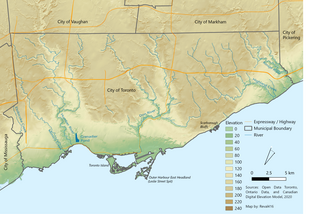
Topographical map of Toronto. The terrain elevation increases steadily away from the shoreline.

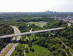
Leaside Bridge crossing the Don valley ravine in 2023. The Toronto ravine system and its waterways cut through the city's landscape.

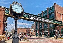
The city's architecture is a blend of eras. Victorian-era bay-and-gable houses are common in older residential areas, while the Distillery District preserves one of North America's most extensive collections of Victorian industrial architecture.
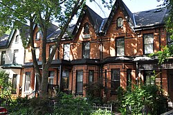
Victorian-era Bay-and-gable houses are a distinct architectural style of residence that is ubiquitous throughout the older neighbourhoods of Toronto.

The Distillery District holds the most extensive collection of preserved Victorian industrial architecture in North America.

To combat suburban sprawl, many outlying neighborhoods were developed with high-density housing, mixing apartment buildings with traditional lots far from the downtown core.
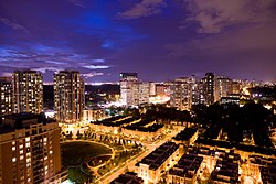
In an attempt to curb suburban sprawl, many suburban neighbourhoods in Toronto encouraged high-density populations by mixing housing lots with apartment buildings far from the downtown core.

Climate and Environment
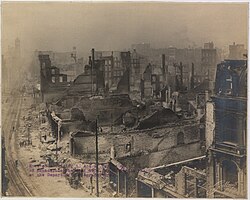
Ruins on Front Street after the Great Toronto Fire of 1904

Toronto experiences a hot-summer humid continental climate. This means residents face significant seasonal variations: hot, humid summers and cold winters with frequent snowfall.
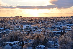
Winters in Toronto are typically cold with frequent snowfall.

The city also manages various environmental challenges, from the flooding caused by Hurricane Hazel in 1954 to severe winter storm complexes.
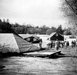
Houses uprooted by flooding of the Humber River after Hurricane Hazel passed through Toronto, 1954

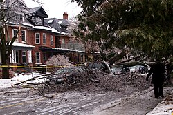
Damage from a fallen tree after the December 2013 storm complex passed through Toronto

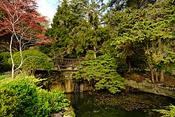
For nature enthusiasts, the city offers expansive green spaces, including the Rouge National Urban Park in Scarborough and the botanical James Gardens.
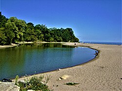
Rouge National Urban Park is a national park in Scarborough

James Gardens, a botanical garden operated by Toronto Parks and Recreation Division

Economy, Education, and Culture

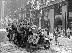
People in Toronto celebrating the Victory in Europe, May 1945

Toronto is the financial heart of Canada, centered around Bay Street. The Financial District houses the operational headquarters of three of Canada's major banks.
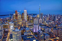
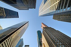
View looking towards Toronto's Financial District

Buildings in the Financial District, including the operational headquarters of three major Canadian banks

Beyond finance, the city is a powerhouse for film production, technology, and biotechnology. It is also a center for higher education, anchored by the University of Toronto, one of the world's leading research institutions.
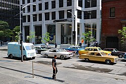
Film production on Wellington Street in 2025

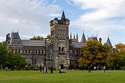
University College on the University of Toronto's St. George campus. University College is one of eleven constituent colleges of the University of Toronto.

Cultural landmarks include the Art Gallery of Ontario, the Royal Ontario Museum, and the Toronto Reference Library, the largest branch of the city's public library system.
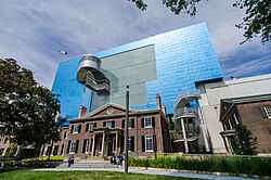
The southern façade of the Art Gallery of Ontario

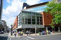
The Toronto Reference Library, the largest branch operated by Toronto Public Library and the de facto main branch of the library system

Sports and Entertainment

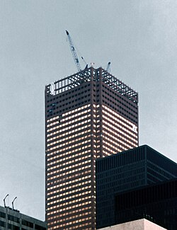
Construction of First Canadian Place, the operational headquarters of the Bank of Montreal, in 1975

Sports are deeply ingrained in Toronto's identity. The city hosts several professional teams across various leagues, utilizing world-class venues like the Rogers Centre, Scotiabank Arena, and BMO Field.

Major Professional Sports Teams in Toronto
Team League Sport Venue
Toronto Maple Leafs NHL Hockey Scotiabank Arena
Toronto Raptors NBA Basketball Scotiabank Arena
Toronto Blue Jays MLB Baseball Rogers Centre
Toronto Argonauts CFL Canadian Football BMO Field
Toronto FC MLS Soccer BMO Field

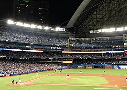
The 2016 American League Wild Card Game played at Rogers Centre. The Toronto Blue Jays use the stadium.

Scotiabank Arena from Bremner Boulevard. The NBA's Toronto Raptors and the NHL's Toronto Maple Leafs play their home games at the arena.

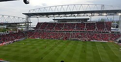
View of BMO Field from the grandstands. The CFL's Toronto Argonauts and MLS' Toronto FC play their home games at the outdoor stadium.

Infrastructure and Transportation

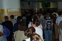
Crowds navigating Union Station during the Northeast blackout of 2003

Toronto's transportation network is one of the most complex in North America. The city operates the largest and busiest streetcar system on the continent, complemented by a comprehensive subway and bus network managed by the Toronto Transit Commission (TTC).
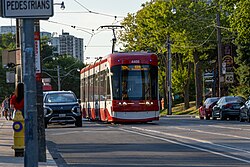
A Flexity Outlook streetcar on Broadview Avenue. The streetcar system is the largest and busiest such system in North America.

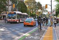
A roadway with bike lanes. Orion VII operated by the Toronto Transit Commission is visible in the background.

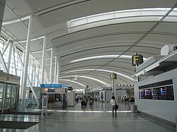
For regional and international travel, Union Station serves as the primary rail hub, while Toronto Pearson International Airport handles the majority of the Greater Toronto Area's air traffic.
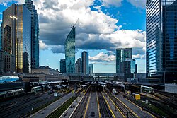
The Union Station Rail Corridor at Union Station. The corridor is used by commuter and intercity rail services.

Interior of Toronto Pearson International Airport's Terminal 1. Toronto Pearson serves as the international airport for the Greater Toronto Area

On the road, Highway 401 is a critical artery; the portion passing through Toronto is recognized as the busiest highway in North America.
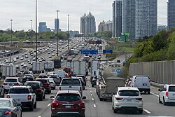
Highway 401 is a 400-series highway that passes west to east through Greater Toronto. Toronto's portion of Highway 401 is the busiest highway in North America.

Frequently Asked Questions
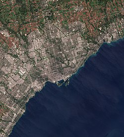
Satellite image of Toronto and the surrounding suburbs in 2018
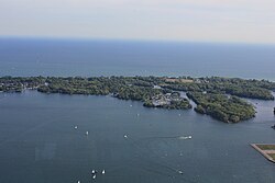
View of the Toronto Islands, an island chain that bounds Toronto's Inner Harbour
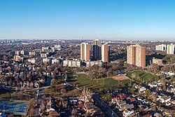
Crescent Town and the surrounding area from the air. Crescent Town was a post-World War II suburban neighbourhood developed in East York.
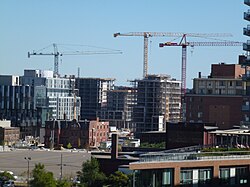
The West Don Lands is a former industrial site in downtown Toronto that has undergone redevelopment.
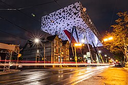
The Rosalie Sharp Centre for Design, an extension of OCAD University's main building
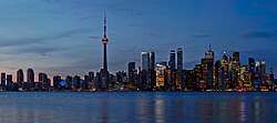
Sunset Toronto Skyline
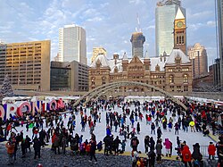
Nathan Phillips Square is the city's main square. The square includes a reflecting pool that is converted into an ice rink during the winter.
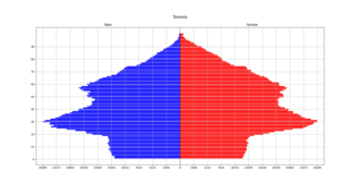
Population pyramid of Toronto from the 2021 Canadian census
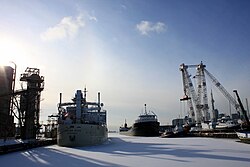
Lake freighters moored in the Port of Toronto
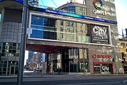
33 Dundas Street East is a former studio complex used by Citytv and Omni Television
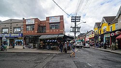
Kensington Market, a neighbourhood that is also partly an outdoor market
The Hockey Hall of Fame is a museum dedicated to ice hockey, as well as a Hall of Fame
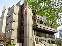
Headquarters for the Toronto District School Board, one of four public school boards that operate in the city
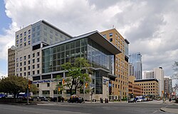
Toronto General Hospital is a major teaching hospital in downtown Toronto
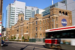
MaRS Discovery District building at College Street. The organization is a medical research trust.
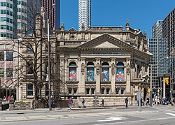
Crowds walk past the Royal Alexandra Theatre during the Toronto International Film Festival
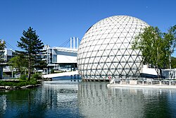
The Cinesphere at Ontario Place
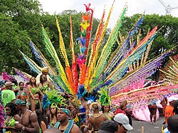
The grand parade for the Caribana festival on Lake Shore Boulevard
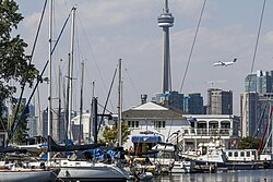
Queen City Yacht Club facilities and piers on the Toronto Islands
A Canadian football game between the Toronto Varsity Blues and the York Lions at York's Alumni Field
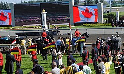
Arrival of Elizabeth II at the 2010 Queen's Plate (later renamed King's Plate upon the accession of her son Charles III) at Woodbine Racetrack
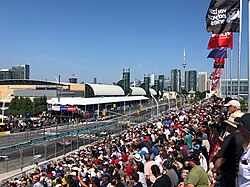
The 2018 Grand Prix of Toronto, an IndyCar Series race formerly held at Exhibition Place
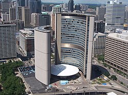
Toronto City Hall is the seat of the municipal government of Toronto
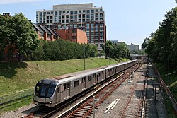
A Toronto Rocket train at Davisville Station

What is the population of Toronto?

As of the 2021 census, the city's population was 2,794,356, while the Census Metropolitan Area (CMA) population reached 6,202,225.

What is the climate like in Toronto?

Toronto has a hot-summer humid continental climate, characterized by warm, humid summers and cold winters with frequent snowfall.

Which professional sports teams are based in Toronto?

Major teams include the Toronto Maple Leafs (NHL), Toronto Raptors (NBA), Toronto Blue Jays (MLB), Toronto Argonauts (CFL), and Toronto FC (MLS).

What is the significance of Bay Street?

Bay Street is the center of Canada's financial district and is home to the operational headquarters of several major Canadian banks.

How did Toronto become a "megacity"?

Toronto became a megacity on January 1, 1998, through the amalgamation of six former municipalities: Old Toronto, North York, Scarborough, Etobicoke, York, and East York.

References

  1. The motto is typically rendered without punctuation, while the city's coat of arms uses typographical bullets to space the words used in the motto. However, some sources from the municipal government of Toronto use punctuation to describe the motto as "Diversity, Our Strength."[3]
  2. Warm-summer (Dfb) before climate change
  3. /təˈrɒnt/ tə-RON-toh;[9] locally [təˈɹɒnoʊ] tə-RON-oh, also [ˈtɹɒnoʊ] TRON-oh[10][11][12]
  4. Humidex, wind chill, average rain, average snow, rain days, snow days, and sunshine are from 1981 to 2010
  5. Maximum and minimum temperature data at The Annex was recorded by human observers from March 1840 to June 2003 under the station name "TORONTO". From July 2003 to present, climate data has been recorded by an automatic weather station under the name "TORONTO CITY".[142]