Eastern Canada: A Comprehensive Overview of the Region's Geography, Population, and Politics
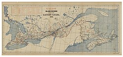
Eastern Canada is a vast and diverse region that encompasses everything from the bustling metropolitan corridors of Ontario and Quebec to the scenic coastal landscapes of the Atlantic provinces. Geographically defined as the area south of Hudson Bay and Hudson Strait and east of Manitoba, this region serves as the heart of Canada's population and economic activity.
While the term "Eastern Canada" is often used broadly, it overlaps with several specific geographic designations. The provinces of Ontario and Quebec are frequently referred to as Central Canada, while New Brunswick, Nova Scotia, and Prince Edward Island are known as the Maritime provinces. Together with Newfoundland and Labrador, these provinces form the region known as Atlantic Canada.
Key Facts
- Composition: Includes Ontario, Quebec, New Brunswick, Nova Scotia, Prince Edward Island, and Newfoundland and Labrador.
- Total Area: Approximately 2,783,400 km².
- Population: Roughly 29.7 million people (as of 2021), representing about 70% of Canada's total population.
- Major Hubs: Home to Canada's capital, Ottawa, and its largest cities, including Toronto and Montreal.
- Time Zones: Spans three time zones: Eastern, Atlantic, and Newfoundland.
Geography and Regional Definitions
The boundaries of Eastern Canada can vary depending on the context. For instance, the Canadian Press defines the region as everything east of and including Thunder Bay, Ontario. This specific definition excludes the more sparsely populated western sections of Northwest Ontario, such as the Rainy River District and parts of the Kenora District.
The region is characterized by significant variations in land use and settlement. While much of the area is vast, the Quebec City–Windsor Corridor stands out as the most densely inhabited and heavily industrialized zone, accounting for nearly 50 percent of the total population.
![Canada population density map (2014)Top left: The Quebec City–Windsor Corridor is the most densely inhabited and heavily industrialized region accounting for nearly 50 percent of the total population[4]](/images/73/38/7338ff5c4211590614f1584487e220ea0cd89896b0ed8e4e3b15d1973bb2f6e3.gif)
Provincial Capitals
Each province within Eastern Canada maintains its own administrative center. The following list outlines the provincial capitals:
- Newfoundland and Labrador: St. John's
- Nova Scotia: Halifax
- Prince Edward Island: Charlottetown
- New Brunswick: Fredericton
- Quebec: Quebec City
- Ontario: Toronto
Demographics and Urban Centers
Eastern Canada is the demographic engine of the country. As of 2021, the region's population reached approximately 29,730,600, with a density of about 10.68 people per square kilometer. The majority of residents are concentrated in the provinces of Ontario and Quebec.
The region hosts three of Canada's five largest metropolitan areas. Toronto, located in Ontario, is a global hub and stands as the fourth largest municipality in North America. Other significant metropolitan areas include Montreal and the National Capital Region (Ottawa-Gatineau).
| City/Region | Province | Approximate Population |
|---|---|---|
| Toronto | Ontario | 6,254,191 |
| Montreal | Quebec | 4,098,927 |
| National Capital Region | ON/QC | 1,568,381 |
| Quebec City | Quebec | 807,200 |
| Hamilton | Ontario | 536,917 |
| London | Ontario | 474,786 |
| Halifax | Nova Scotia | 403,131 |
Political Landscape
The political makeup of Eastern Canada is diverse, though it generally shows strong support for the Liberal Party. However, there are notable regional variations; for example, Central Ontario remains a stronghold for Conservative politics. In the House of Commons, Eastern Canada holds a significant portion of the seats, with 232 Members of Parliament out of the national 338.
The distribution of seats is heavily weighted toward the larger provinces: Ontario holds 122 seats, Quebec holds 78, and the Atlantic provinces collectively hold 32 seats.
Frequently Asked Questions
What is the difference between Eastern Canada and Atlantic Canada?
Eastern Canada is a broad region that includes Ontario and Quebec. Atlantic Canada is a sub-region within Eastern Canada that specifically refers to the provinces of New Brunswick, Nova Scotia, Prince Edward Island, and Newfoundland and Labrador.
Which province in Eastern Canada has the largest population?
Based on 2016 data, Ontario is the most populous province in the region, followed by Quebec.
Where is the capital of Canada located?
The national capital, Ottawa, is located in the province of Ontario within Eastern Canada.
How many time zones are used in Eastern Canada?
The region spans three different time zones: Eastern Time (UTC-05:00), Atlantic Time (UTC-04:00), and Newfoundland Time (UTC-03:30).
What are the Maritime provinces?
The Maritime provinces are a grouping of three provinces in Eastern Canada: New Brunswick, Nova Scotia, and Prince Edward Island.