Scarborough: A Diverse Hub of Culture and History in Toronto
Located in the eastern reaches of Toronto, Ontario, Scarborough is a vibrant administrative district known for its stunning natural landscapes and rich multicultural tapestry. Bordered by Victoria Park Avenue to the west, Steeles Avenue and the city of Markham to the north, the Rouge River and the city of Pickering to the east, and Lake Ontario to the south, the district takes its name from the English town of Scarborough, North Yorkshire, owing to its iconic cliffs.
From its origins as a site for Indigenous settlements to its growth as a collection of rural farms and villages, Scarborough has evolved into a fully urbanized community. It was incorporated as a township in 1850, became a borough in 1967, and achieved city status in 1983 before being amalgamated into the city of Toronto on January 1, 1998.
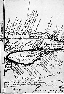
Key Facts
- Population: 629,941 (2021 Census).
- Land Area: 187.70 square kilometres.
- Diversity: 76.6% of the population identify as members of visible minority groups.
- Key Landmarks: The Scarborough Bluffs, Toronto Zoo, and Rouge National Urban Park.
- Education: Home to the University of Toronto Scarborough and Centennial College.
- Motto: "Home Above the Bluffs".
Geography and Natural Landmarks
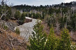
Scarborough is defined by its unique geography, most notably the Scarborough Bluffs, which provide a dramatic coastline along Lake Ontario. The district is also home to the Rouge River Valley, which houses the Toronto Zoo and the expansive Rouge National Urban Park.
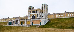
The region's water infrastructure is anchored by the R.C. Harris Filtration Plant, located at the southwest boundary, which supplies the district's drinking water.
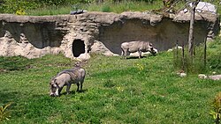
Wildlife and nature are central to the area's appeal, with the Toronto Zoo serving as a major attraction within the river valley.
Demographics and Cultural Diversity
Scarborough is one of the most diverse areas in Canada. As of the 2021 census, the district's population stood at 629,941. The community is characterized by a high percentage of visible minority groups, with South Asian, East Asian, and African communities representing significant portions of the population.
| Panethnic Group | Population | Percentage |
|---|---|---|
| South Asian | 172,880 | 27.72% |
| European | 141,005 | 22.61% |
| East Asian | 111,975 | 17.96% |
| African | 70,655 | 11.33% |
| Southeast Asian | 61,980 | 9.94% |
Religious diversity is equally prominent, with Christianity, Islam, and Hinduism being the most practiced faiths in the district.
Urban Development and Infrastructure
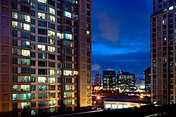
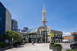
The Scarborough City Centre serves as the district's urban core, featuring a concentration of high-rise condominiums and the Scarborough Town Centre, a major regional shopping destination.
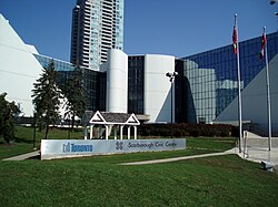
The Scarborough Civic Centre, once the seat of the former city's government, now houses municipal offices for the City of Toronto.
Public Transit and Connectivity
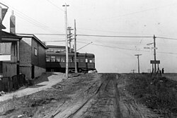
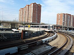
Transit has been a cornerstone of Scarborough's growth since the first line was established in 1893. Current infrastructure includes major roadways like Eglinton Avenue and various rail options.
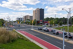
Recent and upcoming transit projects include the extension of Line 2, expected by 2030, and the Line 5 Eglinton light rail, which opened in February 2026. Plans for the Eglinton East LRT aim to further connect Kennedy station to the University of Toronto Scarborough.
Education and Recreation
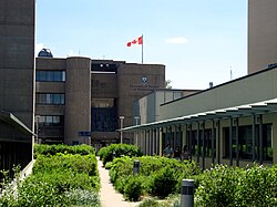
Scarborough offers robust educational opportunities. The University of Toronto Scarborough (est. 1964) hosts over 15,000 students, while Centennial College (est. 1966) was the first vocational college in Ontario.
For secondary education, Agincourt Collegiate Institute (1915) and R.H. King Academy (1922) are among the oldest and most established schools in the area.
Recreation is well-supported by numerous golf courses. These range from the historic Toronto Hunt Club (1895) and Scarboro Golf and Country Club (1912) to public options like Dentonia Park and Tam O'Shanter.
Symbols and Governance
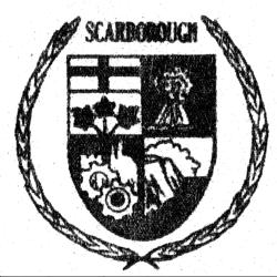
The district's identity is encapsulated in its coat of arms, adopted in 1983. The shield features the arms of Ontario, a sheaf of wheat, industrial cog wheels, and a depiction of the Scarborough Bluffs.
Politically, Scarborough is represented by six councillors across six ridings for both provincial and federal governments.
Frequently Asked Questions
What is the origin of the name Scarborough?
The district was named after the town of Scarborough in North Yorkshire, England, because of the similarity between the English town's cliffs and the local Scarborough Bluffs.
When did Scarborough become part of Toronto?
Scarborough was amalgamated into the present city of Toronto on January 1, 1998, after previously serving as a township, borough, and city.
What are the major post-secondary institutions in the area?
The two primary post-secondary institutions are the University of Toronto Scarborough and Centennial College, the latter being Ontario's first vocational college.
What are the upcoming transit developments in Scarborough?
Key projects include the Line 2 extension (expected around 2030) and the proposed Eglinton East LRT, which will connect Kennedy station to the University of Toronto Scarborough.
How diverse is the population of Scarborough?
Scarborough is highly diverse; according to the 2021 census, 76.6% of its residents identify as members of visible minority groups, with the largest group being South Asian residents.