Isla de Margarita: The Pearl of the Caribbean
Known as the Pearl of the Caribbean, Isla de Margarita is a stunning destination located in the Caribbean Sea. As the primary landmass of the Venezuelan state of Nueva Esparta, this island blends a rich colonial history with diverse natural landscapes, ranging from arid peninsulas to lush mountains and world-class beaches.
Whether it is the duty-free shopping of Porlamar or the historic forts of La Asunción, the island offers a complex tapestry of cultural heritage and geographical variety.

Key Facts
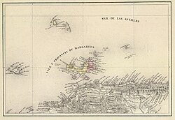
- Location: Caribbean Sea, Venezuela (State of Nueva Esparta).
- Area: 1,020 square kilometers (390 sq mi).
- Highest Point: Cerro Grande (San Juan) at 920 meters (3,020 ft).
- Largest City: Porlamar.
- Climate: Sunny and dry, with temperatures between 24°C and 37°C.
- Status: Established as a duty-free port in 1974.
History and Heritage
The Age of Exploration and Piracy
Christopher Columbus first reached the island in 1498, encountering the native Waikeri people. The island quickly became valuable to the Spanish Crown due to its abundance of pearls, which accounted for nearly a third of all Western Hemisphere tribute. To protect this wealth, the Spanish established the Margarita Province in 1525 and built various fortifications to ward off pirates.
The island's history is marked by dramatic seizures. In 1561, the violent conquistador Lope de Aguirre captured the island, killing Governor Juan Villadrando. Later, around 1675, the pirate Red Legs Greaves reportedly stormed the forts to claim gold and pearls, though some historians view this account as fictional. The Santa Rosa de la Eminencia castle was later ordered by Governor Juan Muñoz de Gadea following an attack by the French buccaneer Marquis de Maintenon in 1676.
The Struggle for Independence
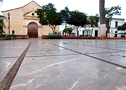
Isla de Margarita played a pivotal role in South American liberation. In 1814, it became the first permanently free territory in Venezuela after gaining independence from Spain. During this era, Luisa Cáceres de Arismendi was imprisoned for over three years in the Fortress of Santa Rosa to pressure her husband, Juan Bautista Arismendi, who fought for independence.
In 1816, Simón Bolívar was confirmed as the Commander-in-Chief of the Second Republic of Venezuela on the island. This served as the launching point for his nine-year campaign to liberate Venezuela, Colombia, Ecuador, Peru, and Bolivia.
Geography and Natural Landscape
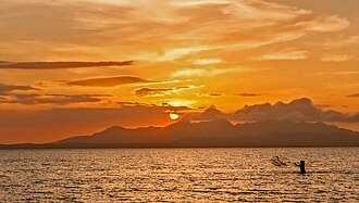
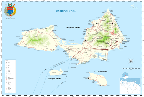
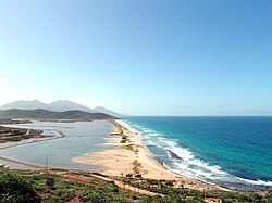
The island is divided into two peninsulas connected by an 18-kilometer (11 mi) isthmus. Together with the islands of Coche and Cubagua, it forms the state of Nueva Esparta.
The Macanao Peninsula
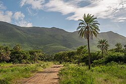
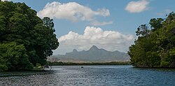
The western Macanao Peninsula is characterized by a central mountain range running east-west, with its highest point at Pico de Macanao (760 meters). This region is more arid and rugged, featuring deep valleys like San Francisco. The peninsula is linked to the east via the La Restinga isthmus, home to the Laguna de La Restinga (also known as Laguna de Arapano), a body of water famous for its mangroves and sightings of pink flamingos.
The Paraguachoa Peninsula
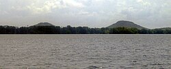
The eastern side is dominated by a north-south mountain range extending from Porlamar to Cabo Negro. This area contains the island's highest elevations, including Cerro Grande (920 m) and El Copey (890 m). Between the two peninsulas lie the Tetas de Maria Guevara, twin breast-shaped hills rising 135 meters above the coastal plain.
Climate and Terrain
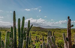
The climate is predominantly sunny and dry, with an average temperature of 32°C (90°F). Rainfall typically occurs between July and October. The terrain varies from the mountainous spines of the peninsulas to extensive salinetas (ancient lagoons formed by sea currents and river contributions) and sandy coasts.
Tourism and Urban Centers
Major Cities
- Porlamar: The largest city and a commercial hub. Its population fluctuates between 85,000 and 125,000 depending on the tourist season. It is located near the Santiago Mariño Caribbean International Airport.
- La Asunción: The state capital and seat of the regional government, overlooked by the Santa Rosa de la Eminencia castle.
- Pampatar: Known for its shopping malls (such as Sambil Margarita) and the 17th-century San Carlos de Borromeo Fortress.
- Juan Griego: The northernmost port in Venezuela, featuring a Gothic-style church and the historic La Galera fortress.
Beaches and Recreation
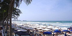
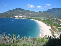
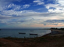
With a coastline of 171 kilometers (106 miles), the island boasts over 70 beaches. Some of the most popular include Playa El Agua, Playa Puerto Cruz, Playa Punta Arenas, and Playa El Yaque.
Administrative Overview
The island is organized into several municipalities, each serving as a center for local administration and commerce.
| Municipality | Capital | Surface (km²) | Population | Density (per km²) |
|---|---|---|---|---|
| Mariño | Porlamar | 39 | 85,942 | 2,203.64 |
| Arismendi | La Asunción | 52 | 23,616 | 454.15 |
| Maneiro | Pampatar | 35 | 35,901 | 1,028.68 |
| Díaz | San Juan Bautista | 166 | 39,491 | 238.04 |
| Península de Macanao | Boca del Río | 331 | 5,205 | 69.26 |
Contemporary Challenges
In recent years, the island has faced significant economic and security challenges. Tourism, once the primary industry, declined by 90% between 2010 and 2020 due to the broader Venezuelan crisis. This decline has coincided with an increase in organized crime. Reports from international agencies and news outlets have identified the island as a hub for illegal drug trafficking and money laundering, citing its duty-free status and weak oversight as contributing factors.
Additionally, the island has seen a rise in violent crime targeting tourists, with several reported murders and robberies between 2010 and 2014 involving visitors from Italy, Britain, France, Belgium, and Germany.
Frequently Asked Questions
Why is Isla de Margarita called the Pearl of the Caribbean?
The nickname stems from the island's history during the Spanish colonial era, when its coasts were abundant in pearls, which provided a significant portion of the tribute paid to the Spanish Crown.
What is the significance of the Tetas de Maria Guevara?
These are twin hills located in the Laguna de La Restinga National Park. Local legends associate them with a woman named María Guevara, either as a revolutionary in the War of Independence or a fishing leader from Cumaná.
Is the island a duty-free zone?
Yes, Margarita Island was established as a duty-free port in 1974 to stimulate the commercial and tourism sectors by offering lower-priced imports.
What are the highest points on the island?
The highest point is Cerro Grande (also known as San Juan) at 920 meters, followed closely by El Copey at 890 meters, both located in the eastern part of the island.
How can visitors reach the island?
The island is accessible via direct flights from Caracas or by ferry services departing from Puerto la Cruz, Cumaná, and La Guaira.