Caribbean islandsWest Indies geographyCaribbean historyCaribbean cultureCaribbean climate

Caribbean Region: Geography, Culture, and History of the West Indies

Exploring the Caribbean: A Comprehensive Guide to the Region The Caribbean is a vibrant and diverse region of the Americas, characterized by its stunning archipelagos, complex history, an...

Exploring the Caribbean: A Comprehensive Guide to the Region

The Caribbean is a vibrant and diverse region of the Americas, characterized by its stunning archipelagos, complex history, and rich cultural tapestry. Spanning an area of approximately 239,681 km², this region is home to over 44 million people, creating a high population density of 151.5 per km². From the turquoise waters of the Lucayan Archipelago to the lush rainforests of the Lesser Antilles, the Caribbean offers a unique blend of geography, biodiversity, and human heritage.
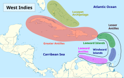
Island groups comprising the West Indies in the Caribbean
: Island groups comprising the West Indies in the Caribbean

Geography and Climate

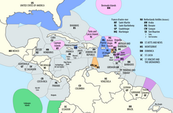
Exclusive economic zones (EEZ) in the Caribbean, with American zones in blue, British in pink, French in purple, Dutch in orange, and Ecuadorian in green

The geography of the Caribbean is defined by its various island groups. These include the Greater Antilles, the Lesser Antilles, and the Lucayan Archipelago. Within the Lesser Antilles, smaller groupings such as the Leeward Islands, Windward Islands, and Leeward Antilles further define the maritime landscape.
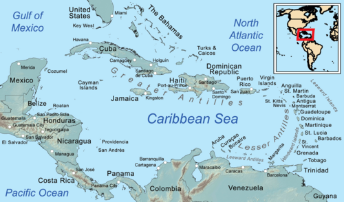
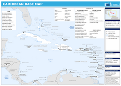
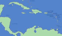
Map of the Caribbean
: Map of the Caribbean

The region's topography is remarkably varied. It ranges from the shallow underwater landforms of the Bahamas and Puerto Rico to the dramatic, pointed Piton peaks in St. Lucia. Coastal areas also include significant continental stretches in countries like Mexico, Venezuela, and Colombia.

Topography and bathymetry in the Caribbean with a 100 m (328 ft) depth contour, delimiting shallow underwater landforms, including the Bahamas, Puerto Rico, and Rosalind banks[32][33]
: Topography and bathymetry in the Caribbean with a 100 m (328 ft) depth contour, delimiting shallow underwater landforms, including the Bahamas, Puerto Rico, and Rosalind banks[32][33]

Climate Patterns

The Caribbean experiences diverse climatic conditions depending on the specific island and latitude. Many areas fall under tropical classifications, which influence local agriculture and lifestyle. For example, San Andrés island features a tropical monsoon climate, while other regions experience varying levels of precipitation and temperature throughout the year.
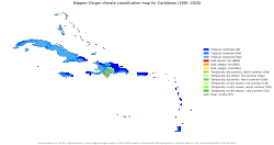
Köppen climate map of the islands of the Caribbean.
: Köppen climate map of the islands of the Caribbean.

Temperature and rainfall vary significantly between locations. In Oranjestad, Aruba, the mean daily maximum stays around 31.5°C (88.7°F) annually, while Havana, Cuba, sees higher record highs reaching up to 38.0°C (100.4°F). Rainfall is also highly seasonal, with some areas seeing peak precipitation during specific months, such as October in San Juan, Puerto Rico.
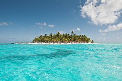
Tropical monsoon climate in San Andrés island, Caribbean, Colombia.
: Tropical monsoon climate in San Andrés island, Caribbean, Colombia.

History and Culture

Political map of Caribbean

The history of the Caribbean is a profound narrative of migration, colonization, and resilience. Long before European contact, the islands were inhabited by Indigenous groups, including the Arawak peoples, such as the Taíno, Lucayan, and Caquetio. These groups left a lasting imprint on the region's linguistic and cultural foundations.
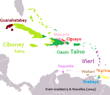
Pre-Columbian languages of the West Indies. Ciboney Taíno, Classic Taíno, and Iñeri were Arawakan, Karina and Yao were Cariban. Macorix, Ciguayo and Guanahatabey are unclassified.
: Pre-Columbian languages of the West Indies. Ciboney Taíno, Classic Taíno, and Iñeri were Arawakan, Karina and Yao were Cariban. Macorix, Ciguayo and Guanahatabey are unclassified.

European contact brought significant political shifts, leading to centuries of colonial rule by various powers. This era shaped the modern political landscape, which now consists of a mix of independent nations, constitutional monarchies, and overseas territories belonging to the United Kingdom, France, the Netherlands, and the United States.
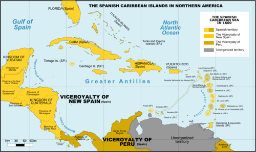
Spanish Caribbean Islands in the American Viceroyalties 1600
: Spanish Caribbean Islands in the American Viceroyalties 1600
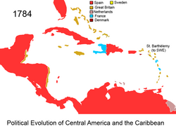
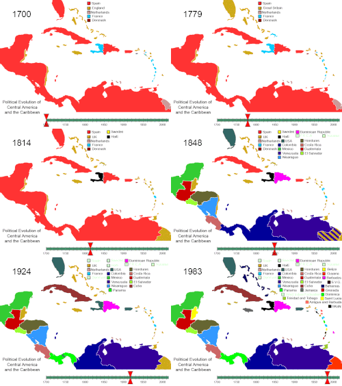
Political evolution of Central America and the Caribbean from 1700 to present
: Political evolution of Central America and the Caribbean from 1700 to present

A Melting Pot of People and Faith

The modern Caribbean is a true melting pot. The population is composed of diverse ethnic groups, including Afro-Caribbean, Indo-Caribbean, White-Caribbean, Mixed-Caribbean, and Indigenous Caribbean peoples. This diversity is reflected in the region's religious landscape, where Christianity (including Catholicism and Protestantism) is the most prominent, alongside Hinduism, Islam, and various folk religions.
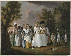
Agostino Brunias. Free Women of Color with Their Children and Servants in a Landscape, Brooklyn Museum
: Agostino Brunias. Free Women of Color with Their Children and Servants in a Landscape, Brooklyn Museum

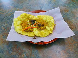
Cultural expression is found in every corner of the islands, from the vibrant Carnival celebrations in Trinidad and Tobago to the unique musical genres and culinary traditions that define each nation. Food, in particular, serves as a vital link to heritage, with national dishes ranging from Jamaica's ackee and saltfish to Cuba's ropa vieja.
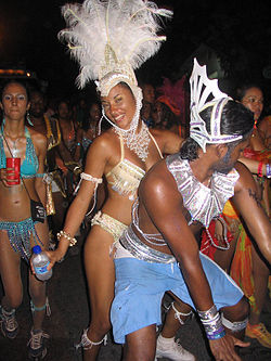
Carnival in Trinidad and Tobago
: Carnival in Trinidad and Tobago
Doubles, one of the national dishes of Trinidad and Tobago
: Doubles, one of the national dishes of Trinidad and Tobago

Key Facts

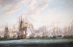
The Battle of the Saintes between British and French fleets in 1782, by Nicholas Pocock
  • Total Area: Approximately 239,681 km².
  • Population: Over 44 million people.
  • Primary Religions: Christianity (73.5%), followed by No Religion (20.6%) and Folk Religions (2.5%).
  • Major Island Groups: Greater Antilles, Lesser Antilles, and Lucayan Archipelago.
  • Diverse Governance: Includes independent republics, constitutional monarchies, and overseas territories.

Regional Overview Summary
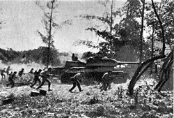
Counter-attack by Cuban Revolutionary Armed Forces supported by T-34 tanks near Playa Giron during the Bay of Pigs Invasion, 19 April 1961.
Quick Reference: Selected Caribbean Countries and Territories
Country/Territory Status Capital Major City/Area
Cuba Independent Republic Havana Santiago de Cuba
Jamaica Independent Constitutional Monarchy Kingston Montego Bay
Puerto Rico U.S. Commonwealth San Juan Ponce
Trinidad and Tobago Independent Republic Port of Spain San Fernando
Dominican Republic Independent Republic Santo Domingo Santiago de los Caballeros
Bahamas Independent Constitutional Monarchy Nassau Freeport

Frequently Asked Questions
ภาพประกอบบทความ
ภาพประกอบจากบทความต้นฉบับ
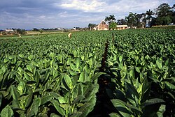
A field in Pinar del Rio planted with Cuban tobacco
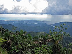
Puerto Rico's south shore, from the Cordillera Central in Jayuya
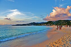
Grand Anse beach, St. George's, Grenada
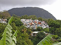
A church cemetery perched in the mountains of Guadeloupe
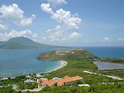
A view of Nevis island from the southeastern peninsula of Saint Kitts
The mostly Spanish-controlled Caribbean in the 18th century
The mostly Spanish-controlled Caribbean in the 16th century
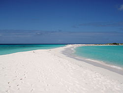
Cayo de Agua, Los Roques Archipelago, Venezuela
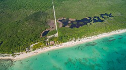
Palancar Beach in Cozumel Island, Mexico
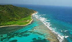
Guanaja Island, Bay Islands, Honduras
Flag of the Caribbean Common Market and Community (CARICOM)
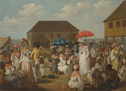
A linen market in Dominica in the 1770s
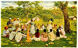
Asian Indians in the late nineteenth century singing and dancing in Trinidad and Tobago
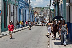
Street scene, Matanzas, Cuba
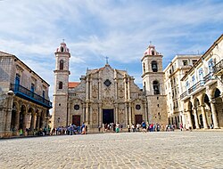
Havana Cathedral (Catholic) in Cuba completed in 1777
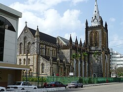
Holy Trinity Cathedral, an Anglican Christian cathedral in Trinidad and Tobago
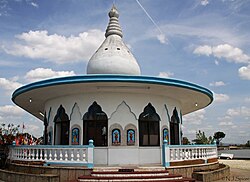
Temple in the Sea, a Hindu mandir in Trinidad and Tobago
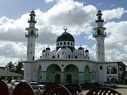
Muhammad Ali Jinnah Memorial Masjid, a Muslim masjid in Trinidad and Tobago
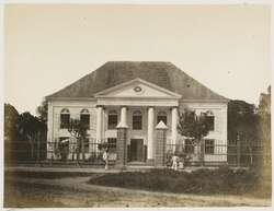
A Jewish synagogue in Suriname
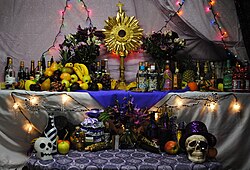
A Haitian Vodou altar
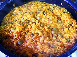
Arroz con gandules, one of the national dishes of Puerto Rico
Plaquita, a Dominican street version of cricket. The Dominican Republic was first introduced to cricket through mid-18th century British contact,[91] but switched to baseball after the 1916 American occupation.[92]

What are the main island groups in the Caribbean?

The Caribbean is primarily divided into the Greater Antilles, the Lesser Antilles, and the Lucayan Archipelago. The Lesser Antilles are further subdivided into the Leeward Islands, Windward Islands, and Leeward Antilles.

How diverse is the religious landscape in the Caribbean?

The region is highly diverse. While Christianity is the largest group (73.5%), including Catholicism and Protestantism, there are significant populations of people with no religion (20.6%), as well as followers of Hinduism, Islam, and various folk religions.

What are some famous landmarks in the region?

Notable landmarks include the Piton peaks in St. Lucia, Harrison's Cave in Barbados, Dunn's Falls in Jamaica, and the historic old city centers of Santo Domingo, Willemstad, and San Juan.

What kind of climate should I expect in the Caribbean?

Climate varies by island. Many areas experience tropical climates with warm temperatures year-round. Some islands have tropical monsoon climates, while others experience distinct wet and dry seasons with varying levels of precipitation.

Which ethnic groups make up the Caribbean population?

The population is a diverse mix of Afro-Caribbean, Indo-Caribbean, White-Caribbean, Mixed-Caribbean, and Indigenous Caribbean ethnic groups.

References

  1. Pronounced /ˌkærɪˈbən, kəˈrɪbiən/ KARR-ih-BEE-ən, kə-RIB-ee-ən, locally /ˈkærɪbiæn/ KARR-ih-bee-an;[4] Spanish: el Caribe; French: les Caraïbes; Dutch: de Caraïben.
  2. The Lucayan Archipelago is excluded from some definitions of "Caribbean" and instead classified as Atlantic; this is primarily a geological rather than cultural or environmental distinction.
  3. Bermuda is an associate member of the Caribbean Community.
  4. 2019 estimate
  5. "World Population Prospects 2022". United Nations Department of Economic and Social Affairs, Population Division. Retrieved July 17, 2022.
Caribbean Region: Geography, Culture, and History of the West Indies | Briefpedia