Exploring the Lesser Antilles: A Guide to the Caribbean's Island Arc
The Lesser Antilles form a stunning, sweeping arc of islands that marks the eastern boundary of the Caribbean Sea where it meets the Atlantic Ocean. Distinct from the larger Greater Antilles to the west, this archipelago is a complex tapestry of volcanic peaks, coral reefs, and diverse political landscapes. From the northern Leeward Islands to the southern Windward Islands and the western Leeward Antilles, this region offers a unique glimpse into the geological and cultural history of the West Indies.
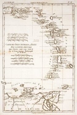
Key Facts
- Total Area: 14,364 km² (5,546 sq mi)
- Total Population: Approximately 3,949,250 (2009 data)
- Political Structure: 8 sovereign states and 17 non-sovereign dependencies.
- Climate: Tropical maritime, characterized by warm temperatures and high humidity.
- Geology: Primarily a volcanic island arc, with some continental islands like Barbados and Trinidad.
Geography and Geological Structure
The Lesser Antilles are geographically organized into three distinct groups based on their position relative to the prevailing trade winds. These winds blow from east to west, meaning the islands that faced the wind first were categorized differently by early sailors.
The Three Main Island Groups
- Leeward Islands: Located in the north, these islands include Anguilla, Saint Kitts and Nevis, and Antigua and Barbuda.
- Windward Islands: Situated to the south, this group includes Dominica, Saint Lucia, and Grenada. They are named "Windward" because they were more exposed to the wind for sailing ships arriving from the east.
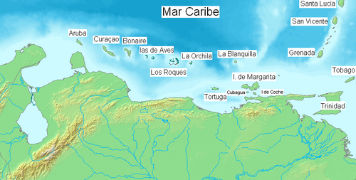
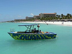
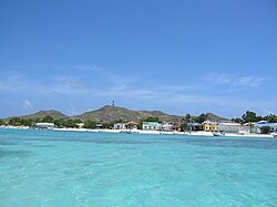
- Leeward Antilles: Located to the west along the Venezuelan coast, this group includes the Dutch ABC islands (Aruba, Bonaire, and Curaçao) and various Venezuelan territories.
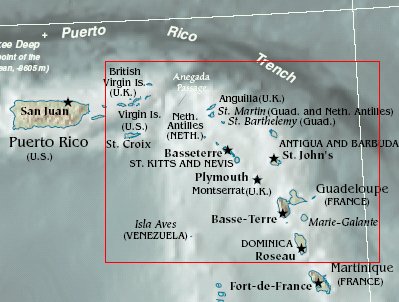
Geologically, the archipelago is a long, partially volcanic island arc. While most islands are part of this volcanic chain stretching from Grenada to Anguilla, some islands are outliers. For example, the Virgin Islands and Sombrero Island are geologically linked to the Greater Antilles, while Trinidad is considered part of the South American continent. Barbados and Tobago are also considered continental islands rather than part of the main volcanic arc.
Climate and Environment
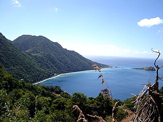
The region enjoys a tropical maritime climate. Because of its proximity to the equator, temperatures remain consistently warm, typically ranging between 26°C and 30°C. High levels of solar radiation and constant evaporation from the surrounding oceans result in relative humidity levels that often exceed 75% annually.
Precipitation is heavily influenced by orography—the effect of mountains on rainfall. As moisture-laden trade winds hit the mountainous islands, the air is forced upward, causing heavy rain on the windward slopes. This creates a "rain shadow" effect, leaving the leeward sides of the mountains significantly drier. Annual rainfall can vary from less than 1,000 mm in low-lying areas to over 4,000 mm in elevated rainforests.
A Journey Through History
Indigenous Roots and the Archaic Age
Long before European arrival, the islands were inhabited by indigenous peoples. The Kalinago were the dominant group in the Lesser Antilles, distinguishing them from the Taíno populations of the Greater Antilles. This cultural boundary was sometimes referred to as the "poison arrow curtain," named after the preferred weapon of the Kalinago used to defend their lands.
Archaeological evidence from the Archaic Age (dating as far back as 7700–6100 B.P.) shows that early inhabitants, such as the Ortoiroid people in Trinidad, relied on stone and bone tools for hunting and fishing. Over time, these communities transitioned into the Neolithic period, developing pottery styles like Huecoid and Saladoid and beginning to cultivate crops like maize, sweet potatoes, and chili peppers imported from the mainland.
European Colonization and Conflict
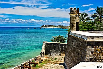
The era of European contact began with Christopher Columbus in 1493. During his second voyage, he discovered several islands, including what he called Deseada (Dominica) and Guadeloupe. Over the following centuries, the archipelago became a battlefield for European powers, including the Spanish, French, Dutch, Danish, and English, all vying for control of the lucrative islands.
The French established a permanent presence in the 1630s, notably in Martinique. Meanwhile, the Spanish maintained control over territories like Trinidad until the British occupied it in 1797. This complex colonial history explains the modern political landscape, where islands are governed by various nations including the UK, France, the Netherlands, the US, and Venezuela.
Modern Political Landscape
Today, the Lesser Antilles is a patchwork of sovereign nations and overseas territories. While eight islands have achieved full independence, many others remain dependencies of larger nations. For instance, Guadeloupe and Martinique serve as official French overseas departments, while Aruba is a constituent country within the Kingdom of the Netherlands.
One notable modern event occurred on the island of Montserrat. In 1995, the Soufrière Hills volcano became active, destroying the capital, Plymouth, and forcing two-thirds of the population to flee the island.
Summary of Political Entities
| Category | Example Entities | Primary Governing Powers |
|---|---|---|
| Sovereign States | Antigua and Barbuda, Barbados, Dominica, Grenada, Saint Kitts and Nevis, Saint Lucia, Saint Vincent and the Grenadines, Trinidad and Tobago | Independent |
| Non-Sovereign Territories | Anguilla, British Virgin Islands, Montserrat | United Kingdom |
| Overseas Departments/Entities | Guadeloupe, Martinique, Saint Barthélemy, Saint Martin | France |
| Kingdom Entities | Aruba, Curaçao, Bonaire, Sint Maarten, Sint Eustatius, Saba | Netherlands |
| Other Dependencies | US Virgin Islands, Nueva Esparta, Federal Dependencies | USA, Venezuela |
Frequently Asked Questions
What is the difference between the Leeward and Windward Islands?
The distinction is based on the prevailing trade winds. The Windward Islands are the southern group that faces the wind first, while the Leeward Islands are located to the north and are more sheltered from those same winds.
Are all islands in the Lesser Antilles volcanic?
Most of the islands in the main arc are volcanic in origin. However, some islands like Barbados and Trinidad are considered continental islands, and the Leeward Antilles consist of a separate island arc accreting to South America.
Which islands are part of the Netherlands?
Several islands are associated with the Netherlands, including Aruba, Bonaire, Curaçao, Saba, Sint Eustatius, and Sint Maarten.
What was the "poison arrow curtain"?
The "poison arrow curtain" was a term used to describe the boundary between the Kalinago people of the Lesser Antilles and the Taíno people of the Greater Antilles, referring to the Kalinago's use of poisoned arrows to defend their territory from invaders.
How many sovereign states are in the Lesser Antilles?
There are eight sovereign states within the Lesser Antilles archipelago.