Geography: The Science of Earth's Landscapes and Human Systems
Derived from the Ancient Greek words gê ('Earth') and gráphō ('write'), geography literally translates to "Earth writing." It is an all-encompassing discipline dedicated to the study of the lands, features, inhabitants, and phenomena of planet Earth. Rather than simply cataloging where objects are located, geography seeks to understand the complexities of the natural and human worlds, exploring how these elements have changed and evolved over time.
Often described as a bridge between the natural and social sciences, geography provides a framework for understanding the interaction between the physical environment and human society. While its primary focus is Earth, many of its core concepts are applied to other celestial bodies within the broader field of planetary science.
![Map of Earth showing both physical features and political boundaries from the 2023 CIA World Factbook[Note 1]](/images/ea/24/ea24771ec9e3a94622090267de5dc9fafad4917c8f93c5f9577bdc7e843cda3e.jpg)
Key Facts
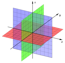
- Interdisciplinary Nature: Acts as a link between natural sciences (like geology) and social sciences (like sociology).
- Core Pillars: The discipline is built upon four consistent concepts: space, place, time, and scale.
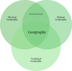
- Main Branches: Divided into physical, human, and technical geography.
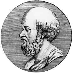
- Ancient Roots: Early spatial understanding dates back to 9th-century BC Babylon, with Greek scholars like Eratosthenes and Ptolemy formalizing the field.
- Modern Tools: Utilizes advanced technologies such as Geographic Information Systems (GIS) and remote sensing.
The Evolution of Geographic Thought
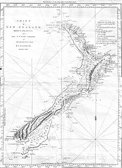
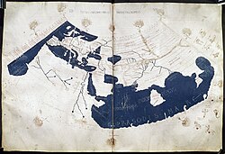
The history of geography is a tapestry of cross-cultural development and trade. Early attempts to map the world began in ancient Babylon around the 9th century BC. However, much of the discipline's conceptual foundation is attributed to Eratosthenes of Cyrene (c. 276 BC – c. 195/194 BC), who is credited with coining the term "geographia." The first recorded use of the word as a book title appeared in the works of the Greek scholar Claudius Ptolemy (100 – 170 AD).
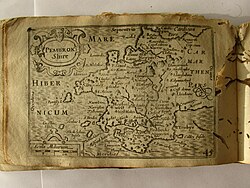
During the Middle Ages, Islamic scholars, most notably Muhammad al-Idrisi, significantly advanced the field by producing highly detailed world maps. The subsequent Age of Discovery further accelerated geographic knowledge as European explorers mapped the "New World." In the modern era, the field has evolved into high-tech disciplines such as geomatics (the science of gathering and managing spatial data) and geographic information science.
The Three Main Branches of Geography
Geography is a broad field that employs both quantitative (numerical) and qualitative (descriptive) approaches, often using mixed methods to gain a complete picture of a phenomenon.
Physical Geography
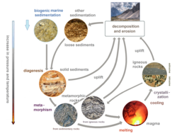
Physical geography focuses on the natural environment. It examines the physical processes that shape the Earth's surface and the systems that sustain life. This includes the study of the rock cycle—the relationship between igneous, sedimentary, and metamorphic rocks—and other natural phenomena.
Human Geography
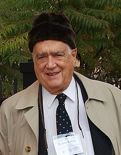
Human geography explores how humans interact with the Earth. It examines the distribution of people, the creation of cultures, and the impact of human activity on the landscape. Scholars like Yi-Fu Tuan have emphasized the importance of language in the creation of "place," distinguishing it from abstract space.
![Yi-Fu Tuan, geographer who foregrounded the importance of language in the making of place[30]](/images/43/99/439996236c37238fe1bcd6812cba5bcbe94589cc8c2983036d00166080c3cf6e.jpg)
Technical Geography
Technical geography focuses on the development of tools and methods used to analyze and visualize geographic data. This branch provides the infrastructure for the other two, ensuring that data is collected and represented accurately.
Methodologies and Tools
Geographers utilize a variety of specialized techniques to gather and interpret data:
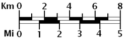
- Cartography: The art and science of map-making. This includes the use of graphical or bar scales to represent real-world distances.
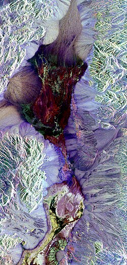
- Remote Sensing: Gathering data from a distance, such as using synthetic aperture radar to image terrain.
- Geographic Information Systems (GIS): Computer systems used for capturing, storing, checking, and displaying data related to positions on Earth's surface.
- Ethnography and Interviews: Qualitative methods used in human geography to understand the lived experiences of people in specific places.
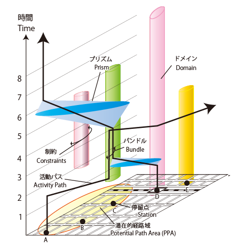
Advanced spatial analysis also involves geostatistics and the study of time geography, which uses concepts like the space-time cube and prisms to visualize how people move through space and time.
Summary of Geographic Disciplines
The following table summarizes the primary divisions of geography and their core focuses.
| Branch | Primary Focus | Common Methods/Tools |
|---|---|---|
| Physical | Natural environment and Earth systems | Geology, Remote Sensing, Field Observation |
| Human | Human-Earth interactions and society | Ethnography, Interviews, Qualitative Cartography |
| Technical | Tools for spatial analysis and mapping | GIS, Geostatistics, Quantitative Cartography |
Frequently Asked Questions
What is the difference between space and place in geography?
While often used interchangeably, space generally refers to the abstract, mathematical, or physical extent of an area, whereas place refers to a specific point on Earth that has been given meaning through human experience and language.
Who is considered the father of the term "geography"?
The Greek scholar Eratosthenes of Cyrene is believed to have coined the term "geographia" around the 3rd century BC.
How is geography used in planetary science?
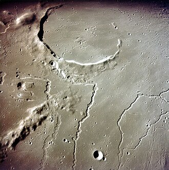
Geographic concepts—such as mapping landforms and analyzing surface features—are applied to other celestial bodies. For example, the study of rilles and craters on the Moon uses principles similar to those used in Earth's physical geography.
What is the "First Law of Geography"?
Proposed by Waldo Tobler, the First Law of Geography suggests that "everything is related to everything else, but near things are more related than distant things," forming the basis for much of modern spatial analysis.
What is the role of GIS in modern geography?
Geographic Information Systems (GIS) allow geographers to layer different types of data (such as population density, elevation, and water sources) onto a single map to identify patterns and relationships that would be invisible in a traditional map.