Fernando de Noronha: Brazil's Volcanic Atlantic Paradise
Located 191 nautical miles (354 km) off the coast of Brazil, Fernando de Noronha is a breathtaking archipelago in the Atlantic Ocean. Part of the state of Pernambuco, this volcanic sanctuary is renowned for its crystalline waters, diverse marine life, and a history that spans from early colonial trade to its current status as a protected ecological treasure.
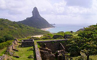
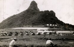
The archipelago consists of 21 islands and islets, covering a total area of 26 square kilometres. Only the main island is inhabited, supporting a small community of residents and a steady stream of eco-tourists. While much of the terrain is low-lying, the landscape is punctuated by dramatic volcanic peaks, most notably Morro do Pico, which rises 323 meters above sea level.
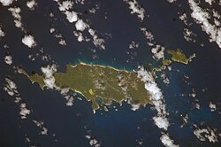
Key Facts
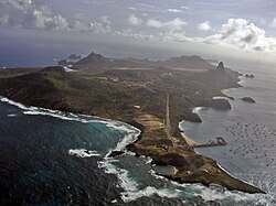
- Location: Pernambuco, Brazil (Atlantic Ocean).
- Status: UNESCO World Heritage Site (designated 2001).
- Highest Point: Morro do Pico (323 meters).
- Conservation: 70% of the area is a national marine park.
- Population: Approximately 3,167 (2022 Census).
- Key Wildlife: Spinner dolphins, sea turtles, sharks, and tuna.
A Complex History of Discovery and Control
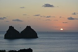
Early Exploration and the "Quaresma" Mystery
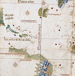
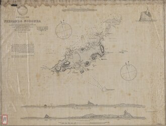
The occupation of Fernando de Noronha dates back to the early 16th century. It was one of the first lands sighted in the New World, appearing on a 1500 chart by Juan de La Cosa and a 1502 map by Alberto Cantino, where it was labeled "Quaresma." Historians debate its exact discovery; some credit a 1501 expedition involving Amerigo Vespucci, while others suggest it was found by João da Nova's Third India Armada. A more recent theory proposes that "Quaresma" actually referred to the Rocas Atoll, placing the official discovery of the main island on August 10, 1503, by the Gonçalo Coelho expedition.
The Era of Brazilwood and Captaincies
The archipelago takes its name from Fernão de Loronha, a Lisbon merchant who held the island as a hereditary captaincy. Between 1503 and 1512, Loronha maintained a commercial monopoly on trade in Brazil. He established a network of feitorias (trading warehouses) along the coast to collect brazilwood—a red dye wood highly prized by European cloth-makers. Fernando de Noronha served as the central collection hub for this lucrative trade before shipments were sent to Europe.
From Prison Island to Protected Sanctuary
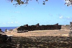
The islands' strategic location eventually led to a darker chapter. In the late 18th century, the archipelago became a site for incarceration. By 1897, the state of Pernambuco took control of the prison, which later served as a political prison between 1938 and 1945. Even as late as 1964, political figures like Miguel Arraes were imprisoned here following a military coup.
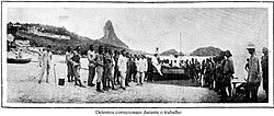
The transition toward conservation began in the late 20th century. In 1988, 70% of the archipelago was designated as a national marine park. In 2001, UNESCO recognized the islands as a World Heritage Site due to their critical role as a feeding ground for marine mammals, sharks, and sea turtles.
Geography and Natural Wonders
Geology and Climate
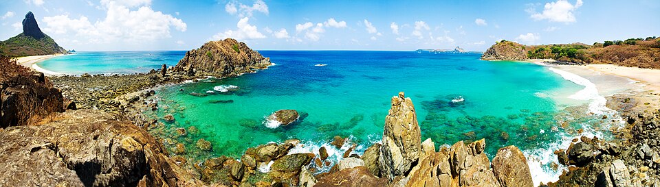
The islands are volcanic in origin, characterized by rugged cliffs and sandy bays. The climate is tropical, with an average annual rainfall of 1,418.4 mm. Temperatures remain consistent throughout the year, with daily means hovering around 26-27°C.
Marine Biodiversity and Tourism
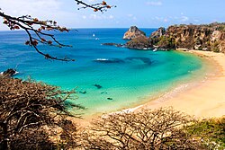
Fernando de Noronha is a premier destination for recreational diving and snorkeling. Thanks to the South Equatorial Current, which brings warm African waters to the islands, divers can often explore depths of 30 to 40 meters without a wetsuit. Underwater visibility is exceptional, sometimes reaching 50 meters.
The most celebrated locations include Sancho Bay, known for its stunning seclusion, and Cachorro Beach. The waters are also a sanctuary for resident spinner dolphins.
Sustainability and the Future
To protect its fragile ecosystem, the archipelago is moving toward total energy independence. The Noronha Verde project, developed by Neoenergia, aims to make the island the first inhabited oceanic island in Latin America to achieve a 100% sustainable energy model. This initiative includes a photovoltaic plant with over 30,000 panels and a 49 MWh battery storage system.
Island Overview Summary
| Category | Details |
|---|---|
| Total Area | 26 km² (Archipelago) / 18.4 km² (Main Island) |
| Population | 3,167 (2022 Census) |
| Highest Point | Morro do Pico (323m) |
| UNESCO Status | Natural World Heritage Site (since 2001) |
| Economy | Tourism, Sustainable Energy, Fishing |
| Time Zone | UTC−02:00 |
Frequently Asked Questions
Who discovered Fernando de Noronha?
The discovery is debated. While some sources point to Amerigo Vespucci or João da Nova in 1501, others believe the island was officially discovered on August 10, 1503, by the Gonçalo Coelho expedition.
Why is the island a UNESCO World Heritage Site?
It was designated in 2001 because of its immense ecological importance, serving as a vital feeding and breeding ground for tuna, sharks, sea turtles, and various marine mammals.
What is the "Noronha Verde" project?
Noronha Verde is a sustainability initiative aiming to make the island 100% renewable. It utilizes a massive solar photovoltaic plant and battery storage to eliminate reliance on non-sustainable energy.
Is a wetsuit necessary for diving in Fernando de Noronha?
Generally, no. Because the South Equatorial Current brings warm water from Africa, diving to depths of 30 to 40 meters is typically comfortable without a wetsuit.
What was the island's role in the brazilwood trade?
Under the captaincy of Fernão de Loronha, the island served as the central collection point for brazilwood harvested along the Brazilian coast before it was shipped to Europe.