Federal Dependencies of Venezuela
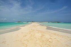
The Federal Dependencies of Venezuela (Spanish: Dependencias Federales de Venezuela) comprise the majority of Venezuela's offshore islands in the Caribbean Sea. Excluding the islands that form the state of Nueva Esparta and certain coastal islands integrated into nearby states, these territories cover a total area of 342 square kilometers. These islands are sparsely populated, with the 2011 Census recording only 2,155 permanent residents, supplemented by seasonal fishers from Margarita Island.
Administratively, these territories are governed by the central government in Caracas, though local leadership often falls to the heads of isolated communities. The region is characterized by its immense biodiversity, strategic maritime importance, and a rich history of colonization and territorial disputes.
Key Facts
- Total Area: 342 square kilometers.
- Population: 2,155 (2011 Census).
- Capital: Gran Roque.
- Composition: Approximately 600 islands and smaller formations.
- Largest Island: La Tortuga, which accounts for nearly half of the total territory.
- Key Territory: The Francisco de Miranda Insular Territory, established in 2011.
History and Colonization
Indigenous Origins
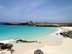
Human presence in the region dates back to approximately 1200 BC. Indigenous Caribs from the mainland, Aruba, or Curaçao are believed to have visited the Los Roques Archipelago—specifically Cayo Sal, Crasquí, and Two Mosquises Sur—to gather salt and food. By 1000 AD, more frequent settlements appeared in Dos Mosquises North, established by farmers and fishermen from the Central Coast. A subsequent migratory wave around 1300 AD brought carriers of Valencioid ceramics to Dos Mosquises Sur.
Spanish and European Influence
During the 16th to 18th centuries, salt was a highly prized resource. Spanish authorities established a customs office at Cayo Sal in the Los Roques archipelago to control these mines. Other European powers also sought a foothold; for instance, the Dutch settled on La Tortuga in 1605 to exploit salt mines before being evicted by the Spanish in 1631.
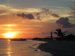
A notable historical event occurred in December 1842, when three corvettes transporting the remains of Simón Bolívar took refuge in Los Roques to escape a storm. Legally, the islands were placed under the jurisdiction of the Captaincy General of Venezuela by a Royal Decree of Charles III in 1777. Following independence and the subsequent secession from Gran Colombia in 1830, Venezuela maintained sovereignty over these territories, a fact officially recognized by Spain in the Treaty of Peace and Friendship of 1845.
Territorial Evolution and Sovereignty
Border Disputes and Treaties
Venezuela's maritime borders have been shaped by various international agreements. The island of Patos was annexed by the British as part of Trinidad, but England recognized Venezuelan sovereignty over it in 1942. Similarly, Aves Island was the subject of a long legal dispute with the United States over guano exploitation; the US recognized Venezuelan sovereignty in 1861, and the Netherlands did so in 1865.
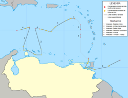
In the late 20th century, Venezuela signed critical maritime boundary treaties (1978) with the United States and the Netherlands, and a subsequent treaty with France in 1983. These agreements defined the current continental shelf and exclusive economic zone in the Caribbean Sea.
Administrative Changes
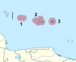
The governance of the islands has evolved from the "Federal Territory Colón" (established in 1871) to the Ley Orgánica de las Dependencias Federales of 1938. In 2011, a new organic law replaced the 1938 legislation, creating the Francisco de Miranda Insular Territory. This new subdivision includes Los Roques, Las Aves, and La Orchila, with its capital at Gran Roque.
Geography and Natural Environment
Island Groups and Topography
The Federal Dependencies stretch 900 km along the coast, from the Los Monjes Archipelago in the west to Patos Island in the east. While many of the 600 formations are simple rocks under 10,000 square meters, others are significant landmasses.
| Island/Archipelago | Surface (km²) | Population (2011) | Location Type |
|---|---|---|---|
| La Tortuga Island | 156.60 | - | Continental Shelf |
| La Blanquilla Island | 64.53 | - | Outside Continental Shelf |
| Los Roques Archipelago | 40.61 | 1,471 | Outside Continental Shelf |
| La Orchila | 40.00 | - | Outside Continental Shelf |
| Los Testigos Islands | 6.53 | 172 | Continental Shelf |
| Aves Island | 0.045 | - | Abyssal |
Ecosystems and Biodiversity
The region is home to diverse marine environments, including barrier reefs in La Orchila and fringe reefs in La Tortuga. The southern reef fronts of Los Roques, La Blanquilla, and the Aves archipelagos feature steep slopes descending to 40 meters.
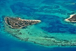
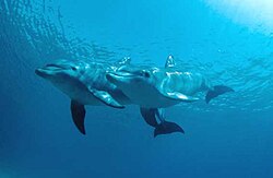
Mangroves serve as critical sanctuaries for endangered species, including sea turtles. The Los Roques National Park is recognized under the Ramsar Convention as a wetland of international importance, promoting the sustainable use of its resources.
Protected Areas
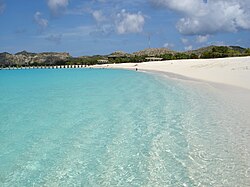
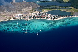
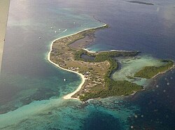
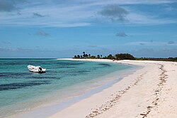
The Los Roques Archipelago National Park, established in 1972, consists of fifty islets and over three hundred keys and sandbanks. It is renowned for its transparent waters, white sands, and high biodiversity.
Frequently Asked Questions
What is the Francisco de Miranda Insular Territory?
Established in 2011, it is a subdivision of the Federal Dependencies that includes the Los Roques Archipelago, the Las Aves Archipelago, and La Orchila Island, with its capital located in Gran Roque.
Which is the largest island in the Federal Dependencies?
La Tortuga is the largest island, accounting for nearly half of the total land area of the Federal Dependencies at 156.60 square kilometers.
How is the territory governed?
The islands are under the direct authority of the National Executive of Venezuela. The Francisco de Miranda Insular Territory is led by a Head of Government appointed by the President of Venezuela.
What is the significance of Aves Island?
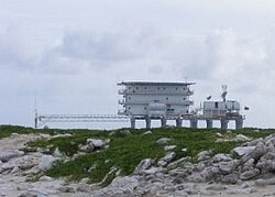
Aves Island is a strategic abyssal island that was the subject of sovereignty disputes with the US and the Netherlands. It currently hosts the Simón Bolívar Naval Scientific Base, established in 1978.
Why is Los Roques Archipelago important?
It is a National Park and a Ramsar-protected wetland known for its immense biodiversity, white sand beaches, and as a vital habitat for various marine species.