Coastal Flooding: Causes, Impacts, and Mitigation Strategies
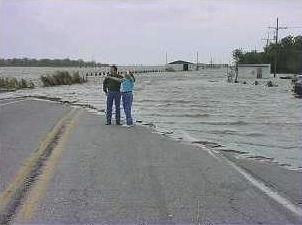
Coastal flooding occurs when seawater submerges dry, low-lying land. The extent of this flooding is primarily determined by the elevation of the floodwater and the topography (the physical features of the land) of the exposed coastal area. Seawater typically reaches inland through direct flooding, the overtopping of barriers, or the breaching of existing defenses.
While coastal flooding is largely a natural phenomenon, its impact has intensified. The combination of climate change—which drives sea level rise and more extreme weather—and a growing human population in coastal zones has increased the vulnerability of millions of people and critical infrastructure.
Key Facts
- Global Population: Over 50% of the global population and 65% of cities with more than five million people reside in the coastal zone.
- Sea Level Acceleration: The average sea level rose by 15–25 cm between 1901 and 2018, with the rate accelerating to 4.62 mm per year from 2013 to 2022.
- Primary Drivers: Melting ice sheets and glaciers (44%) and thermal expansion of water (42%) are the main contributors to sea level rise since 1993.
- Natural Defense: Every four miles of wetland can reduce the height of a storm surge by approximately one foot (30 centimeters).
Causes of Coastal Flooding
Storms and Storm Surges
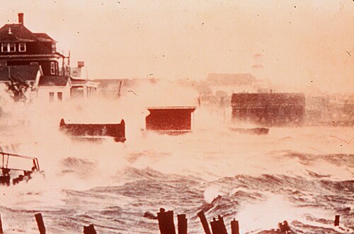
Storm surges are abnormal rises in seawater level during a storm, caused by a combination of wind setup (wind pushing water toward the shore), barometric setup (low pressure allowing water to rise), and wave setup (waves piling up water at the coast). These surges can lead to catastrophic events, such as the 1953 North Sea flood that devastated the Netherlands and England.
Sea Level Rise
Sea levels have been rising since the Last Glacial Maximum roughly 20,000 years ago. Human-induced climate change has accelerated this process. Projections suggest that if greenhouse gas emissions remain high, sea levels could rise by as much as 1.9 meters by 2100. Even modest rises of 0.5 meters or less can increase flood hazard potential by 10 to 1,000 times.
Tidal Flooding
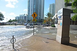
Tidal flooding, or high tide flooding, occurs when unusually high tides—such as spring tides—submerge the land. This is often exacerbated by high winds. In some urban areas, this manifests as "king tides," where flooding occurs even on sunny days.
![High tide flooding, also called tidal flooding, is one of the causes for coastal flooding. It has become much more common in the past seven decades.[12]](/images/2c/16/2c160f5737a7430aa808b3d50a4ace8126706b406128695d5b1f223ef49cfe75.webp)
Tsunami Waves
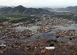
Tsunamis are massive waves typically triggered by underwater earthquakes. These events cause sudden, violent coastal flooding that can lead to immense loss of life and total destruction of coastal villages. A prominent example is the December 26, 2004, Indian Ocean tsunami, which killed an estimated 280,000 to 300,000 people.
Human Influence and Environmental Impact
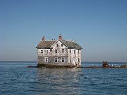
Human modification of the coast often worsens flooding risks. Extracting water from groundwater reservoirs can cause subsidence (the sinking of land), making areas more prone to inundation. Additionally, engineered structures like sea walls can disrupt natural beach processes, leading to increased erosion on adjacent coastlines.
Social and Economic Consequences
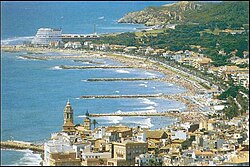
The coastal zone—defined as areas within 100 kilometers of the coast and 100 meters above sea level—is a global economic powerhouse. Because a vast majority of the world's largest cities are located here, coastal flooding threatens a significant portion of the global Gross Domestic Product (GDP) and puts millions of lives at risk.
Flood Control and Mitigation
Engineered and Non-Structural Defenses
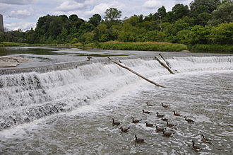
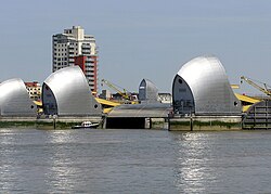
To combat flooding, governments employ various structural defenses. These include weirs to prevent riverine flooding, sea walls, and massive systems like the Thames Barrier in London. Non-structural mechanisms involve land-use planning and early warning systems.
Natural Defenses
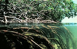
Natural ecosystems provide critical protection. Mangroves, for example, use their high biomass above and below the water to dissipate wave energy and reduce the impact of storm surges.
Case Studies in Coastal Disaster
Hurricane Katrina (New Orleans)
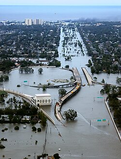
Although Hurricane Katrina made landfall as a Category 3 storm, it produced some of the highest recorded storm surges in North America. The disaster was compounded by the failure of levees and floodwalls. New Orleans' vulnerability was increased by the loss of approximately 1,900 square miles of wetlands since 1930, removing a vital natural buffer.
The 2004 Indian Ocean Tsunami
A magnitude 9.0 earthquake off the coast of Sumatra triggered a tsunami that devastated the Indian Ocean basin. Beyond the human toll, the event destroyed critical natural habitats, including coral reefs, seagrass beds, and mangroves.
| Type of Flood | Primary Cause | Example/Impact | Mitigation Method |
|---|---|---|---|
| Storm Surge | Wind and low pressure | Hurricane Katrina | Wetlands, Levees |
| Tidal Flooding | Spring tides / King tides | Miami "Sunny day" floods | Sea walls, Planning |
| Tsunami | Underwater earthquakes | 2004 Indian Ocean event | Mangroves, Warning systems |
| Sea Level Rise | Climate change / Thermal expansion | Global coastal erosion | Emission cuts, Barriers |
Frequently Asked Questions
What is the difference between a storm surge and tidal flooding?
A storm surge is a rise in sea level caused by the winds and low pressure of a storm system, whereas tidal flooding is caused by the natural astronomical cycles of the tides, such as spring tides.
How does climate change accelerate coastal flooding?
Climate change causes sea levels to rise through the melting of glaciers and ice sheets, as well as the thermal expansion of warming seawater. It also increases the frequency and intensity of extreme weather events that trigger surges.
Why are mangroves considered a natural defense?
Mangroves have dense biomass both above and below the water line, which helps to dissipate the energy of incoming waves and storm surges, reducing the impact on the land behind them.
Can human engineering make coastal flooding worse?
Yes. For example, extracting groundwater can cause the land to sink (subsidence), and building sea walls can redirect wave energy to adjacent areas, increasing erosion and flooding risks elsewhere.
What is the "coastal zone" in terms of geography?
The coastal zone is generally defined as the area within 100 kilometers of the coastline and at an elevation of 100 meters or less above sea level.