Beringia: The Prehistoric Land Bridge Between Asia and North America
Beringia is a prehistoric geographical region that once served as a vital connection between the easternmost reaches of Asia and the westernmost edges of North America. Defined by boundaries stretching from the Lena River in Russia to the Mackenzie River in Canada, and from the Chukchi Sea in the north to the Kamchatka Peninsula in the south, this vast area encompasses what we now know as the Bering Strait, the Chukchi and Bering Seas, Alaska, and the Yukon.
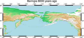
At its peak, Beringia was not merely a narrow crossing but a massive land bridge—up to 1,000 kilometers (620 miles) wide—covering an area roughly equivalent to the combined size of British Columbia and Alberta. This expanse of approximately 1.6 million square kilometers allowed for the biological dispersal of plants, animals, and eventually humans across two continents.
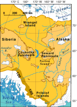
Key Facts
- Maximum Width: Up to 1,000 km (620 mi).
- Total Area: Approximately 1.6 million km² (620,000 sq mi).
- Formation Trigger: Global cooling during the Pleistocene epoch lowered sea levels by more than 50 meters.
- Human Migration: Small populations from Siberia entered the Americas between 23,000 and 21,000 years before present (YBP).
- Final Closure: The land bridge was submerged by rising sea levels approximately 11,000 to 10,000 YBP.
The Geography of a Vanished World
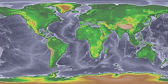
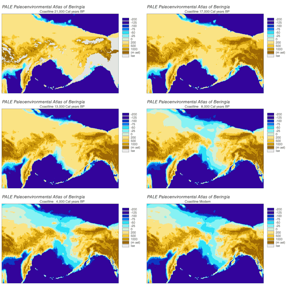
The existence of Beringia was dictated by the Pleistocene epoch, a period characterized by repeated cycles of global cooling and the expansion of massive glaciers. As water became trapped in these ice sheets, global sea levels dropped significantly. Because the average depth of the Bering Strait today is only 40–50 meters (130–160 ft), a drop of more than 50 meters was sufficient to expose the seabed as dry land.
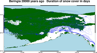
The history of this connection was not constant but intermittent. Research indicates a seaway existed from roughly 135,000 to 70,000 YBP, followed by a land bridge from 70,000 to 60,000 YBP. After a period of intermittent connections, a stable land bridge remained from approximately 30,000 until 11,000 YBP, when the Holocene sea level rise reopened the strait.
Beringia as a Glacial Refugium
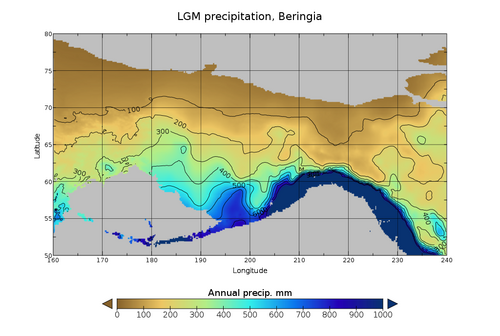
Beringia acted as a refugium—an area where species could survive during a period of unfavorable conditions elsewhere. Between 57,000 and 15,000 YBP, the Siberian edge of the bridge was wetter and colder than the surrounding steppe-tundra. As the region warmed around 15,000 YBP, forage increased for browsers and mixed feeders, triggering significant mammal migrations.
The movement of species into the heart of North America was often blocked by ice. Between 24,000 and 13,000 YBP, the Laurentide and Cordilleran ice sheets fused, creating a barrier. It was only when the Yukon corridor opened between these receding ice sheets around 13,000 YBP that gene flow between Eurasia and continental North America resumed fully before the land bridge vanished.
Human Habitation and the Peopling of the Americas
The migration of Paleo-Indians (Paleolithic hunter-gatherers) is one of the most significant events in human history. It is believed that a small population of a few thousand people arrived from eastern Siberia during the Last Glacial Maximum (26,000 to 19,000 YBP).
These early humans expanded into the Americas between 23,000 and 21,000 YBP, moving south as glaciers melted. By 14,000 YBP—and possibly as early as 20,000 YBP—these populations had spread rapidly across both North and South America. Genetic data, including DNA and blood type distribution, strongly link these indigenous populations to their Siberian ancestors.
The End of an Era and Megafaunal Extinction
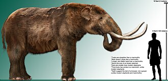
As the Holocene began, the environment shifted. Forest-adapted species moved north from the south, while arid-adapted species faced habitat loss or extinction. One notable example is the Mammut americanum (American mastodon), which became extinct between 12,000 and 9,000 years ago. This extinction is attributed to a combination of climate change and human-related activities.
| Feature/Period | Details |
|---|---|
| Maximum Width | 1,000 km (620 mi) |
| Total Area | 1.6 million km² (620,000 sq mi) |
| Last Stable Bridge | c. 30,000 – 11,000 YBP |
| Human Arrival | c. 23,000 – 21,000 YBP |
| Sea Level Threshold | > 50 meters below current levels |
Frequently Asked Questions
What exactly was Beringia?
Beringia was a prehistoric landmass and maritime region connecting Siberia (Asia) and Alaska/Yukon (North America). It became a land bridge during glacial periods when sea levels dropped.
How did the land bridge form?
During the Pleistocene epoch, global cooling caused water to freeze into massive glaciers, lowering the global sea level by more than 50 meters, which exposed the shallow floor of the Bering Strait.
When did humans first cross into the Americas?
It is believed that small populations of hunter-gatherers arrived from Siberia between 23,000 and 21,000 years before present, eventually spreading throughout the Americas by 14,000 YBP.
What happened to the land bridge?
As the Earth warmed and glaciers melted during the start of the Holocene, sea levels rose, submerging the land bridge approximately 11,000 to 10,000 years ago.
What is a glacial refugium?
A refugium is an area that remains habitable for plants and animals while surrounding regions become uninhabitable due to glaciation or extreme climate change, allowing species to survive and later recolonize other areas.