Atlas History and Evolution: From Renaissance Volumes to Digital Maps
An atlas is a systematic collection of maps, typically focusing on the Earth, a specific continent, or a particular region. While we often think of them as bound books, the concept has expanded significantly with advances in astronomy and technology. Today, atlases can depict the celestial sphere, other planets, or even the intricate structures of human anatomy. Beyond simple geography, modern atlases frequently integrate geopolitical, social, religious, and economic statistics to provide a comprehensive view of the world.
Key Facts
- Definition: A collection of maps representing Earth, celestial bodies, or biological structures.
- Etymology: Named by Gerardus Mercator in 1595 after the Titan Atlas.
- First Modern Atlas: Abraham Ortelius's Theatrum Orbis Terrarum (1570).
- Evolution: Transitioned from custom-bound individual maps to standardized books and digital multimedia.
- Diverse Types: Includes travel, desk, star, and anatomical atlases.
The Etymology and Origins of the Term
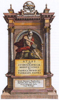
The use of the word "atlas" in a geographical context began in 1595 with the publication of Atlas Sive Cosmographicae Meditationes de Fabrica Mundi et Fabricati Figura by the Flemish geographer Gerardus Mercator. Mercator’s original vision was broader than a mere collection of maps; he intended the work to be a description of the creation and form of the entire universe.
Mercator chose this name as a neologism to honor the Titan Atlas, the "King of Mauretania," whom he regarded as the first great geographer. While his work was a wide-ranging text, subsequent editions evolved into the map collections we recognize today, cementing the term's usage by the mid-17th century.
![The Maghreb (south-up) in Muhammad al-Idrisi's Nuzhat al-Mushtāq (نزهة المشتاق في اختراق الآفاق), also known as the Tabula Rogeriana (12th century).[2]](/images/b4/77/b47797802acf42cf62cff5d09a6babf70e6b3fefc7c7ad0319378b7de1df7893.jpg)
A History of Cartographic Collections
While the Italian cartographer Pietro Coppo prepared a systematic arrangement of uniform maps in the early 16th century, his work was never published. Consequently, the title of the first modern atlas is traditionally awarded to Abraham Ortelius and his 1570 publication, Theatrum Orbis Terrarum (Theatre of the Orb of the World).
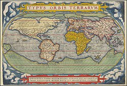
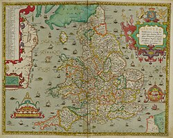
The production of atlases in the 16th through 19th centuries differed greatly from modern methods. Rather than purchasing a finished, bound book, customers often selected individual map components from shelves. These maps could be customized with coloring or gilding before being bound together. This meant that two atlases with the same title page could actually contain different contents based on the buyer's preferences. It was not until the 19th century that states began the systematic production of national atlases.
Common Types of Atlases
Atlases are categorized based on their intended use and subject matter:
Travel and Desk Atlases
A travel atlas (often called a road map) is designed for portability, frequently utilizing spiral bindings so they can fold flat. These are often produced at specific scales: national atlases in Europe typically range from 1:250,000 to 1:500,000, while city atlases may range from 1:20,000 to 1:25,000.
In contrast, a desk atlas is designed for reference, appearing in hardback or paperback formats similar to a standard textbook.
Specialized Subject Atlases
- Star Atlases: These map the celestial sphere, focusing on major named asterisms (patterns of stars).
- Planetary Atlases: These depict the planets and their satellites within our solar system.
- Anatomical Atlases: These map the organs and structures of the human body or other organisms.
Summary of Notable Atlases Through the Ages
| Era | Notable Examples | Key Figures/Regions |
|---|---|---|
| 16th - 17th Century | Theatrum Orbis Terrarum; Atlas Sive Cosmographicae... | Abraham Ortelius; Gerardus Mercator |
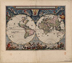
| 17th Century | Atlas Maior; Atlas Novus | Joan Blaeu (Netherlands) |
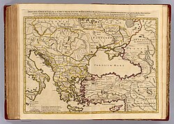
| 18th Century | Atlas Nouveau; Britannia Depicta | Amsterdam; London |
| 19th Century | Rand McNally Atlas; Times Atlas of the World | USA; United Kingdom |
| 20th - 21st Century | National Geographic Atlas; Atlas Mira | Global/Various |
Frequently Asked Questions
What is the difference between an atlas and a map?
A map is a single representation of an area, whereas an atlas is a collection of many maps, often organized by theme, region, or scale.
Who created the first modern atlas?
The title is conventionally awarded to the Brabantian cartographer Abraham Ortelius for his 1570 work, Theatrum Orbis Terrarum.
Can an atlas contain more than just geography?
Yes. Many atlases include statistical data regarding economics, religion, social structures, and geopolitics, as well as descriptive information about the places depicted.
What is a star atlas?
A star atlas is a specialized cartographic tool used in astronomy to map the celestial sphere and identify major asterisms.
How have atlases changed in the digital age?
While traditionally bound books, many modern atlases are now available in multimedia and digital formats, allowing for interactive and highly detailed exploration.