Andes Mountains: The World's Longest Continental Range
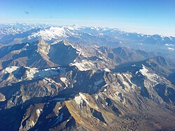
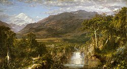
The Andes (Spanish: Cordillera de los Andes; Quechua: Anti) constitute the longest continental mountain range on Earth. Forming a continuous highland along the western edge of South America, this massive system stretches approximately 8,900 kilometers (5,500 miles) from north to south. Spanning seven countries—Argentina, Bolivia, Chile, Colombia, Ecuador, Peru, and Venezuela—the range varies in width from 200 to 700 kilometers (120 to 430 miles), with its widest point located between 18°S and 20°S latitude.
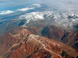
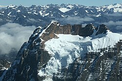
With an average height of about 4,000 meters (13,000 feet), the Andes are the highest mountains outside of Asia. They are characterized by a rugged relief of parallel cordilleras, high plateaus, and deep intermontane valleys that create some of the most extreme environments on the planet.
Key Facts
- Length: 8,900 km (5,500 mi), the longest continental range in the world.
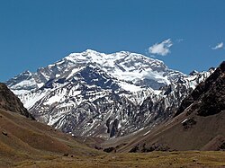
- Highest Peak: Aconcagua in Argentina, reaching 6,961 m (22,838 ft).
- Global Extremes: Chimborazo (Ecuador) is the point on Earth farthest from the center; Ojos del Salado is the world's highest volcano.
- Biodiversity: Home to roughly 30,000 vascular plant species and nearly 1,000 amphibian species.
- Countries: Argentina, Bolivia, Chile, Colombia, Ecuador, Peru, and Venezuela.
Geography and Regional Divisions
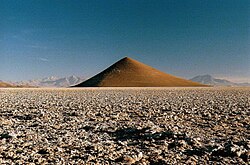
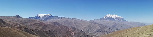
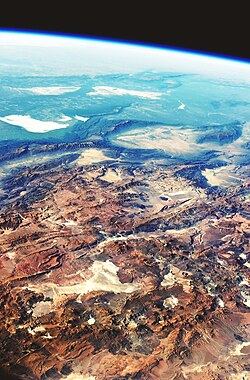
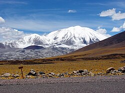
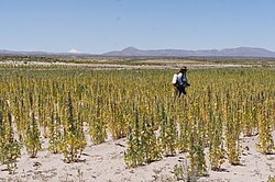
The Andes are divided into three primary sections: the Southern Andes (Argentina and Chile, south of Llullaillaco), the Central Andes (Bolivia and Peru), and the Northern Andes. The range encompasses diverse ecological zones, from the humid cloud forests of the eastern slopes to the arid high plains of the Altiplano (a high-altitude plateau) and the glaciated peaks of the south.
These environmental gradients have historically shaped human civilization, leading to the establishment of major highland cities such as Bogotá, Cusco, La Paz, and Quito. La Paz, Bolivia's seat of government, holds the distinction of being the highest capital city in the world at approximately 3,650 meters (11,975 feet).
Geology and Seismic Activity
The formation of the Andes is the result of the Andean orogeny, a process of mountain building caused by tectonic uplift and plate subduction. The range features several oroclines (bends in the mountain axis), most notably the Bolivian Orocline at 18°S, where the range shifts from a northwest orientation in Peru to a southward trend in Chile and Argentina.
The region is seismically active, experiencing shallow intraplate earthquakes within the South American Plate. In the Peruvian Andes, these events manifest through normal, strike-slip, and reverse mechanisms. Additionally, the Amazonian Craton is actively underthrusted beneath the sub-Andes region of Peru, creating thrust faults.
Climate and Hydrology
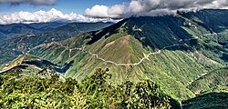
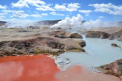
Climate in the Andes is dictated by latitude, altitude, and proximity to the ocean. The northern region is generally warm and rainy, while the central section is arid. The southern section is characterized by cool, rainy conditions. Temperature and atmospheric pressure drop significantly as elevation increases.
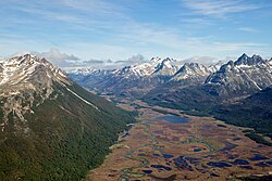
The snow line (the altitude above which snow remains year-round) varies drastically. In the tropical north, it sits between 4,500 and 4,800 meters. However, in the far south, it drops to 300 meters in Tierra del Fuego, where several large glaciers descend all the way to sea level.
Flora and Fauna
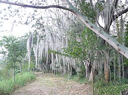
The Andes are a global biodiversity hotspot. Approximately 30,000 species of vascular plants reside here, with nearly half being endemic. Notable plants include the Cinchona pubescens, the source of quinine used to treat malaria, and the endangered Polylepis forests (known locally as Queñua or Yagual), which grow at altitudes up to 4,500 meters.

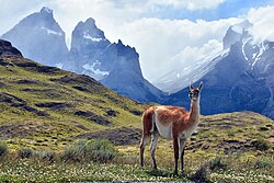
The range is equally vital for animal life, particularly amphibians, with nearly 1,000 species (two-thirds endemic). Other wildlife includes approximately 600 mammal species, 1,700 bird species, and 600 reptile species.
Summary of Andean Peaks and Regions
The following table highlights some of the most significant peaks across the various countries of the range.
| Country/Border | Peak Name | Elevation (m) | Notable Feature |
|---|---|---|---|
| Argentina | Aconcagua | 6,961 | Highest in Western Hemisphere |
| Chile/Argentina | Ojos del Salado | 6,893 | Highest volcano in the world |
| Peru | Huascarán | 6,768 | Highest peak in Peru |
| Ecuador | Chimborazo | 6,268 | Farthest point from Earth's center |
| Bolivia | Nevado Sajama | 6,542 | Highest peak in Bolivia |
Frequently Asked Questions
Which is the highest mountain in the Andes?
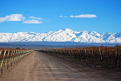
Aconcagua, located in Mendoza, Argentina, is the highest peak in the Andes and the highest mountain in the Western Hemisphere, reaching an elevation of 6,961 meters (22,838 feet).
Why is Chimborazo significant despite not being the highest peak?
Due to the equatorial bulge caused by the Earth's rotation, the peak of Chimborazo in Ecuador is the point on the Earth's surface that is farthest from the Earth's center.
What is the Altiplano?
The Altiplano is a high-altitude plateau located in the Central Andes, primarily in Bolivia and Peru, known for its arid high plains.
How does the climate vary across the range?
The climate changes based on latitude and altitude: the northern Andes are typically warm and rainy, the central section is dry, and the southern section is cool and rainy.
What are some important crops that originated in the Andes?
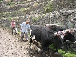
Potatoes and tobacco are two of the most important global crops that originated from the Andean region.