Valparaíso: The Jewel of the Pacific
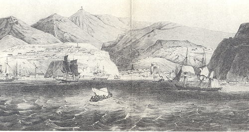
Perched on the coast of Chile, Valparaíso is a city of vibrant colors, steep hills, and a deep maritime legacy. Known affectionately as "Valpo" or "The Jewel of the Pacific," this historic port city is celebrated for its unique urban layout and its status as a UNESCO World Heritage Site. From its bustling harbor to the winding alleys of its hills, Valparaíso blends colonial history with a bohemian spirit.
Founded in 1536 and named after Valparaíso de Arriba in Spain, the city has evolved into a major cultural and economic hub. Its residents, known as Porteños, live in a city defined by its dramatic geography, where the urban center meets the Pacific Ocean at an elevation of just 10 meters.
Key Facts
- UNESCO Status: The historic quarter was inscribed as a World Heritage Site in 2003.
- Population: The commune has a population of 284,938 (2024), with a larger metro area exceeding 1 million people.
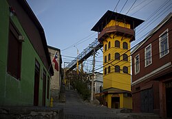
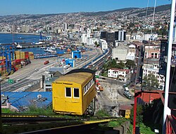
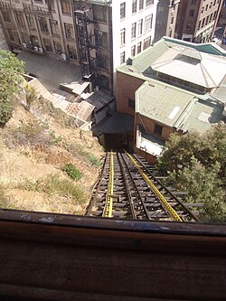
- Geography: Famous for its cerros (hills) and ascensores (funiculars).
- Economy: Driven by its strategic port and a thriving tourism sector.
- Climate: A Mediterranean-style climate (Csb) with mild temperatures and seasonal rainfall.
History and Urban Evolution
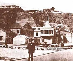
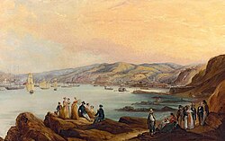
Valparaíso's history is marked by its role as a critical stop for ships traveling between the Atlantic and Pacific oceans. During the 19th century, it flourished as a global commercial center, attracting immigrants and architects from around the world.
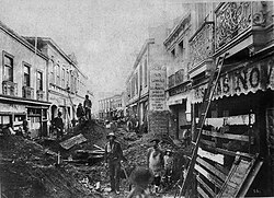
However, the city's growth has been punctuated by natural disasters. A devastating earthquake in 1906 significantly altered the city's landscape, leading to periods of reconstruction and modernization.
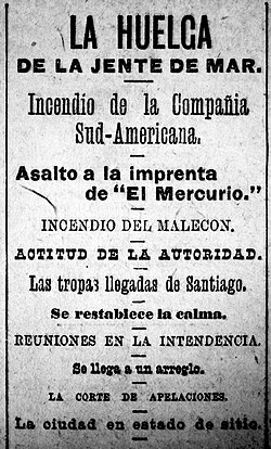
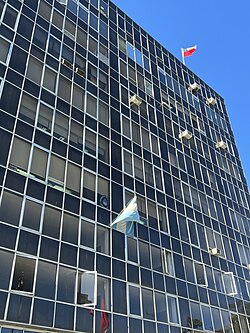
By the 20th century, the city maintained its importance through its port and the establishment of key cultural institutions, such as the newspaper El Mercurio de Valparaíso, which has documented the city's social and political upheavals for generations.
Geography and Climate
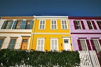
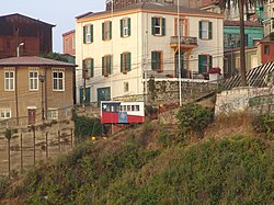
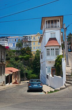
The city is characterized by a rugged coastline and steep hills that overlook the bay. This terrain has necessitated creative transport solutions and resulted in a colorful, tiered architectural style.
The climate is generally mild. At the Punta Angeles Lighthouse, the mean daily maximum temperature in January is approximately 21.9°C, while July sees a mean of 16.3°C. Precipitation is concentrated in the winter months, with June typically being the wettest month, averaging 106.1 mm of rainfall.
| Metric | Summer (Jan) | Winter (Jul) | Annual Average |
|---|---|---|---|
| Mean Max Temp (°C) | 21.9 | 16.3 | 19.2 |
| Mean Min Temp (°C) | 13.6 | 8.1 | 10.7 |
| Avg Precipitation (mm) | 0.2 | 66.7 | 363.2 |
Cityscape and Landmarks
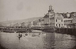
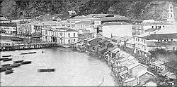
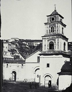
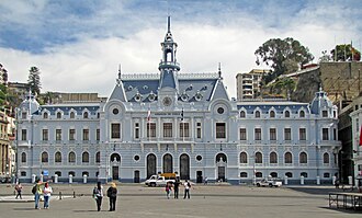
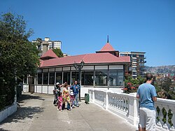
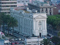
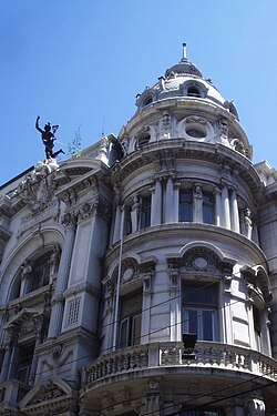
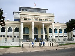
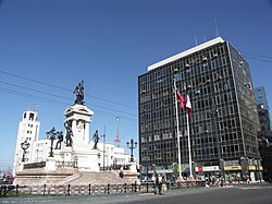
The Historic Quarter is the heart of the city's cultural appeal. This area includes the Iglesia de la Matriz, Sotomayor Square, and the Edificio Armada de Chile. The city is also famous for its ascensores—funicular railways that transport residents and tourists up the steep hills.
Notable landmarks include:
- Cerro Alegre and Cerro Concepción: Historic districts known for their architecture and boutiques.
- Cerro Bellavista: Home to the "Museo a Cielo Abierto" (Open Air Museum).
- La Sebastiana: The former home of poet Pablo Neruda.
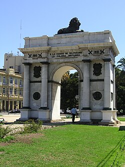
- British Arch: A monument reflecting the city's historical ties to the United Kingdom.
Transport and Infrastructure
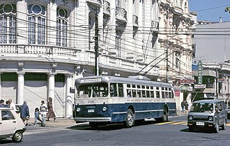
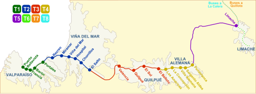
Due to its verticality, Valparaíso employs a diverse range of transport. Beyond the iconic funiculars, the city is served by the Metro Valparaíso and historic trolleybuses, some of which remained in service into the early 2020s.
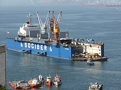
The Port of Valparaíso remains one of the most important maritime gateways in Chile, facilitating international trade and supporting the local economy.
Education and Culture
Valparaíso is a center for higher learning, hosting several prestigious institutions:
- Federico Santa María Technical University (est. 1931)
- Pontifical Catholic University of Valparaíso (est. 1925)
- Playa Ancha University of Educational Sciences (est. 1948)
- University of Valparaíso (est. 1981)
The city's cultural richness is further evidenced by its museums, including the National Maritime Museum and the Municipal Museum of Fine Arts at the Palacio Baburizza.
Frequently Asked Questions
![The "Broadcasting Building" of the Parque Cultural de Valparaíso (PCdV) which has been established on a former prison's ground on Cerro Cárcel[65][66]](/images/0f/e5/0fe567910bea840c991053a48356c31a027e9f428d5978e53515d57f9fe6635a.jpg)
What is the significance of the funiculars in Valparaíso?
The funiculars, or ascensores, are essential transport systems that allow people to navigate the city's steep hills (cerros), connecting the lower port area to the residential neighborhoods above.
Why is Valparaíso a UNESCO World Heritage Site?
It was recognized in 2003 for its unique urban design, which adapted to a challenging topography, and its history as a major port that influenced the development of the South Pacific.
What is the typical weather in Valparaíso?
The city has a Mediterranean climate with mild temperatures year-round. Summers are dry and warm, while winters are cooler and bring the majority of the annual rainfall.
Who are the Porteños?
Porteños is the demonym used to describe the people who are born or live in the city of Valparaíso.
What are the most famous hills to visit?
Cerro Alegre and Cerro Concepción are the most popular for tourists due to their well-preserved architecture, art galleries, and scenic views of the bay.