Tobago: A Caribbean Haven of History and Natural Beauty
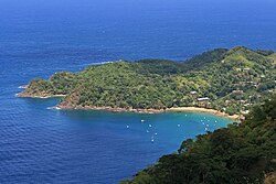
Tobago, officially known as the Ward of Tobago, is a stunning island located in the southeastern Caribbean. Situated 35 kilometres (20 nautical miles) northeast of Trinidad and approximately 160 kilometres (85 nautical miles) off the coast of Venezuela, it serves as a serene counterpart to its larger neighbor. From its tumultuous colonial past to its current status as a tourist destination, Tobago offers a rich tapestry of cultural and natural heritage.
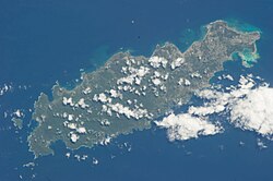
Key Facts
- Capital: Scarborough
- Official Language: English (Vernacular: Tobagonian Creole)
- Area: 300 square kilometres
- Population: 60,735 (2011 Census)
- Governance: Autonomous administrative division with the Tobago House of Assembly
- Unique Record: Changed hands 33 times during the colonial era, the most in Caribbean history
The Deep History of Tobago
Indigenous Roots
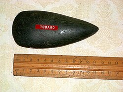
Long before European arrival, Tobago was inhabited by Indigenous peoples. The Ortoiroid cultural tradition settled the island between 3500 and 1000 BCE. By the first century CE, the Saladoid people arrived, introducing agricultural staples such as cassava, sweet potatoes, Indian yam, tannia, and corn, along with pottery-making. Over centuries, these traditions evolved through the influence of the Barrancoid and Troumassoid cultures.
A Focal Point of Colonial Conflict
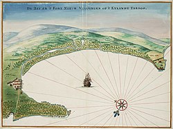
Christopher Columbus first sighted Tobago on August 14, 1498, though he did not land. The subsequent centuries were marked by extreme volatility. Starting with Dutch settlers in 1628 who established Nieuw Walcheren and the fort of Nieuw Vlissingen, the island became a prize for various European powers.
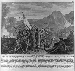
The Curonians, Dutch, English, French, Spanish, and Swedish all fought for control. This struggle resulted in the island changing ownership 33 times before the Treaty of Paris finally ceded it to the British in 1814. During periods of English rule in the late 17th century, a plantation economy emerged, relying on the forced labor of imported Africans to produce sugar, cotton, and indigo.
Path to Independence
The 19th century saw the decline of the sugar trade due to the abolition of slavery in 1834, a devastating hurricane in 1847, and international competition. In 1889, Tobago became a ward of Trinidad. The island later faced another major setback in 1963 when Hurricane Flora destroyed numerous crops and villages, prompting a shift toward economic diversification and the birth of the tourism industry. Trinidad and Tobago gained independence from Britain in 1962 and became a republic on August 31, 1976.
Geography and Climate
Tobago is approximately 40 kilometres long and 10 kilometres wide. Its tropical climate is characterized by two distinct seasons: a wet season from June to December and a dry season from January to May. The island is particularly vulnerable to tropical cyclones due to its location south of the Atlantic Main Development Region.
| Metric | Dry Season (Jan-May) | Wet Season (Jun-Dec) | Annual Average |
|---|---|---|---|
| Mean Daily Max Temp | ~30.2°C to 31.7°C | ~30.7°C to 31.5°C | 31.0°C |
| Mean Daily Temp | ~26.3°C to 28.1°C | ~27.4°C to 27.8°C | 27.3°C |
| Precipitation | Lower (Min: 21.4mm in Mar) | Higher (Max: 266.9mm in Jul) | 1,774.2mm |
Demographics and Society
The population of Tobago is primarily of African descent (85.3% as of 2011), with smaller percentages of Mixed (8.5%), Dougla (a term for people of mixed Indian and African descent, 4.2%), and Indian (2.5%) ancestry. The island is predominantly Christian, with Protestantism being the most common denomination.
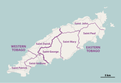
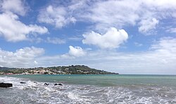
The capital, Scarborough, serves as the primary urban center. While the island was historically divided into seven parishes, it is now managed as an autonomous administrative division with its own legislature, the Tobago House of Assembly.
Economy and Attractions
Tourism and Recreation
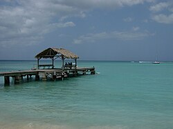
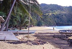
Tobago is renowned for its pristine beaches and world-class diving. The Maverick Ferry, a 350-foot wreck sunk off Rocky Point, is a premier site for divers, attracting diverse marine life including the 4-foot jewfish. Other popular spots include Pigeon Point and the tranquil shores of Castara.
Cinema and Art
The island served as the filming location for Disney's Swiss Family Robinson (1960). Locations included Richmond Bay and the Craig Hall Waterfalls. A famous treehouse was built in a 200-foot saman tree in Goldsborough Bay; although the structure was destroyed by Hurricane Flora in 1963, the tree still stands today.
Nature and Wildlife
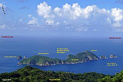
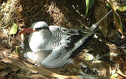
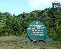
From the bird sanctuaries of St Giles Island to the red-billed tropicbirds of Little Tobago, the island is a haven for ecology enthusiasts.
Culture and Cuisine
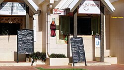
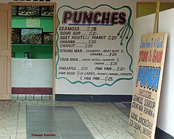
Tobagonian culture is a vibrant blend of its African roots and colonial influences. This is most evident in its cuisine, featuring staples like Crab and Dumplings, as well as traditional drinks such as Pacro Water and Sea Moss.
The island has produced numerous notable figures in sports, politics, and the arts, including footballer Dwight Yorke, singer Calypso Rose, and former politician A.N.R. Robinson.
Frequently Asked Questions
Why is Tobago known for changing hands so many times?
Due to its strategic location in the Caribbean, multiple European powers—including the Dutch, English, French, Spanish, and Swedish—competed for control of the island, leading to 33 changes in sovereignty before 1814.
What is the "Dougla" ethnic group?
Dougla is a term used in the region to describe people of mixed African and East Indian ancestry.
What is the best diving spot in Tobago?
The Maverick Ferry wreck is widely considered the best diving site, offering a 350-foot structure teeming with marine life, including groupers and rays.
How is Tobago governed?
Tobago is an autonomous administrative division of Trinidad and Tobago, governed locally by the Tobago House of Assembly.
Where can I find the Swiss Family Robinson tree?
The original saman tree used for the film's treehouse is located in Goldsborough, just off Windward Road, on the property of Roberts Auto Service and Tyre Shop.