San Andrés Island: A Caribbean Gem of Colombia
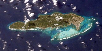
Located deep in the Caribbean Sea, San Andrés is the largest island of a Colombian archipelago that includes Providence and Saint Catherine. Situated approximately 750 km (470 mi) northwest of the Colombian mainland, this tropical paradise is more than just a tourist destination; it is a complex blend of African, European, and Indigenous influences. In 2000, the region was designated as the Seaflower Biosphere Reserve by UNESCO, protecting a massive marine area of 300,000 km² to preserve its extraordinary biodiversity.
Key Facts
- Location: Caribbean Sea, 750 km northwest of mainland Colombia.
- Status: UNESCO Biosphere Reserve (Seaflower Biosphere Reserve).
- Languages: San Andrés Creole, English, and Spanish.
- Ethnic Group: Raizal (descendants of African and European settlers).
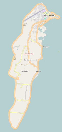
- Highest Point: Cerro La Loma (El Cliff).
- Key Wildlife: The critically endangered San Andrés vireo.
A Turbulent and Diverse History
The history of San Andrés is a chronicle of colonial competition, piracy, and resilience. While Spanish mapping began in the 16th century—with records suggesting Christopher Columbus encountered the islands during his fourth voyage—the islands saw a rotating door of occupants.
Colonial Shifts and Piracy
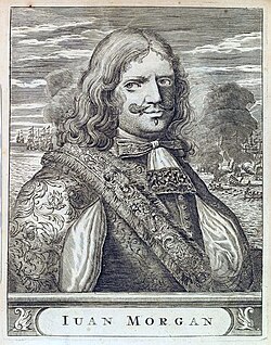
By the early 17th century, English Puritans from Barbados and England settled the islands, evicting Dutch settlers in 1631. These colonists eventually moved toward Providence Island for better water resources and safety. From 1633, enslaved people were brought from Jamaica to work in cotton, tobacco, and lumbering. The islands were a magnet for privateers, including the famous Welsh pirate Henry Morgan.
The Path to Colombian Sovereignty
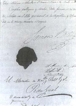
Control shifted between England and Spain throughout the 18th century. In 1802, inhabitants requested to depend on the Viceroyalty of New Granada. Following the independence movements of 1810 and the influence of Simón Bolívar, the islands became part of Gran Colombia in 1822.
The 20th century solidified Colombian rule, despite attempts by the United States to suggest the islands join Panama. The 1928 Esguerra-Bárcenas Treaty saw Nicaragua recognize Colombian sovereignty, though this remained a point of international dispute into the 21st century. In 2007, the International Court of Justice (ICJ) reaffirmed Colombia's full sovereignty over San Andrés, Providence, and Saint Catherine.
Geography and Natural Environment
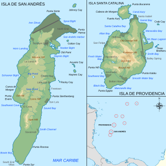
San Andrés is a relatively flat island, measuring 13 km (8.1 mi) in length and 3 km (1.9 mi) in width. Its volcanic origins have left the island with fertile red clay soil and small deposits of quartz. The landscape is dominated by grass, trees, and sandy coastlines, with the highest elevation reaching 84 meters (276 ft) at Cerro La Loma.
Climate and Weather
The island enjoys a tropical climate with consistent temperatures. Daily means typically hover around 27°C to 28°C (80°F to 82°F). Precipitation is highest between June and November, with October seeing the most significant rainfall, averaging 323.8 mm.
Flora, Fauna, and Biodiversity
The island is a critical habitat for several endemic species. Most notable is the San Andrés vireo (Vireo caribaeus), a small green bird listed as critically endangered due to urban expansion. Its habitat is now largely confined to a small area in the south.
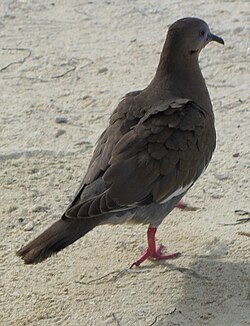
Other notable bird species include the white-winged dove (Zenaida asiatica) and several endemic subspecies of warblers, mockingbirds, and bananaquits.
Culture and Demographics
The population has grown significantly, reaching an estimated 75,000. While the Raizal people—descendants of the original African and European settlers—maintain the island's unique cultural identity, a large influx of people from mainland Colombia now makes up about two-thirds of the population.
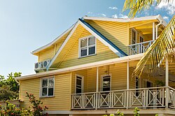
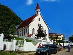
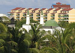
This cultural melting pot is reflected in the architecture and religion, where Baptist churches and mosques coexist alongside traditional Caribbean homes.
Tourism and Local Attractions
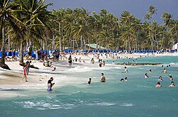
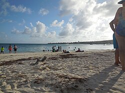
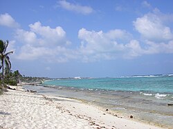
Tourism is a primary economic driver, with hundreds of thousands of visitors arriving annually to enjoy the "sea of seven colors."
Must-Visit Sites
- Johnny Cay: A popular coral islet and one of the most visited spots in the archipelago.
- La Piscinita: A calm, fish-rich area ideal for snorkeling.
- Hoyo Soplador: A natural blowhole where seawater can shoot up to 20 meters (66 ft) high.
- The Pond (La Laguna): A freshwater lake atop a hill, home to white herons and brown caimans.
- Morgan's Cave: A site linked to Henry Morgan, featuring a museum and underwater passage.
Water Sports
Diving is highly popular due to excellent visibility (10–30 meters) and diverse underwater formations, including seaweed walls, coral reefs, and marine plateaus at depths ranging from 3 to 30 meters.
Island Summary
| Feature | Detail |
|---|---|
| Total Archipelago Area | 57 km² (including cays and reefs) |
| San Andrés Island Area | 26 km² |
| Primary Languages | Creole, English, Spanish |
| UNESCO Status | Seaflower Biosphere Reserve (since 2000) |
| Highest Peak | Cerro La Loma (84m) |
Frequently Asked Questions
Who are the Raizal people?
The Raizal are the native islanders of San Andrés and Providencia, descended from the African and European settlers who first inhabited the archipelago.
What is the Seaflower Biosphere Reserve?
It is a UNESCO-declared reserve established in 2000 that encompasses the islands and approximately 10% of the Caribbean Sea to protect its rich marine biodiversity.
Is San Andrés part of Colombia?
Yes, it is a Department of Colombia, although its sovereignty was historically contested by Nicaragua until a 2007 ruling by the International Court of Justice.
What is the best activity for water lovers on the island?
Diving and snorkeling are highly recommended, particularly at La Piscinita for calm waters and West View for varying depths and marine life.
Which bird species is most at risk on the island?
The San Andrés vireo (Vireo caribaeus) is critically endangered due to the loss of its mangrove and scrub bush habitat.