Polynesia: Geography, History, and the Great Pacific Migrations
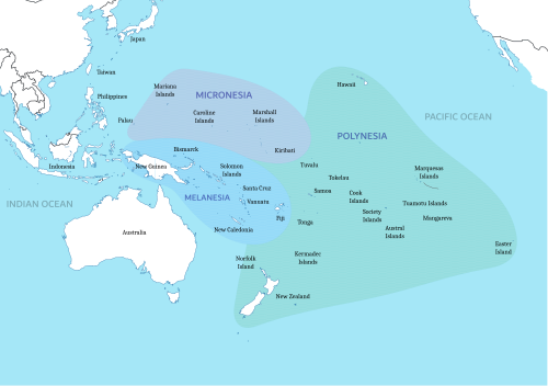
Polynesia is a vast region of the mid- and southern Pacific Ocean, defined primarily by the Polynesian Triangle. This expansive area is characterized by a relatively small amount of land distributed across an immense stretch of ocean, creating a unique cultural and geographical landscape that spans thousands of miles.
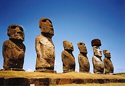
From the volcanic peaks of Hawaii to the shores of New Zealand and the remote statues of Easter Island, Polynesia represents one of the three major cultural areas of the Pacific, alongside Melanesia and Micronesia.
Key Facts
- Total Population: Approximately 7,658,846 (2021).
- Land Area: Between 300,000 and 310,000 square kilometers, with New Zealand accounting for over 270,000 km².
- Political Structure: Comprises 6 sovereign countries and various dependencies of France, the UK, USA, Chile, and New Zealand.
- Origins: Most evidence supports an expansion from Taiwan starting around 3000–1000 BC.
- Navigation: Renowned for ancient long-distance voyaging using multi-hulled canoes.
Geography and Territorial Distribution
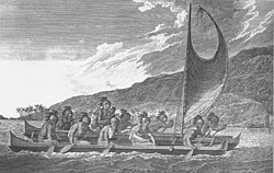
![Māori war canoe (waka) drawn after James Cook's voyage to New Zealand.[48]](/images/27/be/27bedf288e4d3fd21e2d269396ee550c371e9dd5594a5d6c6b1bb3f7e58c854e.jpg)
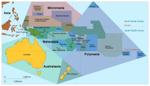
The geography of Polynesia is a study in contrast, featuring massive landmasses like New Zealand and tiny coral atolls. The region is divided into sovereign states, external dependencies, and internal territories.
Sovereign States and Dependencies
The region includes six independent nations: New Zealand, Samoa, Tonga, Tuvalu, and the Cook Islands and Niue (both in free association with New Zealand). Additionally, several territories are managed by external powers, such as French Polynesia and Wallis and Futuna (France), the Pitcairn Islands (UK), and Hawaii (USA).
Regional Outliers
While the Polynesian Triangle defines the core, there are "outliers"—islands with Polynesian culture located within the geographical boundaries of Micronesia (such as Kapingamarangi and Nukuoro) or Melanesia (such as Tikopia and Rennell in the Solomon Islands).
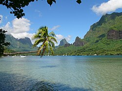
The History of Polynesian Expansion
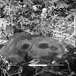
The settlement of Polynesia is one of the most remarkable feats of human migration. The prevailing scientific theory is the Express Train model, which suggests a rapid expansion of Austronesian people from Taiwan via the Philippines and Indonesia.
The Migration Timeline
- 3000–1000 BC: Expansion begins from Taiwan, reaching Island Melanesia by roughly 1400 BC.
- 900 BC: Settlement of the western Polynesian islands.
- The Long Pause: A gap of approximately 1,000 years occurred before further eastward expansion.
- 1000–1300 AD: Settlement of central Polynesia (Cook Islands, Society Islands) followed by the far-flung corners of the triangle: Hawaii, New Zealand, and Easter Island.

Genomic Insights
A 2021 genomic analysis provides a detailed pathway of migration starting from Samoa to the Cook Islands in the 11th century, moving to the Society Islands, and eventually branching toward the Marquesas and Easter Island (Rapa Nui) by approximately 1200 AD.
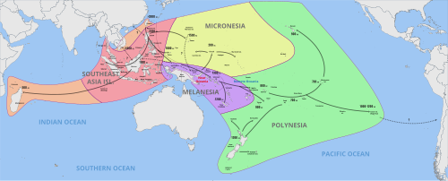
Culture and Ancient Navigation
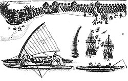
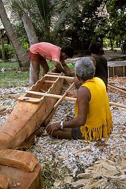
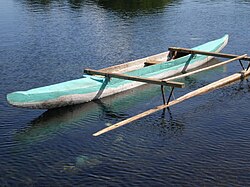
Polynesian societies developed sophisticated maritime technologies to conquer the Pacific. Using multi-hulled canoes and outriggers, navigators relied on stars, ocean currents, and wildlife to find distant islands.
Intercontinental Connections
There is strong evidence of contact between Polynesians and the Americas long before European arrival. The sweet potato (kūmara), native to South America, was widespread in Polynesia by 1300 AD. Furthermore, DNA analysis from 2020 indicates intermingling between Polynesians and pre-Columbian Zenú people between 1150 and 1380 AD.
Regional Demographics and Data
The following table provides a snapshot of the population and land area of key Polynesian territories as of 2021.
| Country/Territory | Area (km²) | Population | Capital |
|---|---|---|---|
| New Zealand | 268,680 | 5,129,727 | Wellington |
| Hawaii (USA) | 16,636 | 1,360,301 | Honolulu |
| French Polynesia (France) | 4,167 | 304,032 | Papeete |
| Samoa | 2,944 | 218,764 | Apia |
| Tonga | 748 | 106,017 | Nukuʻalofa |
| Tuvalu | 26 | 11,204 | Funafuti |
Frequently Asked Questions

What is the Polynesian Triangle?
The Polynesian Triangle is the region of the Pacific Ocean defined by Hawaii to the north, New Zealand to the southwest, and Easter Island to the southeast.
How did Polynesians settle such distant islands?
They used advanced navigation techniques and multi-hulled voyaging canoes, allowing them to travel thousands of miles across open ocean by reading natural signs like stars and currents.
Is there evidence that Polynesians reached South America?
Yes. Evidence includes the presence of the South American sweet potato in Polynesia by 1300 AD and genomic data showing intermingling with Native South Americans between 1150 and 1380 AD.
What is the "Express Train" model of migration?
It is the theory that Polynesian ancestors migrated rapidly from Taiwan through the Philippines and Indonesia, reaching western Polynesia around 900 BC before a long pause in expansion.
Which country has the largest land area in Polynesia?
New Zealand has the largest land area, accounting for more than 270,000 square kilometers of the region's total land.