Continents of Earth: Geography, Geology, and Global Models
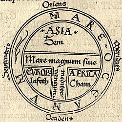
A continent is defined as one of several large terrestrial geographical regions on Earth. Unlike many scientific classifications, continents are often identified by convention rather than strict, universal criteria. Depending on the model used, a continent may be a single large landmass, a landmass including its nearby islands and continental shelf, or a specific section of a larger landmass—such as Europe and Asia within the broader expanse of Eurasia.
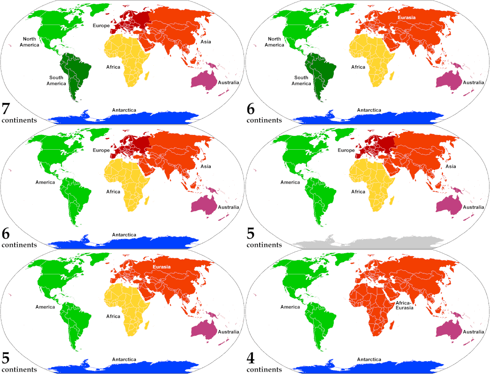
Because of these varying definitions, the number of recognized continents can range from as few as four to as many as seven. While most English-speaking countries recognize a seven-continent model, other systems merge regions to reflect continuous landmasses or geological similarities.
Key Facts
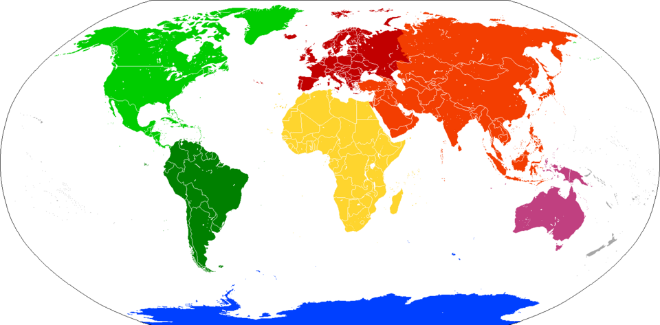
- Seven-Continent Model: The most common English-speaking convention includes Asia, Africa, North America, South America, Antarctica, Europe, and Australia.
- Geological Definition: Geologists define continents as major landmasses consisting of continental crust, which includes both dry land and submerged continental shelves.
- Variable Counts: Depending on the convention, the world may be divided into four (Afro-Eurasia, America, Antarctica, Australia), five, six, or seven continents.
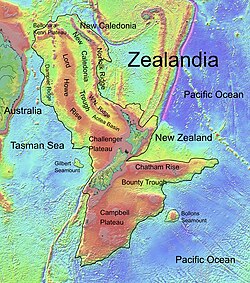
- Zealandia: Recognized in 2017, Zealandia is the largest submerged landmass and is considered a geological continent.
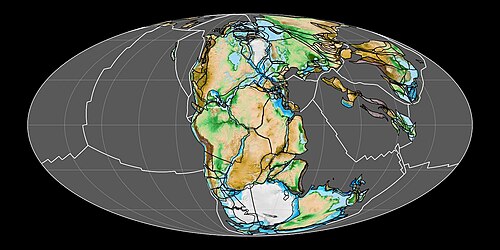
- Pangaea: Approximately 200 million years ago, Earth's landmasses were joined in a single supercontinent known as Pangaea.
Defining the Continent: Convention vs. Geology
By general convention, continents are understood to be large, continuous, and discrete masses of land, ideally separated by expanses of water. However, this leads to arbitrary classifications. For example, Greenland is the world's largest island at approximately 2,166,086 square kilometers, while Australia, at 7,617,930 square kilometers, is classified as the smallest continent.
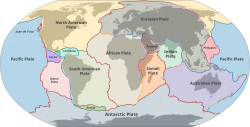
In the field of geology, the definition shifts toward the composition of the Earth's crust. Geological continents correspond to large areas of continental crust found on tectonic plates—the massive slabs of rock that make up the Earth's outer shell. This definition excludes small continental fragments, known as microcontinents, such as Madagascar.
The Role of Oceania
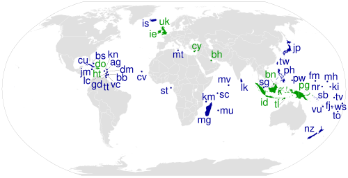
To ensure all land is categorized, oceanic islands are often grouped with the nearest continent. Under this scheme, many island nations in the Pacific are grouped with Australia to form the geographical region of Oceania.
Continental Models and Variations
The number of continents varies based on whether the observer prioritizes continuous landmasses or cultural and geological boundaries.
| Number of Continents | Continents Included | Basis of Model |
|---|---|---|
| Four | Afro-Eurasia, America, Antarctica, Australia/Oceania | Continuous landmasses |
| Five | Africa, Eurasia, America, Antarctica, Australia/Oceania | Merged Americas and Eurasia |
| Six | Africa, Eurasia, North America, South America, Antarctica, Australia/Oceania | Geological continents |
| Seven | Africa, Asia, Europe, North America, South America, Antarctica, Australia/Oceania | Standard English convention |
Area and Population Distribution
Asia is the largest continent by both land area and population, accounting for nearly 30% of the world's land and nearly 60% of its people. In contrast, Antarctica has no permanent human population despite its significant size.
| Continent | Land Area (km²) | % of World Area | Population | % of World Pop. |
|---|---|---|---|---|
| Asia | 44,614,000 | 29.8% | 4,694,576,167 | 59.4% |
| Africa | 30,365,000 | 20.3% | 1,393,676,444 | 17.6% |
| North America | 24,230,000 | 16.2% | 595,783,465 | 7.5% |
| South America | 17,814,000 | 11.9% | 434,254,119 | 5.5% |
| Antarctica | 14,200,000 | 9.5% | 0 | 0% |
| Europe | 10,000,000 | 6.7% | 745,173,774 | 9.4% |
| Oceania | 8,510,926 | 5.7% | 44,491,724 | 0.6% |
Geological Perspectives and History
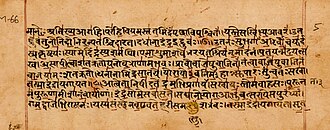
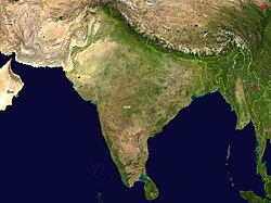
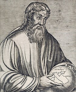
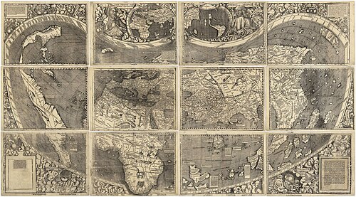
The concept of continents has evolved alongside our understanding of the Earth. Ancient texts, such as the Rigveda, mentioned divisions of the earth, while early European maps often struggled to place newly encountered lands. For instance, the 1507 Waldseemüller map was the first to show the Americas as separate from Asia.
Geologically, the Earth has seen the rise and fall of supercontinents—massive landmasses that incorporate most or all of Earth's continental crust. The most famous of these, Pangaea, existed roughly 200 million years ago before breaking apart into the current configurations.
Submerged and Hidden Continents
Not all continents are fully above sea level. Zealandia, the largest submerged landmass, was formally recognized as a geological continent in 2017. This highlights the difference between a geographical continent (visible land) and a geological one (crustal composition).
Frequently Asked Questions
How many continents are there?
The answer depends on the model used. Most English-speaking countries recognize seven: Asia, Africa, North America, South America, Antarctica, Europe, and Australia. Other models recognize four, five, or six by merging regions like Europe and Asia into Eurasia.
What is the difference between a continent and an island?
The distinction is often arbitrary and based on size. For example, Australia is considered the smallest continent, while Greenland is considered the largest island, despite both being discrete landmasses surrounded by water.
What is Zealandia?
Zealandia is a geological continent that is almost entirely submerged under the ocean. It was recognized in 2017 as the largest submerged landmass on Earth.
What is a supercontinent?
A supercontinent is a massive landmass that consists of most or all of Earth's continental crust. Pangaea is the most well-known example, existing approximately 200 million years ago.
Why are Europe and Asia sometimes called Eurasia?
Europe and Asia are part of the same continuous landmass. While they are separated by cultural and historical boundaries, they are geographically a single entity known as Eurasia.