Persian Gulf: Geography, History, and Global Economic Significance
The Persian Gulf is a critical inland sea located in West Asia, serving as a vital maritime link and a cornerstone of global energy and commodity trade. Spanning approximately 251,000 square kilometers, this shallow basin is bordered by some of the world's most influential nations and is defined by its strategic connection to the Indian Ocean.
From its ancient role as a hub for the great Persian empires to its modern status as a center for oil, gas, and fertilizer production, the Gulf is as much a geopolitical focal point as it is a geographical one.
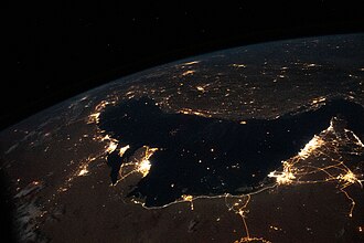
Key Facts
![A historical map of the Persian Gulf in a Dubai museum with the word Persian censured [17][18]](/images/42/40/4240d22a1fff73e4f42eedf920ff348f5c90eafba54e34bbac181fab33a43797.jpg)
- Maximum Length: 989 km (615 mi).
- Average Depth: 50 m (160 ft), making it a very shallow sea.
- Strategic Chokepoint: Connected to the Gulf of Oman via the Strait of Hormuz.
- Primary Inflow: The Shatt al-Arab river delta (carrying the Tigris and Euphrates).
- Economic Role: A global hub for oil, gas, and nitrogen fertilizers.
Geography and Oceanography
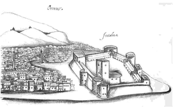
The Persian Gulf is an inland sea bounded by Iran to the north and Saudi Arabia to the south. Its eastern gateway is the Strait of Hormuz, which at its narrowest point is only 56 km (35 mi) wide. To the west, the Gulf is marked by the Shatt al-Arab delta, known in Iran as the Arvand Rud (meaning "Swift River").
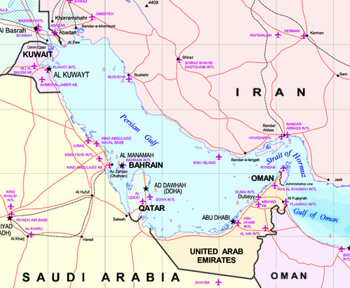
Oceanographically, the Gulf is characterized by high evaporation rates that exceed the combined inputs of precipitation and river discharge. This creates a water deficit of approximately 416 cubic kilometers per year, which is compensated by currents flowing in from the Strait of Hormuz. Because the Gulf's water is more saline, a distinct exchange occurs: denser, high-salinity water exits along the bottom of the Strait, while fresher ocean water flows in across the surface.
Regional Dimensions and Coastlines
The Gulf's physical scale is modest in depth but significant in reach. While its maximum depth reaches only 90 meters, its coastlines support eight different basin countries, each with varying degrees of maritime access.
| Country | Coastline Length (km) | Exclusive Economic Zone (km²) |
|---|---|---|
| Iran | 1,536 | 97,860 |
| Saudi Arabia | 1,300 | 33,792 |
| United Arab Emirates | 900 | 52,455 |
| Qatar | 563 | 31,819 |
| Kuwait | 499 | 11,786 |
| Bahrain | 161 | 8,826 |
| Oman | 100 | 3,678 |
| Iraq | 58 | 540 |
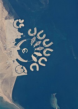
Historical Evolution
Ancient Eras and the Persian Empires
Human habitation in the region dates back to the Paleolithic era. Interestingly, during the Last Glacial Period (115,000–11,700 years ago), much of the Persian Gulf was dry land due to sea levels being up to 125 meters lower than they are today. This created a vast floodplain where ancient rivers converged.
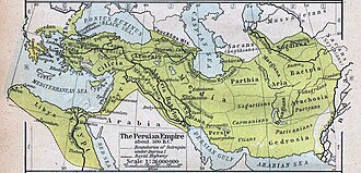
Between 625 BC and 226 AD, the northern coast was dominated by a series of Persian empires, including the Median, Achaemenid, Seleucid, and Parthian. Under Darius the Great, the Achaemenid Empire utilized ships with capacities of 100 to 200 people to patrol the Gulf and major rivers like the Tigris and the Nile.
Colonial Influence and Conflict
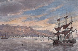
Piracy was a significant issue in the Gulf until the 19th century, particularly involving the Al Qasimi tribe. This led to the British Persian Gulf campaign of 1819 and the subsequent General Maritime Treaty of 1820. From 1763 to 1971, the British Empire maintained political control over various states, including the Trucial States (now the UAE), Bahrain, Kuwait, Oman, and Qatar.
Modern Geopolitics
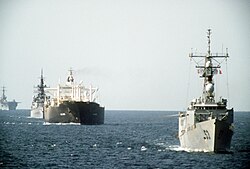
In the late 20th century, the Gulf became a theater for major conflicts. The Iran-Iraq War (1980–1988) saw attacks on oil tankers, and the 1991 Gulf War followed Iraq's invasion of Kuwait. The United States increased its presence in the region during this time, and the United Kingdom continues to maintain a military profile, including the permanent base HMS Jufair opened in 2018.
Wildlife and Ecology
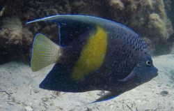
Despite industrialization, the Persian Gulf supports diverse marine life. The region is home to various aquatic mammals and fish, including the Yellowbar Angelfish. The islands of the Gulf serve as critical nesting habitats for waterbirds; a 2009 study of ten Iranian islands recorded over 100,000 breeding pairs of species such as the crab plover and the bridled tern.
Global Economic Impact
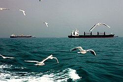
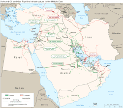
The Persian Gulf is world-renowned for its oil and gas reserves, but it is also a powerhouse in the agricultural chemical sector. It is a primary hub for nitrogen fertilizers, specifically urea and ammonia. Leading exporters include Saudi Arabia, Qatar, Iran, and Oman.
In the 2020s, the region has accounted for approximately 30–35% of global urea exports and 20–30% of ammonia exports. Consequently, up to 30% of all internationally traded fertilizers transit through the Strait of Hormuz.
Frequently Asked Questions
Why is the Strait of Hormuz so important?
The Strait of Hormuz is the only sea passage from the Persian Gulf to the open ocean. It is a critical chokepoint for global trade, as a significant portion of the world's oil and roughly 30% of internationally traded fertilizers pass through it.
How deep is the Persian Gulf?
The Persian Gulf is relatively shallow. It has an average depth of 50 meters (160 feet) and a maximum depth of 90 meters (300 feet).
Which countries border the Persian Gulf?
The basin countries include Iran, Iraq, Kuwait, Saudi Arabia, Bahrain, Qatar, the United Arab Emirates, and the Musandam exclave of Oman.
What happened to the Gulf during the last Ice Age?
During the Last Glacial Period, sea levels dropped by as much as 125 meters. Because the Gulf is so shallow, most of it became dry land, forming a flat floodplain where several rivers converged.
What are the primary non-oil exports of the region?
The region is a global leader in the production and export of nitrogen fertilizers, specifically urea and ammonia.