East China Sea: Geography, Geopolitics, and Natural Wonders
The East China Sea is a vital marginal sea—a body of water partially enclosed by land—of the Western Pacific Ocean. Situated directly offshore from East China, it serves as a critical maritime crossroads connecting several of Asia's most influential nations. While known internationally by its formal name designated by the International Hydrographic Organization (IHO), it is referred to as the "East Sea" (Dōng Hǎi) in China, reflecting its position relative to the mainland.
Geography and Physical Characteristics
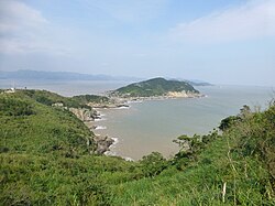
Covering an area of approximately 1,249,000 square kilometers, the East China Sea is defined by a complex set of boundaries. To the north, it extends toward the Yellow Sea, separated by an imaginary line running from the southwestern tip of South Korea's Jeju Island to Qidong at the Yangtze River estuary. Its eastern and southeastern borders are formed by the first island chain of the Eurasian continental mainland, which includes the Japanese island of Kyushu and the Ryukyu Islands.
To the south, the sea is bounded by the island of Taiwan. This positioning allows the East China Sea to act as a gateway, connecting to the Sea of Japan via the Korea Strait in the northeast, the South China Sea through the Taiwan Strait in the southwest, and the Philippine Sea via gaps in the Ryukyu Islands, such as the Miyako and Tokara Straits.
Depth and Topography
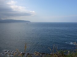
The topography of the East China Sea is characterized by its shallow nature. Nearly three-quarters of the sea is less than 200 meters deep, with an overall average depth of 350 meters. However, this shallow profile is interrupted by the Okinawa Trough, a deep-sea valley that reaches a maximum depth of 2,716 meters.
Hydrology and Islands
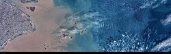
The most significant freshwater contribution to the region is the Yangtze River (Chang Jiang), the largest river flowing into the East China Sea. Beyond the mainland, the sea contains various islands and submerged reefs. In the northern region, a cluster of reefs exists, including Hupijiao Rock, Yajiao Rock, and Socotra Rock (also known as Suyan Rock or Ieodo), the latter of which is a point of contention between South Korea and China.
Nomenclature and Cultural Significance
The naming of the sea varies by region and language. In Chinese literature, it is one of the "Four Seas," representing the cardinal direction of the east. In Japan, the sea was referred to as Higashi Shina Kai (East Shina Sea) until 2004, when official government documents transitioned to the standard usage of Higashi Shina Kai (East China Sea).
In Indonesia, the sea is commonly known as Laut Cina Timur. However, since 2014, the Indonesian government officially switched the term "Cina" to "Tiongkok," making Laut Tiongkok Timur the standard official name, though the former remains common in media.
Geopolitical Tensions and Resource Disputes
The East China Sea is a focal point of international friction, primarily concerning the Exclusive Economic Zone (EEZ)—an area of the ocean where a coastal state has special rights to explore and use marine resources.
The China-Japan EEZ Conflict
China and Japan both claim 200 nautical mile EEZ rights, but the total width of the East China Sea is only 360 nautical miles, leading to overlapping claims. China advocates for the "natural prolongation" of its continental shelf, arguing that its EEZ should extend to the Okinawa Trough. Conversely, Japan proposes a "median line" division to split the territory.
This dispute is intensified by the presence of natural gas. The Chunxiao gas field, discovered by China in 1995, is located in an area China considers undisputed but which Japan believes may extend into disputed waters. While both nations agreed to joint development in 2008, they have yet to execute a formal plan. The Xihu Sag area, which includes fields like Canxue and Baoyunting, is estimated to hold 364 BCF of proven natural gas reserves.
Other Regional Disputes
- South Korea and China: The two nations disagree over the EEZ rights surrounding Socotra Rock, where South Korea has established the Ieodo Ocean Research Station.
- Island Ownership: Various disputes over island ownership have led to official and civilian protests between China and Japan.
Military and Historical Context
The strategic importance of the East China Sea is reflected in the heavy military presence of the region. Taiwan, Japan, China, and South Korea all conduct regular military exercises in these waters. Currently, the People's Republic of China (PRC) possesses more naval vessels in its littoral operations (coastal waters) within the East and South China Seas than the US Navy. In response, the US Indo-Pacific Command has prioritized naval operations to counter this growing strength.
Historically, the sea was a hub for the whaling industry; American whaleships cruised these waters searching for right whales between 1849 and 1892. Interestingly, the sea also appears in ancient astronomy, where the "Donghai" (East Sea) is possibly represented by the star Eta Serpentis in the "Left Wall" of the Heavenly Market enclosure.
Summary of the East China Sea
| Feature | Details |
|---|---|
| Approximate Area | 1,249,000 sq km |
| Average Depth | 350 meters |
| Maximum Depth | 2,716 meters (Okinawa Trough) |
| Bordering Entities | China, Japan, South Korea, Taiwan |
| Primary River | Yangtze River |
| Key Resource | Natural Gas (e.g., Chunxiao field) |