Ottoman Syria: History, Administration, and Territorial Evolution
Ottoman Syria is a historiographical term used to describe the various administrative divisions of the Ottoman Empire located within the Levant. Geographically, this region is defined as the territory east of the Mediterranean Sea, west of the Euphrates River, north of the Arabian Desert, and south of the Taurus Mountains. For over four centuries, from 1516 to 1918, this region served as a vital crossroads of the Ottoman Empire, evolving from a single province into a complex network of autonomous districts and vilayets.
Key Facts
- Period of Rule: 1516–1918.
- Conquest: Established after Sultan Selim I defeated the Mamluk Sultanate at the Battle of Marj Dabiq.
- Administrative Shift: Transitioned from large eyalets (provinces) to smaller vilayets following the 1864 Tanzimat reforms.
- Capital: The region was administered remotely from Constantinople.
- Key Divisions: Included major centers such as Aleppo, Damascus, Beirut, and Jerusalem.
The Conquest and Early Administration
Before the arrival of the Ottomans, Syria was under the control of the Mamluk Empire, which was centered in Lower Egypt. This changed in 1516 when Sultan Selim I won the Battle of Marj Dabiq near Aleppo. Following this victory, Selim continued his campaign into Egypt, winning the Battle of Ridanieh in 1517 and effectively ending the Mamluk Sultanate.
Initially, Selim I maintained the existing Mamluk administrative subdivisions. However, by July 1517, he reorganized the region into a single large province known as the Eyalet of Şam (Syria), which was further divided into smaller districts called sanjaks.
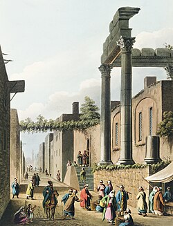
Evolution of Provincial Boundaries (1549–1663)
As the empire grew, the administration of Syria became more fragmented to allow for better local control. In 1549, the region was split into two primary eyalets: Aleppo in the north and Damascus in the south.
The Eyalet of Aleppo
The Eyalet of Aleppo served as the northern hub, encompassing several sanjaks including Aleppo, Adana, Marash, Aintab, and Urfa. Over time, the Adana Eyalet was eventually split from Aleppo to form its own administration.
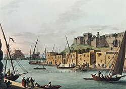
The Eyalet of Damascus and Beyond
The Eyalet of Damascus originally covered a vast area including the sanjaks of Damascus, Tripoli, Acre, Safad, Nablus, Jerusalem, Lajjun, Salt, and Gaza. In 1579, the Eyalet of Tripoli was carved out of Damascus. Later, in 1660, the Eyalet of Safad was established, which was subsequently renamed the Eyalet of Sidon and eventually the Eyalet of Beirut.
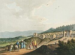
Conflict and Reform in the 19th Century
The 19th century brought significant political instability and administrative overhaul. Between 1831 and 1841, the Syrian provinces were ceded to Muhammed Ali of Egypt under the Convention of Kutahya, though they eventually returned to direct Ottoman control.
This era was also marked by social tension. Decrees issued by the Sublime Porte (the central Ottoman government) in 1839 and 1856 aimed to equalize the status of Muslim and non-Muslim subjects. While intended as reforms, these changes led to friction and violent conflicts in Aleppo (1850), Nablus (1856), and Damascus and Lebanon (1860).
In response to the 1860 civil conflict and pressure from France, the Ottoman government created the Mount Lebanon Mutasarrifate in 1861. This was an autonomous region governed by a non-Lebanese Christian mutasarrıf (governor).
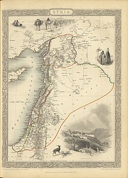
The Tanzimat Reforms and Final Structure
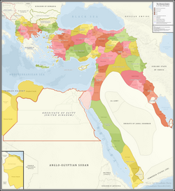
The Tanzimat reforms were a period of modernization intended to centralize and standardize the empire. A law passed in 1864 replaced the large eyalets with smaller vilayets. These were governed by a vali (governor) appointed by the central government, but they included provincial assemblies to allow for local participation.
By 1872, the Mutasarrifate of Jerusalem was split from the Syria Vilayet, granting Jerusalem a special autonomous status. From 1872 until the end of World War I, the region was primarily divided into the Vilayets of Aleppo, Beirut, and Syria, alongside the Mutasarrifates of Mount Lebanon, Jerusalem, and Karak (established in 1895).
| Period | Administrative Unit | Key Characteristics |
|---|---|---|
| 1517–1549 | Eyalet of Şam | Single large province subdivided into sanjaks. |
| 1549–1864 | Multiple Eyalets | Split into Aleppo, Damascus, Tripoli, and Sidon. |
| 1864–1918 | Vilayets | Standardized smaller provinces (Aleppo, Beirut, Syria). |
| 1861 / 1872 | Mutasarrifates | Special autonomous status for Mount Lebanon and Jerusalem. |
Frequently Asked Questions
How did the Ottoman Empire acquire Syria?
The Ottoman Empire acquired Syria in 1516 after Sultan Selim I defeated the Mamluk Sultanate at the Battle of Marj Dabiq.
What was the difference between an Eyalet and a Vilayet?
An eyalet was a larger provincial division used in the early Ottoman period. A vilayet was a smaller, more standardized administrative unit introduced during the Tanzimat reforms of 1864 to improve governance.
What was the Mount Lebanon Mutasarrifate?
Established in 1861 following civil conflict, it was an autonomous administrative region in Mount Lebanon governed by a non-Lebanese Christian governor.
Which cities were the primary administrative centers of Ottoman Syria?
The primary centers included Aleppo, Damascus, Beirut, and Jerusalem, each serving as the heart of their respective vilayets or mutasarrifates.
When did Ottoman rule in Syria end?
Ottoman rule ended in 1918 following the Sinai and Palestine campaign during World War I.