Nueva Esparta State: The Pearl of the Venezuelan Caribbean
Located in the shimmering waters of the Caribbean Sea, Nueva Esparta is a unique Venezuelan state comprising three primary islands: Margarita, Coche, and Cubagua. Known for its rich colonial history, vibrant commercial hubs, and breathtaking natural landscapes, this insular region serves as a cornerstone of Venezuela's tourism and maritime heritage.
From the bustling shopping districts of Porlamar to the serene heights of the Macanao Peninsula, Nueva Esparta blends a legacy of heroism with a modern, leisure-driven economy. Its name, meaning "New Sparta," was bestowed to honor the bravery of its inhabitants during the struggle for Venezuelan independence, drawing a parallel to the legendary warriors of ancient Greece.
Key Facts
- Capital: La Asunción
- Largest City: Porlamar
- Composition: Three islands (Margarita, Coche, and Cubagua)
- Total Area: 1,151 km²
- Population: 491,610 (2010 Census)
- Climate: Hot semi-arid with diverse microclimates
- Emblematic Tree: Guayacán (Guaiacum officinale)
A Journey Through History
The Era of Pearls and Nueva Cádiz
The history of Nueva Esparta is inextricably linked to the sea. Shortly after the discovery of the region, European sailors found vast pearl deposits on Cubagua. By 1500, adventurers had already established settlements to exploit these gems. In 1528, the settlement was granted city status and renamed Nueva Cádiz, becoming the first city in Venezuela. This city enjoyed political autonomy and traded directly with Castile, replacing early huts with stone houses brought from Araya.
However, the prosperity of Nueva Cádiz was short-lived. A combination of natural disasters—including a hurricane and possible earthquake in 1541—and attacks by French pirates in 1543 led to the city's abandonment and the migration of its people to Margarita Island.
Independence and Statehood
The Province of Margarita is the oldest of the provinces that formed the Captaincy General of Venezuela in 1777. After the emergence of the Republic of Venezuela in 1830, it remained one of the original 13 provinces. In 1864, it was officially named Estado Nueva Esparta. Despite several administrative shifts in the late 19th and early 20th centuries, it regained its permanent statehood in 1909.
Geography and Natural Environment
Topography and Climate
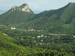
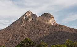
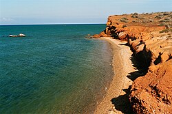
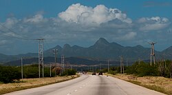
Nueva Esparta features a varied landscape, from coastal plains to rugged peaks. The highest elevations are found in the Macanao Peninsula and the Serranía de El Copey, with Cerro Grande reaching 920 meters above sea level.
The region is characterized by a hot semi-arid climate. While Porlamar remains quite dry with an average temperature of 27°C, the Serranía de El Copey receives significantly more rainfall (up to 1,100 mm annually), supporting lush cloud forests and premontane dry forests.
Flora and Fauna
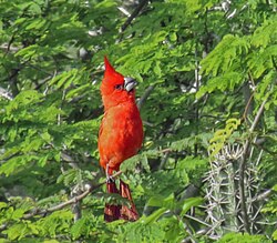
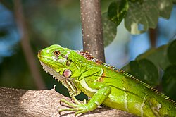
The insular coastal vegetation supports a diverse array of wildlife. Birdwatchers can spot the Cardinalis phoeniceus (Red Cardinal), troupials, and chachalacas. The reptile population is equally diverse, featuring green iguanas, anoles, and various snakes, including the coral snake and rattlesnake.
Economy and Tourism
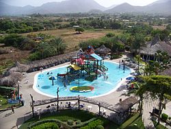
Tourism is the primary engine of the Nueva Esparta economy. The state is famous for its Free Port status, established in 1971, which spurred massive immigration and commercial growth. This has made the region a premier shopping destination in Venezuela.
Commercial Hubs
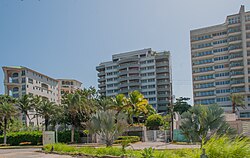
Porlamar is the largest economic center, while Pampatar hosts some of the most modern shopping complexes, including Parque Costazul (the third largest mall in the country), La Vela, and Rattan Plaza.

Natural and Cultural Attractions
Visitors are drawn to the state's pristine beaches and historic fortifications. Notable sites include:
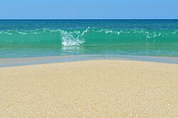
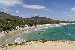
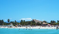
- Beaches: Playa El Yaque (famous for windsurfing), Playa El Agua, and El Amor Beach on Coche Island.
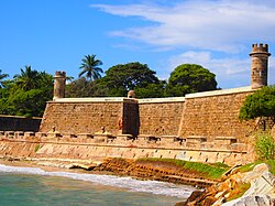
- Fortifications: The San Carlos de Borromeo Fortress in Pampatar, built between 1664 and 1684 to protect the bay.
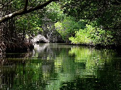
- Natural Monuments: Laguna de Las Marites, a shallow lagoon surrounded by mangroves and home to various bird species.
Regional Overview
The state is divided into several municipalities across its three islands, with the majority of the population concentrated in the commercial zones of Margarita.
| Island | Estimated Population (2010) | Area (km²) | Largest Location |
|---|---|---|---|
| Margarita Island | 400,000 | 1,071 | Porlamar |
| Coche Island | 8,756 | 55 | San Pedro de Coche |
| Cubagua Island | 71 (2007) | 24 | Playa Charagato |
Culture and Society
Education and Arts
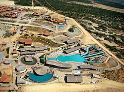
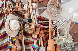
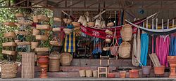
The state is a hub for higher education, featuring institutions such as the Universidad de Margarita and the National Experimental University of the Arts. Local culture is further enriched by the Francisco Narváez Museum of Contemporary Art and a strong tradition of local handicrafts.
Prominent Figures
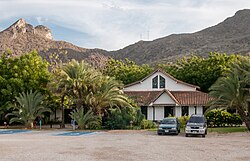
Nueva Esparta has produced several military and intellectual leaders, including Captain Antonio Díaz, a hero of the Battle of Pagayos, and Lieutenant Colonel Gaspar Marcano, a signatory of the Chacachacare compliance and author of the "Margarita Epic."
Frequently Asked Questions
What is the significance of the name "Nueva Esparta"?
The name was given to the island territory to honor the heroism of its people during the Venezuelan struggle for independence, comparing their courage to that of the ancient Spartans.
Which is the largest city in the state?
Porlamar is the largest city and serves as the primary economic and commercial center of the region.
What was Nueva Cádiz?
Nueva Cádiz was the first city established in Venezuela, located on Cubagua Island. It was founded to exploit rich pearl deposits but was eventually abandoned due to natural disasters and pirate attacks.
What are the best beaches for visitors?
Some of the most popular beaches include Playa El Agua (the busiest), Playa El Yaque (ideal for water sports), and El Amor Beach on Coche Island.
What is the climate like in Nueva Esparta?
The state generally has a hot semi-arid climate. However, there are microclimates, such as the cloud forests in the Serranía de El Copey, which receive significantly more rainfall than the coastal areas.