New Guinea: Geography, Biodiversity, and History of the World's Second-Largest Island
New Guinea is a land of staggering scale and diversity. As the world's second-largest island, covering 785,753 square kilometers, it serves as a biological and linguistic bridge between Asia and Australia. Known by various names including Papua and Irian, the island is home to the third-largest remaining rainforest on Earth and possesses the highest plant biodiversity of any island in existence.
Key Facts
- Global Rank: 2nd largest island in the world.
- Highest Point: Puncak Jaya, reaching 4,884 meters.
- Linguistic Diversity: The most linguistically diverse area on Earth, with over 1,000 languages.
- Biodiversity: Contains between 5% and 10% of all species on the planet.
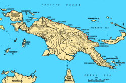
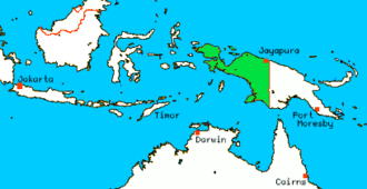
- Political Division: Split between Indonesia (West) and Papua New Guinea (East).
Geography and Climate
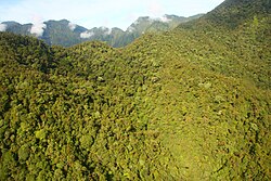
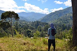
The island is defined by the New Guinea Highlands, a massive spine of mountains stretching over 1,600 kilometers from east to west. These mountains create a dramatic landscape where many peaks exceed 4,000 meters. In the western half, the island reaches its zenith at Puncak Jaya, the highest point in Oceania.
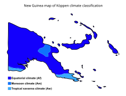
Due to its equatorial position, most of the island experiences a warm, humid climate year-round, influenced by the northeast monsoon. However, the high elevations tell a different story; the tree line sits around 4,000 meters, and the tallest peaks host equatorial glaciers, though these have been retreating since at least 1936.
Regional Context
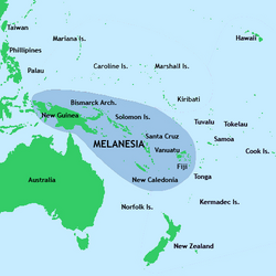
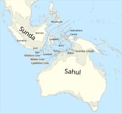
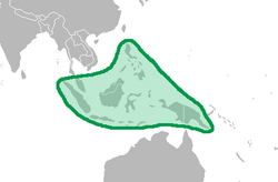
Geographically, New Guinea is part of the Melanesian archipelago. In prehistoric times, it was part of a larger landmass known as Sahul, which connected it to Australia before rising ocean levels separated the two after the last ice age.
Political and Administrative Divisions
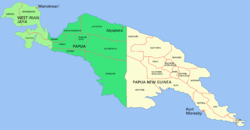
New Guinea is divided almost equally between two sovereign nations along a north-south line.
Western New Guinea (Indonesia)
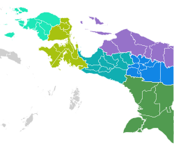
The western half is administered by Indonesia and is divided into several provinces, including Papua, Central Papua, Highland Papua, South Papua, Southwest Papua, and West Papua. The largest settlement in this region is Jayapura.
Eastern New Guinea (Papua New Guinea)
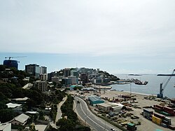
The eastern half comprises the independent state of Papua New Guinea, divided into numerous provinces such as Central, Morobe, and the Western Highlands. Its most populous city and national capital is Port Moresby.
Demographics and Culture
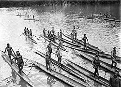
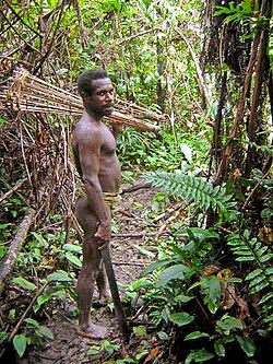
With a population of approximately 14.8 million as of 2020, New Guinea is one of the most culturally complex places on Earth. Archaeological evidence suggests human habitation may date back as far as 60,000 years, with continuous habitation since 50,000 BCE.
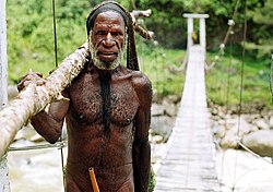
The island is renowned for its extreme linguistic diversity. It is home to nearly a thousand different tribal groups and an equivalent number of languages. These are generally categorized into Austronesian languages and Papuan languages, the latter of which consists of many unrelated language families.
Biodiversity and Ecology
Despite occupying less than 0.5% of the Earth's surface, New Guinea holds a disproportionate amount of the world's life. It is considered "nearly a continent" due to its biological distinctiveness, sharing many ancestral origins with Australia.
Flora and Fauna
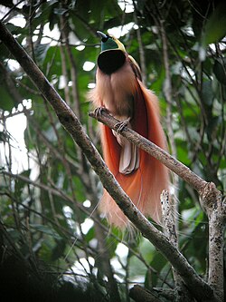
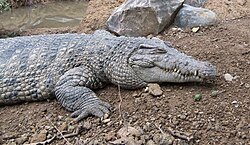
The island is the world's most floristically diverse island, surpassing Madagascar and Borneo. A 2020 study cataloged 13,634 species of vascular plants. The animal kingdom is equally rich, featuring 284 mammal species (69% endemic), 578 breeding bird species, and a vast array of amphibians and reptiles.
Marine and Freshwater Ecosystems
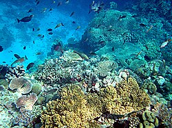
The waters surrounding New Guinea are equally vibrant. The region hosts 1,200 species of fish and approximately 600 species of reef-building coral—representing 75% of the world's known total. These corals cover 18 million hectares off the northwest peninsula.
Summary of Ecoregions
| Category | Key Examples |
|---|---|
| Terrestrial | Central Range montane rain forests, New Guinea mangroves, Trans-Fly savanna |
| Freshwater | Vogelkop–Bomberai, New Guinea Central Mountains, Papuan Peninsula |
| Marine | Bismarck Sea, Solomon Sea, Gulf of Papua, Arafura Sea |
Historical Overview
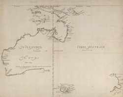
European contact began in the 16th century with Portuguese and Spanish explorers. Jorge de Menezes sighted the western tip in 1526, and Íñigo Ortíz de Retes named the island "Nueva Guinea" in 1545.
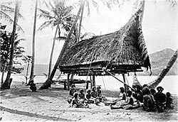
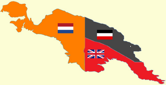
Colonial history saw the island split among several powers. The Netherlands claimed the western half in 1828. In the east, the British transferred administrative responsibility to Australia in the early 20th century. During World War I, Australia seized German New Guinea, eventually administering both the Territory of Papua and the Territory of New Guinea.
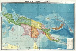
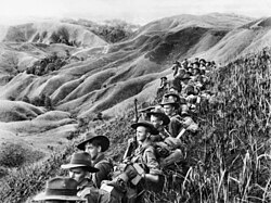
Following World War II, the eastern portion moved toward independence. In the west, the Netherlands initially prepared the territory for independence in the 1950s. However, after negotiations and military interventions, the territory was handed to the UN and subsequently to Indonesia in 1963. In 1969, the "Act of Free Choice" formally annexed Western New Guinea into Indonesia.
Frequently Asked Questions
Why is New Guinea so linguistically diverse?
The island's rugged geography, characterized by high mountains and dense rainforests, isolated various tribal groups for thousands of years, allowing hundreds of distinct languages to develop independently.
What is the relationship between New Guinea and Australia?
Geologically, they were once part of the same landmass called Sahul. This shared history explains why many of New Guinea's species, particularly marsupials, are shared with Australia.
Which is the highest point on the island?
The highest point is Puncak Jaya, located in the western half of the island, reaching an elevation of 4,884 meters.
How is the island divided politically?
The island is split roughly in half: the western portion is part of Indonesia, and the eastern portion is the independent nation of Papua New Guinea.
What makes New Guinea's flora unique?
It is the most floristically diverse island in the world, with over 13,000 species of vascular plants, many of which are endemic (found nowhere else on Earth).