Lidar Applications Across Science, Industry, and Technology
Lidar, a remote sensing technology that uses laser light to measure distances, has evolved into a versatile tool used in everything from deep-space exploration to consumer electronics. The effectiveness of a lidar system is generally determined by its object detection range, its resolution (the accuracy with which it identifies and classifies objects), and its resistance to reflectance confusion—the ability to distinguish targets in the presence of bright sunlight or highly reflective surfaces.
While high-end sensors can cost upwards of US$12,000, the industry is trending toward more affordable options, with some sensors starting around US$1,200. This price reduction is opening the door for lidar to enter new consumer and industrial markets.
Key Facts
- Versatility: Used in fields as diverse as archaeology, forestry, atmospheric science, and gaming.
- Data Output: Produces a "point cloud," a set of data points in space representing the external surface of an object.
- Environmental Advantage: Can "see" through dense forest canopies to map the ground below.
- Precision: Capable of centimeter or millimeter precision in specialized surveying and simulation.
- Consumer Integration: Now integrated into high-end tablets and smartphones for augmented reality and photography.
Environmental and Earth Sciences
Archaeology and Geomorphology
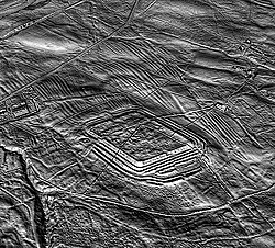
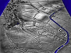
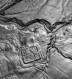
Lidar is revolutionary for archaeology because it creates high-resolution digital elevation models (DEMs). These models reveal micro-topography hidden by vegetation. By analyzing the intensity of returned signals, especially in the infrared spectrum, researchers can detect buried features that affect plant growth.
Notable successes include the discovery of the city of Mahendraparvata in Honduras and the identification of over 60,000 man-made structures in the Maya Biosphere Reserve. In the UK, lidar has been used to map Roman forts such as Epiacum and Bremenium.
Forestry and Ecology
In forestry, lidar provides precise inventories of forest plots, calculating individual tree heights, crown width, and biomass. It is also used for disaster management; for example, aerial lidar helped map the 2020 Australian bushfires by distinguishing between healthy and burned vegetation.
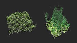
![A typical workflow to derive forest information at individual tree or plot levels from lidar point clouds[106]](/images/4a/3a/4a3a463ba1c7b0de0e9e5284f41e0d26ae9475029a57940dc935349534d17d09.png)
Geology and Soil Science
Geomorphologists use lidar to study the evolution of Earth's surface, detecting subtle features like river terraces and glacial landforms. It has been used to monitor severe rock-falls in the Mont Blanc massif and to locate the Seattle Fault in Washington. Soil scientists utilize detailed terrain modeling to identify slope changes that indicate soil spatial relationships.
Atmospheric Science and Weather
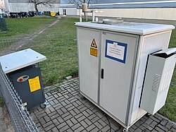
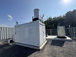
Atmospheric lidar operates by measuring backscatter from the atmosphere or reflections off the ground. Doppler lidar measures the frequency shift of backscattered light to determine wind speed and temperature, a technique used in the renewable energy sector to analyze wind shear and turbulence.
Another specialized method, Differential Absorption Lidar (DIAL), uses two or more closely spaced wavelengths to measure the concentration of specific gases, such as methane and carbon dioxide, in the atmosphere.
Flood Forecasting
In Japan, DIAL and Raman lidar are being developed to improve rainfall prediction. By observing the vertical distribution of water vapor and wind, this data is integrated with satellite observations to create advanced meteorological datasets.
Transportation and Robotics
Autonomous Vehicles
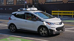
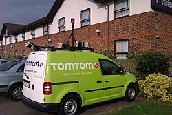
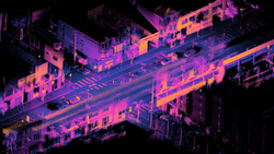
Lidar is a cornerstone of self-driving technology, providing the real-time spatial awareness necessary for obstacle avoidance. Early adaptive cruise control systems relied solely on lidar, and modern autonomous cars often use multiple units to create a 360-degree view of their surroundings.
Robotics and Mining
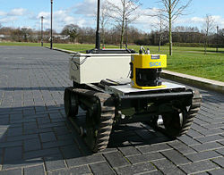
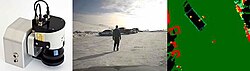
From mobile robots constructing maps to autonomous haulage systems in mining (such as those used by Rio Tinto), lidar allows machines to navigate complex environments without human intervention.
Specialized and Consumer Applications
Physical Security and Infrastructure
Modern 3D lidar systems enhance security by creating volumetric detection zones. Unlike 2D systems, 3D lidar can distinguish between a human intruder and a small animal or swaying vegetation by analyzing the object's height and volume.
Consumer Electronics and Entertainment
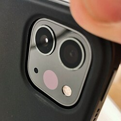
Apple integrated lidar into the iPad Pro and iPhone Pro models to improve augmented reality (AR), autofocus in low light, and the accuracy of the Measure app. In the gaming world, simulation titles like iRacing and Assetto Corsa use lidar point clouds to replicate race tracks with millimeter precision.
Other Notable Uses
- Agriculture: Monitoring flying insects by species and sex, and identifying weeds via machine learning.
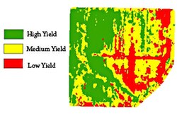
Lidar is used to analyze yield rates on agricultural fields. - Airport Operations: Real-time monitoring of passenger and vehicle flows at Dallas Fort Worth International Airport.
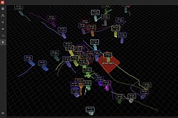
A lidar-based spatial intelligence system tracking individual passengers in real time at passport control. - Physics: Detecting snow in the Martian atmosphere via the NASA Phoenix lander.
- Media: Tracking movements on the set of Wheel of Fortune and creating 3D music videos for Radiohead.
Summary of Lidar Applications
| Sector | Primary Application | Key Benefit |
|---|---|---|
| Archaeology | Digital Elevation Models (DEM) | Reveals structures under vegetation |
| Atmospheric | Doppler & DIAL Sensing | Wind speed and gas concentration |
| Transport | Autonomous Navigation | Real-time obstacle avoidance |
| Forestry | Canopy Analysis | Biomass and carbon density estimation |
| Security | Volumetric Detection | Reduction of false alarms |
Frequently Asked Questions
What is a lidar point cloud?
A point cloud is the primary output of a lidar scan, consisting of a vast collection of individual data points that represent the external surface of an object or landscape in 3D space.
How does lidar see through trees?
Lidar pulses can penetrate gaps in the forest canopy. While some light reflects off leaves, some reaches the ground and returns, allowing researchers to create a digital terrain model of the earth's surface beneath the vegetation.
What is the difference between 2D and 3D lidar in security?
2D lidar scans a single flat plane, which can lead to false alarms from small animals. 3D lidar captures height, width, and depth, allowing the system to classify objects by volume and size.
How is lidar used in the atmosphere?
It is used in two main ways: measuring backscatter to detect clouds and aerosols, and measuring ground reflections to analyze atmospheric absorption and gas concentrations.
Can lidar be used for underwater mapping?
Yes, in hydrographic surveying, lidar can measure water depths from 0.9 to 40 meters, depending on the clarity of the water.