Lebanon: A Journey Through History, Culture, and Geography
Nestled on the eastern shores of the Mediterranean Sea, the Lebanese Republic is a land of profound historical depth and striking natural beauty. From the ancient maritime legacy of the Phoenicians to its modern role as a cultural hub in the Middle East, Lebanon represents a unique intersection of diverse religious, ethnic, and political identities.
The nation is characterized by its dramatic landscapes, where snow-capped mountains meet turquoise waters, and its cities serve as living museums of human civilization. Whether through its world-renowned cedar forests or the bustling streets of its capital, Beirut, Lebanon continues to be a focal point of resilience and cultural richness.
Key Facts
- Capital: Beirut, the most populous city and a primary tourism hub.
- Government: A unitary parliamentary republic based on confessionalism (a system of power-sharing among religious groups).
- Official Language: Arabic, with French recognized as a minority language and Lebanese Arabic used as the local vernacular.
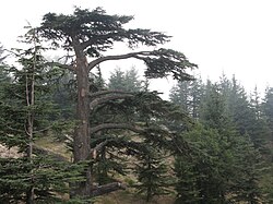
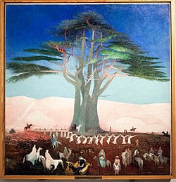
- National Emblem: The Lebanon cedar, a symbol of endurance and heritage.
- Geography: A total area of 10,452 km², featuring the Mount Lebanon and Anti-Lebanon mountain ranges.
A Legacy of Civilizations
Antiquity and the Phoenician Era
Lebanon's history begins in the deep mists of antiquity. The city of Byblos is among the oldest continuously inhabited cities in the world, with evidence of occupation dating back to between 8800 and 7000 BC. As a UNESCO World Heritage Site, it stands as a testament to the early urban development of the region.
![Byblos is believed to have been first occupied between 8800 and 7000 BC[29] and continuously inhabited since 5000 BC,[30] making it among the oldest continuously inhabited cities in the world.[31][32] It is a UNESCO World Heritage Site.[33]](/images/ab/4d/ab4d0d0d53f59331bc5dc899d840453d9ba92d50ff6095d8d93a3b83c04fb65e.jpg)
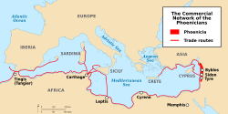
The region was the heart of Phoenicia, a seafaring civilization known for its vast trade networks and the establishment of colonies, most notably Carthage.
From the Middle Ages to the Ottoman Empire
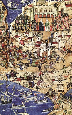
Throughout the Middle Ages, Lebanon was a site of strategic conflict and cultural exchange. The County of Tripoli, a Crusader state, eventually fell to the Egyptian Mamluks in 1289. Later, the region came under Ottoman rule, leading to the establishment of the Emirate of Mount Lebanon in 1516.
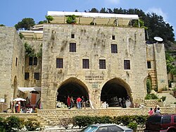
The 17th century saw the rise of influential local leaders, exemplified by the architecture of the Fakhreddine II Palace.
The French Mandate and Independence
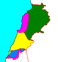
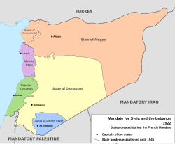
Following World War I, Lebanon became a French Mandate. In 1920, the borders of Greater Lebanon were established, partly based on maps drawn by the French expedition of Beaufort d'Hautpoul in 1862.
![An 1862 map drawn by the French expedition of Beaufort d'Hautpoul,[57] later used as a template for the 1920 borders of Greater Lebanon.[58][59]](/images/6e/ec/6eec70cbb9479e3753ace113c9239c1ef471630585880a34167d26b6ea8d0329.jpg)
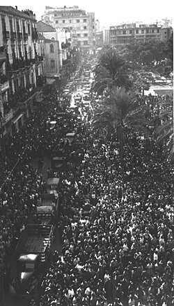
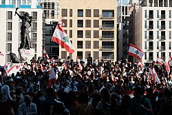
Lebanon declared its independence on November 22, 1943, a date celebrated with great fervor in Beirut's Martyrs' Square.
Modern Conflict and Recovery
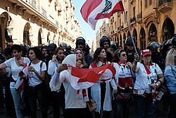
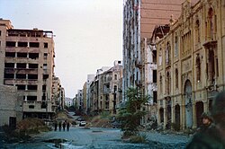
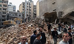
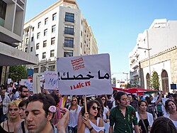
The latter half of the 20th century was marked by instability, including a devastating civil war and various foreign occupations. The country saw the withdrawal of Israeli troops in May 2000 and Syrian troops in April 2005. More recently, Lebanon has faced severe national crises starting in 2019, characterized by non-sectarian protests against economic hardship and political corruption.
Geography and Environment
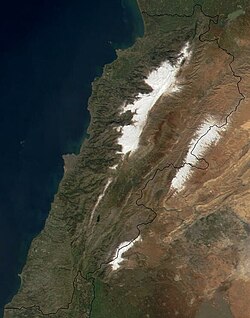
Lebanon's terrain is dominated by the Mount Lebanon range, which averages elevations above 2,500 meters. This range creates a distinct climate and provides a sanctuary for the iconic Lebanon cedar.
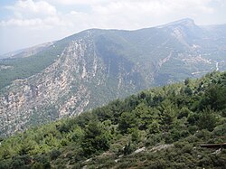
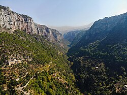
The Kadisha Valley, home to the Qannoubine Monastery, is another geographic highlight, offering a glimpse into the spiritual and natural heritage of the mountains.
Government and Demographics
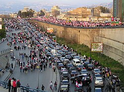
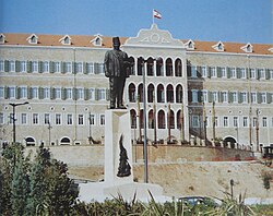
Lebanon operates under a complex political system where the presidency, prime ministry, and parliamentary speakership are distributed among different religious sects to maintain balance.
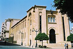
The population is predominantly Arab (95%), with a significant Armenian minority (4%). The religious landscape is diverse, consisting primarily of Islam (53.31%) and Christianity (41.40%), alongside the Druze community (5.21%).
![Distribution of religious groups of Lebanon according to 2009 municipal election data with the boundaries of ancient Mount Lebanon Mutasarrifate marked with a dotted line.[325]](/images/d3/2b/d32b4ccecf5b9d764c1be090b890a4333acd0467fd81e72e619136662e73a639.webp)
Administrative Divisions
The country is divided into several governorates, including Beirut, Akkar, Baalbek-Hermel, Beqaa, Keserwan-Jbeil, Mount Lebanon, Nabatieh, North, and South.
Economy and Urban Centers
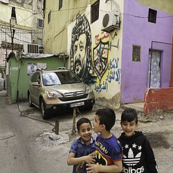
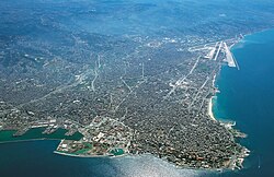
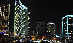
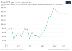
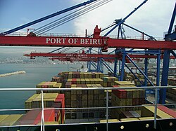
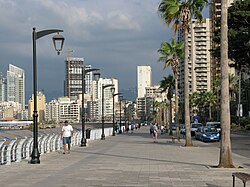
Beirut serves as the economic and tourism heart of the nation. Despite economic volatility, the city remains a center for innovation, education, and commerce.
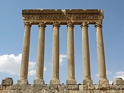
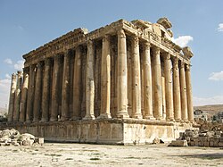
Beyond the capital, cities like Tripoli, Sidon, and Tyre maintain historical and commercial importance. The ruins of Baalbek, featuring the Temple of Bacchus and the Temple of Jupiter, attract visitors from around the world as some of the best-preserved Roman temples in existence.
| Category | Detail |
|---|---|
| Population (2024 Est.) | 5,364,482 |
| Total Area | 10,452 km² |
| GDP (PPP, 2022) | $78.233 Billion |
| HDI (2023) | 0.752 (High) |
| Currency | Lebanese pound (LBP) |
Frequently Asked Questions
What is the system of confessionalism in Lebanon?
Confessionalism is a political system where government positions are distributed among various religious communities to ensure representation and maintain sectarian harmony within the parliamentary republic.
Which is the oldest city in Lebanon?
Byblos is believed to be one of the oldest continuously inhabited cities in the world, with occupation dating back as far as 8800 BC.
What is the significance of the Lebanon cedar?
The Lebanon cedar is the national emblem of the country and is historically and culturally significant, symbolizing strength and longevity.
What are the primary languages spoken in Lebanon?
Arabic is the official language, while Lebanese Arabic is the common vernacular. French is also widely recognized and used as a minority language.
What is the role of Beirut in the country?
Beirut is the capital and largest city, serving as the primary hub for tourism, finance, education, and government administration.