Iberian Peninsula: Geography, History, and Cultural Evolution
The Iberian Peninsula is a vast and diverse region located in southwestern Europe. Mostly separated from the rest of the continent by the Pyrenees mountain range, it primarily comprises Peninsular Spain and Continental Portugal. Together with Andorra, Gibraltar, and a small portion of Metropolitan France, it forms the second-largest peninsula in Europe by area, surpassed only by the Scandinavian Peninsula.
With a total area of approximately 583,254 square kilometres and a population of roughly 53 million people, the region is characterized by its rugged terrain and a rich tapestry of historical influences that have shaped its modern identity.
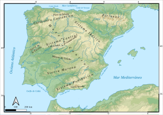
Key Facts

- Total Area: Approximately 583,254 km².
- Population: Roughly 53 million inhabitants.
- Highest Point: Mulhacén, reaching 3,478 meters.
- Major Countries: Spain, Portugal, and Andorra.
- Coastline: 3,313 km total, split nearly evenly between the Atlantic and Mediterranean.
- Mean Altitude: 637 meters, the second highest in Western Europe.
Geography and Geology
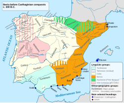
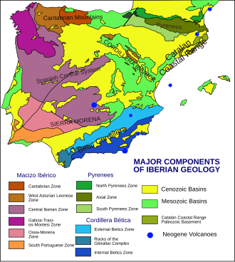
The topography of the Iberian Peninsula is notably uneven and contrasting. Its mountain ranges generally run from west to east, with some peaks exceeding 3,000 meters above sea level. This mountainous nature contributes to the region's high mean altitude.
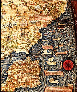
The peninsula's dimensions are roughly octagonal—a shape the ancient geographer Strabo famously compared to an ox-hide. It extends approximately 865 km from Punta de Tarifa in the south to Punta de Estaca de Bares in the north, and about 1,155 km from Cabo da Roca in the west to Cap de Creus in the east.
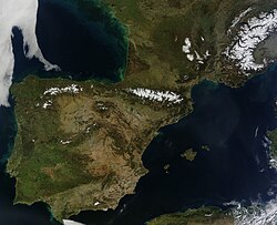
Coastlines and Waterways
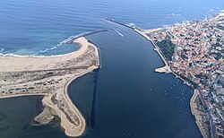
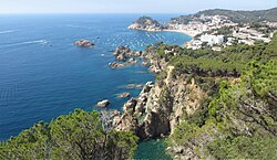
The coastline totals 3,313 km, with 1,660 km bordering the Mediterranean Sea and 1,653 km bordering the Atlantic Ocean. Geological history shows that these coasts have been significantly inundated; sea levels rose from a minimum of 115–120 meters below current levels during the Last Glacial Maximum (LGM) to their present state about 4,000 years ago.
Climate and Peaks
Climate varies drastically across the region. The southwestern interior experiences some of the hottest temperatures in Europe, with Córdoba averaging around 37 °C in July and August. In contrast, the northern tip of Galicia in A Coruña sees summer daytime highs averaging just below 23 °C.
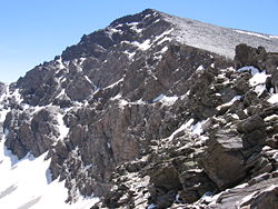
The highest point in the entire peninsula is the Mulhacén, which stands at 3,478 meters.
Historical Evolution
![An instance of the Southwest Paleohispanic script inscribed in the Abóbada I stele.[39]](/images/0e/1b/0e1bde33690ba3797406926b8971876826823588d1d23ae267c18a7833c8e651.jpg)
The human history of Iberia is one of the oldest in Europe, beginning with the arrival of Neanderthals around 200,000 BP during the Lower Paleolithic period. Over millennia, various cultures emerged, from the Mousterian and Châtelperronian periods to the later Neolithic and Chalcolithic eras.
From Proto-history to Roman Rule
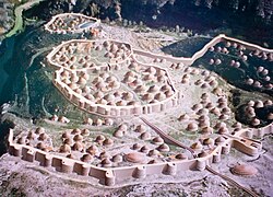
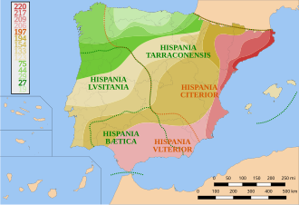
Before the Roman conquest, the peninsula was home to various indigenous groups and scripts. The Roman period (220 BCE – 19 BCE) brought significant administrative and cultural assimilation, integrating the region into the Roman Empire.
Medieval and Pre-Modern Eras
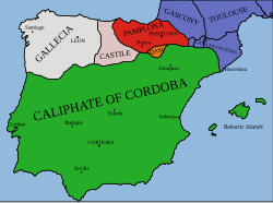
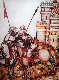
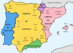
Following the fall of Rome, the region saw periods of Germanic and Byzantine rule, followed by the establishment of al-Andalus under Islamic rule around 1000 CE. By the end of the 15th century, the peninsula was divided into several kingdoms. In 1490, the estimated population was 6.525 million, with the Crown of Castile being the most populous at 4.3 million.
Political and Demographic Landscape
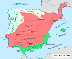
Today, the peninsula is divided into several sovereign states and territories. Spain and Portugal dominate the landmass, while Andorra and Gibraltar represent smaller political entities.
| Country / Territory | Capital | Area (Mainland) | Population (Mainland) | Density (people/km²) |
|---|---|---|---|---|
| Spain | Madrid | 493,515 km² | 45,404,858 | 92.00 |
| Portugal | Lisbon | 89,015 km² | 10,248,477 | 115.13 |
| Andorra | Andorra la Vella | 468 km² | 85,863 | 183.47 |
| French Cerdagne | Font-Romeu-Odeillo-Via | 539 km² | 12,035 | 22.33 |
| Gibraltar | Gibraltar | 7 km² | 32,688 | 4,669.71 |
Major Urban Centers
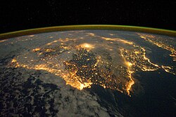
The region hosts several massive metropolitan areas. According to 2019 Eurostat data, the largest are Madrid (6.6 million) and Barcelona (5.5 million), followed by Lisbon (2.8 million) and Valencia (2.5 million).
Language and Culture
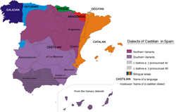
The Iberian Peninsula is a linguistic crossroads. While Spanish and Portuguese have become global languages, several other regional languages remain vital. These include Catalan (over 7 million speakers in Europe), Galician, and Basque, the latter of which is one of the oldest languages in Europe.
Frequently Asked Questions
![An anonymous picture depicting Lisbon, the centre of the slave trade, by the late 16th century.[138]](/images/24/05/2405cb2ea95a7f0c1b027a5d5e3b5839267665cb472a745fa5fa196519d5647c.png)
Which countries are located on the Iberian Peninsula?
The peninsula primarily consists of Spain and Portugal, but also includes the principality of Andorra, the British Overseas Territory of Gibraltar, and a small part of France (French Cerdagne).
What is the highest point in the region?
The highest peak is the Mulhacén, which reaches an elevation of 3,478 meters.
How does the climate vary across the peninsula?
The climate is highly diverse, ranging from the hot interior of the southwest (such as Córdoba) to the much cooler, temperate conditions found in the northern regions like Galicia.
What are the primary languages spoken in Iberia?
The most widely spoken languages are Spanish and Portuguese, alongside significant regional languages including Catalan, Galician, and Basque.
When did the first humans arrive in the Iberian Peninsula?
Neanderthals are believed to have first entered the peninsula around 200,000 BP during the Lower Paleolithic period.