Greenland Geography and Environmental Profile
Greenland is a vast and rugged landmass situated in both the Northern and Western Hemispheres. While it is geographically part of North America, it is not located on the mainland. Politically, it serves as an autonomous territory of the Kingdom of Denmark. Positioned strategically between the Arctic Ocean and the Atlantic Ocean, Greenland is defined by its extreme landscapes and unique environmental characteristics.
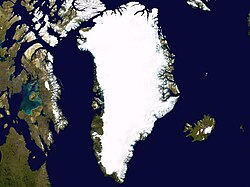
Key Facts
- Highest Point: Gunnbjørn Fjeld, reaching 3,700 meters (12,139 ft), making it the highest point in the Arctic.
- Total Area: 2,166,086 square kilometers.
- Coastline: An extensive 44,087 kilometers.
- Population: 56,344 residents.
- Capital: Nuuk.
Physical Geography and Terrain
The terrain of Greenland is characterized by dramatic contrasts. From the depths of the Arctic and North Atlantic Oceans at sea level to the towering peaks of the interior, the landscape is dominated by ice and rock. The territory features a diverse array of natural geographic features, including deep fjords (long, narrow inlets with steep sides or cliffs) and massive glaciers.
Mountains and Water Features
Beyond the heights of Gunnbjørn Fjeld, Greenland's geography includes significant mountain ranges, valleys, and canyons, including a feature known as Greenland's Grand Canyon. The landscape is further carved by numerous rivers, waterfalls, and lakes, while various islands dot the surrounding coastline.
Environment and Biodiversity
Greenland's environment is shaped by its extreme Arctic climate. This harsh setting supports specialized flora and fauna that have adapted to survive in freezing temperatures. The region's biodiversity includes a variety of mammals and birds specifically suited for the polar environment.
Conservation and Geology
To protect its unique natural heritage, Greenland maintains several protected areas, including national parks and biosphere reserves. The territory also hosts World Heritage Sites, recognizing its global significance. Geologically, the region is a subject of study for its ancient rock formations and the impact of renewable energy initiatives in a polar setting.
Administrative and Demographic Structure
Greenland is organized into various administrative divisions, including municipalities and counties, with the city of Nuuk serving as the capital. The population is distributed across several cities and smaller settlements throughout the territory.
Time Zones
Due to its vast longitudinal span, Greenland utilizes three different time zones:
- UTC+00: Used in Danmarkshavn and Ittoqqortoormiit.
- UTC-03: Used in Pituffik.
- UTC-02: Used in the rest of Greenland.
Summary of Greenland's Geographic Data
| Feature | Detail |
|---|---|
| Political Status | Autonomous territory of the Kingdom of Denmark |
| Total Area | 2,166,086 km² |
| Coastline Length | 44,087 km |
| Highest Peak | Gunnbjørn Fjeld (3,700 m) |
| Population | 56,344 |
| Capital City | Nuuk |
Frequently Asked Questions
What is the highest point in the Arctic?
The highest point in the Arctic is Gunnbjørn Fjeld, located in Greenland, with an elevation of 3,700 meters (12,139 ft).
Which country does Greenland belong to?
Greenland is an autonomous territory of the Kingdom of Denmark.
How many time zones are used in Greenland?
Greenland uses three time zones: UTC+00, UTC-02, and UTC-03.
What is the capital of Greenland?
The capital city of Greenland is Nuuk.
Is Greenland part of the North American mainland?
No, while it is located in North America, it is not on the mainland.