Exploring the North Pole: The Ultimate Guide to Earth's Northernmost Point
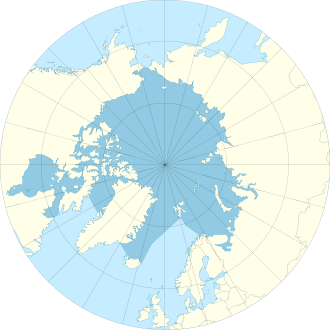
The North Pole, often referred to as the Geographic North Pole or the Terrestrial North Pole, represents the precise point in the Northern Hemisphere where the Earth's axis of rotation meets its surface. It is important to distinguish this location from the Magnetic North Pole, which is a different point used for navigation.
As the northernmost point on Earth, the North Pole sits directly opposite the South Pole. It defines the geodetic latitude of 90° North and serves as the convergence point for all lines of longitude. Because all lines of longitude meet here, the Pole does not have a single fixed longitude; it can be defined as any degree value. Similarly, because no official time zone has been assigned, any time can be used as the local time.
Geography and Environment
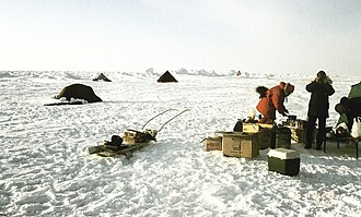
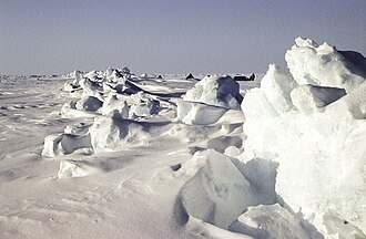
Unlike the South Pole, which sits on a solid continental land mass, the North Pole is located in the middle of the Arctic Ocean. The area is characterized by constantly shifting sea ice that covers the waters almost permanently. This makes the construction of a permanent station impractical compared to the South Pole.
The ocean floor beneath the ice is incredibly deep. Measurements taken by the USS Nautilus in 1958 recorded a depth of 4,087 meters (13,409 ft), while the Russian Mir submersible measured it at 4,261 meters (13,980 ft) in 2007.
Proximity to Land and Inhabitants
The North Pole is isolated from major landmasses. The nearest land is generally considered to be Kaffeklubben Island, located off the northern coast of Greenland, approximately 700 km (430 mi) away. The nearest permanently inhabited settlement is Alert on Ellesmere Island, Canada, situated about 817 km (508 mi) from the Pole.
Despite the harsh conditions, certain wildlife can be found in the vicinity. Polar bears are known to travel near the area, with a 2006 expedition reporting a sighting just 1 mile (1.6 km) from the Pole. Other animals, such as ringed seals and Arctic foxes, have also been observed in the surrounding Arctic regions.
A History of Exploration
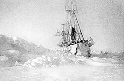
The quest to reach the North Pole has evolved from early cartography to high-tech submarine and submersible missions.
Early Maps and Expeditions
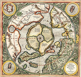
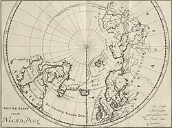
Early attempts to map the region were often speculative. Historical maps, such as those by Gerardus Mercator in 1595 and C.G. Zorgdragers in 1720, provided early visual representations of the area.
In the early 20th century, explorers like Robert Peary claimed to have reached the Pole in 1909. While his claims were celebrated by the contemporary press, they remain heavily disputed by modern historians.
![Peary's sledge party at what they claimed was the North Pole, 1909. From left: Ooqueah, Ootah, Henson, Egingwah, and Seeglo.[8]](/images/18/09/1809158559323b1c0f0976563802e42eac60266db60aca22e171a0518a819573.jpg)

Submarines and Drifting Stations
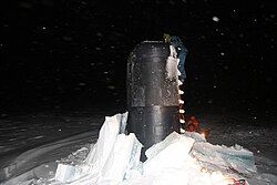
The mid-20th century saw a shift toward naval and scientific exploration. In 1958, the USS Nautilus became the first submarine to cross the North Pole. This was followed by several other notable naval milestones, including the first tri-submarine surfacing in 1986 and the first international surfacing involving the HMS Superb in 1987.
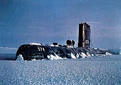
Because the ice is constantly moving, researchers have often used drifting stations. The Soviet Union and later Russia established manned drifting stations annually starting in 1937. More recently, the private Russian base Barneo has operated near the Pole during the early spring since 2002.
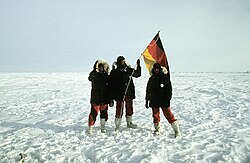
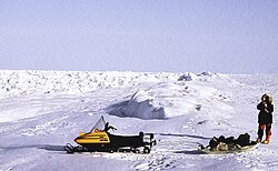
Modern Achievements and Deep-Sea Descent
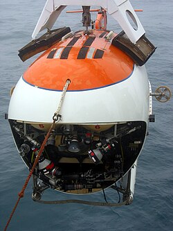
In 2007, a Russian scientific expedition named Arktika 2007 achieved a historic milestone: the first manned descent to the ocean floor at the North Pole. Using two MIR submersibles, researchers reached a depth of 4.3 km (2.7 mi) to support Russia's extended continental shelf claim, even placing a Russian flag on the seabed.
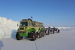
Surface exploration has also continued with specialized vehicles. In the late 1990s and early 2000s, Lada Niva Marsh vehicles were driven to the Pole, demonstrating the ability of heavy-duty machinery to navigate the extreme terrain.
Climate and Changing Conditions
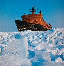
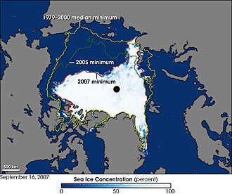
The Arctic environment is undergoing significant changes. Studies in the 2000s predicted that the North Pole could become seasonally ice-free due to Arctic ice shrinkage. The timeline for this shift has varied in scientific predictions, ranging from 2016 to the late 21st century.
The impact of global warming was highlighted in 2007 when British endurance swimmer Lewis Gordon Pugh completed a 1 km swim in the open water between ice floes to draw attention to the melting ice.
Summary of Key North Pole Data
| Category | Details |
|---|---|
| Geographic Latitude | 90° North |
| Environment | Arctic Ocean (shifting sea ice) |
| Sea Depth | Approximately 4,087 m to 4,261 m |
| Nearest Land | Kaffeklubben Island (~700 km) |
| Nearest Inhabited Place | Alert, Canada (~817 km) |
| First Submarine Crossing | USS Nautilus (1958) |
Key Facts
- The North Pole is the point where the Earth's axis of rotation meets the surface.
- All directions from the North Pole point South.
- There is no official time zone at the North Pole.
- The area is located in the middle of the Arctic Ocean, not on land.
- The first manned descent to the North Pole seabed occurred in 2007.
Frequently Asked Questions
What is the difference between the North Pole and the Magnetic North Pole?
The North Pole (Geographic North Pole) is the fixed point where the Earth's axis of rotation meets the surface. The Magnetic North Pole is the point where the Earth's magnetic field points vertically downward, and its location shifts over time.
Can you build a permanent house at the North Pole?
It is currently impractical to build a permanent station at the North Pole because it is located on shifting sea ice rather than solid land, unlike the South Pole.
What is the weather like at the North Pole?
The climate is extremely cold. Data from a nearby Greenlandic weather station shows mean daily temperatures often falling well below freezing, with record lows reaching as low as −50 °C (−58 °F).
How do people travel to the North Pole today?
Exploration is conducted via icebreakers, submarines, aircraft, and specialized vehicles like the Lada Niva Marsh or amphibious vehicles like the Yemelya.
Is there any land near the North Pole?
The nearest land is Kaffeklubben Island, located about 700 km (430 mi) away off the coast of Greenland.