Gera: The Historic Textile Hub of Thuringia
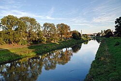
Located in the eastern part of the German state of Thuringia, Gera is a city defined by its resilience and industrial heritage. As the third-largest city in the state and the easternmost anchor of the Thüringer Städtekette (the string of Thuringia's six largest cities), Gera serves as a vital link between the regional centers of Erfurt and Leipzig. Nestled in the wide valley of the White Elster river, the city blends a rich royal history with a legacy of industrial innovation.
From its first mention in 995 to its era as a powerhouse of the European textile trade, Gera has evolved through various political and economic shifts. Today, it is a city of architectural contrasts, where late-Baroque residences stand alongside modern urban developments.
Key Facts
- State: Thuringia, Germany.
- Population: 95,608 (as of December 31, 2024).
- Geography: Situated in the East Thuringian Hill Country along the White Elster river.
- Historical Status: Former capital of the Principality of Reuss-Gera.
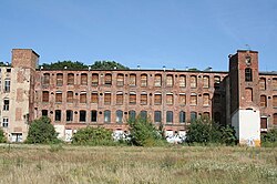
- Industrial Legacy: Once a major center for the textile industry.
- Notable Figure: Birthplace of the world-renowned painter Otto Dix.
Historical Evolution
Middle Ages and the Early Modern Period
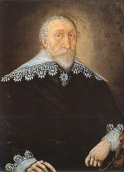
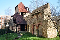
Gera began developing into a city during the 13th century. A pivotal moment occurred in 1533 when the Reformation was introduced. The city's economic trajectory changed significantly in the 16th century when Count Henry invited cloth-makers from the Spanish Netherlands to settle in Gera, laying the foundation for its future as a textile hub.
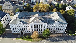
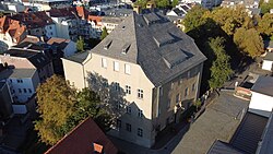
In 1673, the House of Reuss was elevated to Imperial Counts, granting them full sovereignty and establishing Gera as their royal residence. However, the city faced devastating setbacks in 1686 and 1780 due to massive town fires. The subsequent rebuilding in the 1780s gave the inner city its characteristic late-Baroque style.
The Industrial Boom and the 20th Century
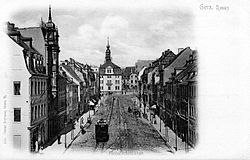
The 19th century marked a period of explosive growth. The installation of the first power loom in 1836 accelerated the textile industry, and the arrival of the railway in 1859 transformed Gera into a major transport hub. The city was also a pioneer in urban transit, installing the second electric tram system in Germany in 1892.
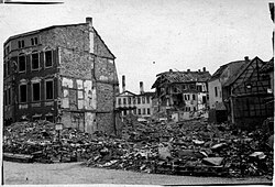
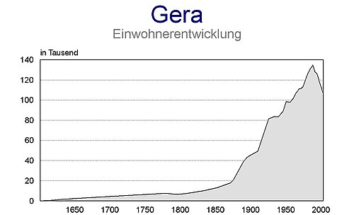
Following World War I and the German Revolution, the prince of Reuss abdicated, and Gera became part of the newly formed state of Thuringia in 1920. During the GDR era, Gera served as an administrative center (Bezirk capital) starting in 1952. However, the post-1990 reunification period brought severe economic challenges as the textile industry collapsed and administrative functions were relocated, leading to a significant population decline from a peak of 135,000 in 1988.
Geography and Demographics
Topography and Climate
Gera is situated in a hilly landscape, with elevations ranging from 180 meters at the river level to 354 meters at its southeastern point. The city is strategically positioned approximately 60 km south of Leipzig and 80 km east of Erfurt.
Population Trends
The city's population has fluctuated wildly based on economic fortunes. After a century of growth peaking in the late 1980s, the population dropped to under 100,000 by 2012. Recent demographic data shows a diverse migrant population, with significant communities from Russia, Vietnam, and Ukraine.
Culture and Cityscape
Architectural Heritage
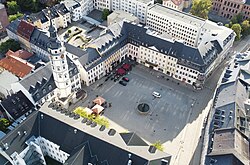
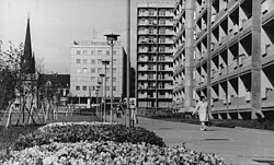
Gera's cityscape is a gallery of its history. Visitors can find Gründerzeit architecture (the style of the founders' era from the late 19th century) on Friedrich Engels Street, as well as various villas and Bauhaus-style buildings from the early 20th century.
Key Sights and Museums
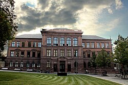
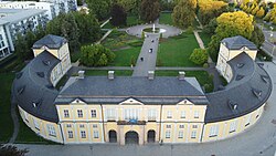
The city boasts several cultural landmarks, including the Orangerie at Küchengarten and the Otto Dix House. Its religious architecture is represented by several historic churches, including St. Saviour's and St. John's.
Economy and Infrastructure
Transport and Connectivity
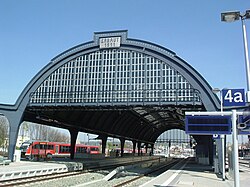
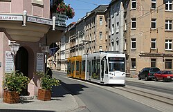
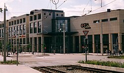
Gera is well-connected by road via the A4 and A9 Autobahnen. The city maintains an active tram network with three main lines, continuing its legacy as a transit pioneer. For air travel, the Leipzig/Halle Airport is the closest regional hub.
Economic Status
While the city has struggled with unemployment following the loss of its industrial core, urban planning initiatives like the Bundesgartenschau 2007 have aimed to stimulate the economy. The median salary in Gera remains approximately 10% lower than the average for eastern Germany.
| Category | Detail |
|---|---|
| State | Thuringia |
| Total Area | 152.19 km² |
| Population (2024) | 95,608 |
| Elevation (Market Place) | 205 m |
| Main River | White Elster |
| Lord Mayor | Kurt Dannenberg (CDU) |
Frequently Asked Questions
What is the Thüringer Städtekette?
The Thüringer Städtekette is a nearly straight string of the six largest cities in Thuringia, stretching from Eisenach in the west through Gotha, Erfurt, Weimar, and Jena, ending with Gera in the east.
Why was the textile industry important to Gera?
The textile industry drove Gera's rapid growth in the 19th century, transforming it into a wealthy industrial center. This era saw the introduction of power looms and the construction of many of the city's grand villas.
Who is Otto Dix?
Otto Dix (1891–1969) was a famous painter and printmaker born in Gera, known for his stark and often critical depictions of society and the horrors of war.
How did German reunification affect the city?
Reunification led to the closure of most of Gera's factories and the loss of its status as an administrative center, resulting in an economic crisis and a significant decline in population.
What are the main transport options in Gera?
Gera is served by a network of trams, buses, and rail lines. It is also accessible via the A4 and A9 Autobahnen and is located near the Leipzig/Halle Airport.