French Louisiana: The Rise and Fall of a North American Empire
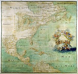
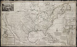
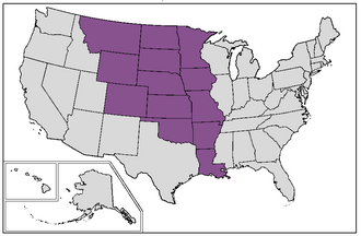
From the vast wilderness of the Great Lakes to the humid shores of the Gulf of Mexico, French Louisiana once stood as a massive district of New France. Established in 1682, this territory encompassed the entire drainage basin of the Mississippi River, stretching from the Appalachian Mountains in the east to the Rocky Mountains in the west. For over a century, France sought to project its power into the heart of North America, creating a colonial legacy that still resonates in the culture and architecture of the region today.
The colony was born from the ambition of explorer René-Robert Cavelier, Sieur de La Salle, who claimed the region for King Louis XIV. However, the sheer scale of the land proved difficult to manage. Due to limited financial and human resources, the French presence remained sparse, often relying on strategic alliances with Native American tribes rather than dense settlement.
Key Facts
- Founded: 1682 by René-Robert Cavelier, Sieur de La Salle.
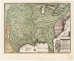
- Geography: Spanned the Mississippi River basin from the Great Lakes to the Gulf of Mexico.
- Capitals: Mobile (1702–1720), Biloxi (1720–1722), and New Orleans (1722–1762).
- Major Divisions: Upper Louisiana (Illinois Country) and Lower Louisiana.
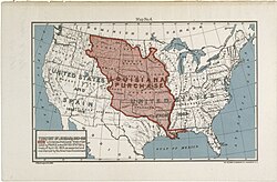
- End of French Rule: Sold to the United States in the 1803 Louisiana Purchase.
Boundaries and Settlement
French Louisiana was divided into two primary regions, each with distinct characteristics and settlement patterns.
Lower Louisiana (Basse-Louisiane)
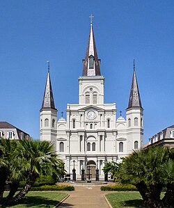
Lower Louisiana covered the lower Mississippi watershed, including parts of modern-day Arkansas, Louisiana, Mississippi, and Alabama. Early efforts began with the Arkansas Post in 1686 and Fort Maurepas in 1699. The administrative center eventually settled in New Orleans in 1722, which became the colony's most vital port.
Upper Louisiana (Haute-Louisiane)
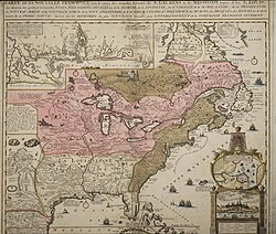
Also known as the Illinois Country (Pays des Illinois), this region included settlements in present-day Missouri, Illinois, and Indiana. Key outposts included Cahokia, Kaskaskia, and Ste. Genevieve. Initially governed as part of Canada, it was formally integrated into Louisiana in 1712.
The History of Exploration and Governance
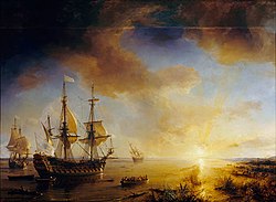
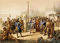
The colony's origins are tied to the 1682 expedition of La Salle and Henri de Tonti. After descending the Mississippi River to its delta, La Salle claimed the valley for France. Despite his success, his later attempt to establish a colony on the Texas coast in 1684 failed, and he was assassinated by his own party in 1687.
Governance in Louisiana was characterized by absolutism, meaning King Louis XIV maintained strict control without the use of parliaments or assemblies. The colony's administration shifted over time: it was royal property until 1712, then managed by businessman Antoine Crozat, and later by the Mississippi Company before returning to royal rule in 1731.

Colonial Society and Culture
The demographic makeup of Louisiana was a complex blend of Europeans, Africans, and Native Americans. While the French were the ruling class, they were numerically outnumbered by Native American tribes for much of the colony's history.
- Native Americans: Despite official prohibitions, some Native Americans were forced into slavery, though planters generally preferred African enslaved labor.
- The Cajun Community: Following their expulsion from Acadia by the British, thousands of Acadians settled in Louisiana, eventually forming the distinct Cajun culture.
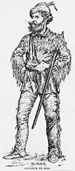
- Coureurs des bois: These "runners of the woods" were often former soldiers or settlers who lived among Native Americans to engage in the fur trade.
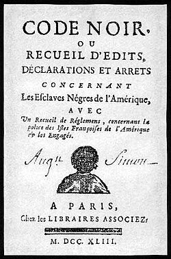
The legal framework of the colony was influenced by the Code Noir, a decree that regulated the lives of enslaved people and the duties of masters.
The Decline and Transfer of Power

The fate of French Louisiana was decided by global conflicts. During the French and Indian War (part of the Seven Years' War), France suffered major defeats in Canada. The 1763 Treaty of Paris forced France to cede its eastern territories to Great Britain and its western territories to Spain.
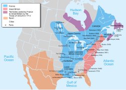
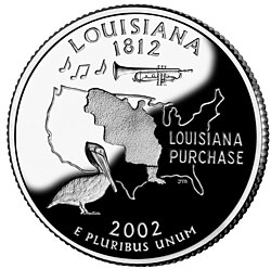
France briefly regained the western territory in 1801 through the secret Third Treaty of San Ildefonso. However, Napoleon Bonaparte, facing financial strain and failures in the Caribbean, decided to sell the land to the United States in 1803. This transaction, known as the Louisiana Purchase, cost 80 million francs (15 million dollars) and effectively ended France's colonial presence in the heart of North America.
Summary of French Louisiana

| Feature | Details |
|---|---|
| Time Periods | 1682–1762; 1801–1803 |
| Primary Capitals | Mobile, Biloxi, New Orleans |
| Key Figures | La Salle, Louis XIV, Napoleon Bonaparte |
| Population (1803) | ~70,000 Europeans/Africans; ~0.5 million Native Americans (West of Mississippi) |
| Successor State | United States (via Louisiana Purchase) |
Frequently Asked Questions
Who founded French Louisiana?
The colony was established in 1682 by the French explorer René-Robert Cavelier, Sieur de La Salle, who claimed the Mississippi River basin for King Louis XIV.
What was the difference between Upper and Lower Louisiana?
Upper Louisiana (the Illinois Country) consisted of settlements in present-day Missouri, Illinois, and Indiana. Lower Louisiana comprised the lower Mississippi watershed, including present-day Louisiana, Arkansas, Mississippi, and Alabama.
Why did France sell Louisiana to the United States?
Napoleon Bonaparte sold the territory in 1803 because France was strained by military operations in Europe and the Caribbean, and he decided the immense territory was no longer sustainable to maintain.
What is the origin of the Cajun people in Louisiana?
The Cajuns are descendants of Acadians who were expelled from Acadia (modern-day Canada) by the British and later settled in Louisiana, with a significant group arriving in 1785.
What was the role of the Code Noir?
The Code Noir was a legal code applied in Louisiana during the 18th century to regulate the status and treatment of enslaved people and the obligations of their owners.