Free State: The Agricultural and Mineral Heart of South Africa
The Free State is a landlocked province situated in the center of South Africa. Known for its vast, grassy plains and rich soil, it serves as a critical hub for both the nation's food security and its mineral wealth. Its capital, Bloemfontein, holds a unique position as the judicial capital of South Africa, housing the Free State Division of the High Court.
Historically, the province's roots trace back to the Boer republic known as the Orange Free State. While many South African provinces underwent significant border shifts, the Free State's boundaries have remained remarkably stable since before the Boer War, with the primary modern change being the reincorporation of Bantustans in 1994.
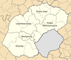
Key Facts
- Capital: Bloemfontein (Judicial capital of South Africa).
- Economy: Known as the "granary of South Africa" due to its massive agricultural output.
- Mining: A global leader in gold production, contributing 20% of the world's total.
- Demographics: Sotho is the dominant first language, spoken by 72.3% of the population.
- Geography: Home to the Vredefort Dome, the oldest and largest known meteorite impact site on Earth.
- Nature: Site of the successful reintroduction of South African cheetahs at Laohu Valley Reserve.
Geography and Climate
The landscape of the Free State is characterized by a succession of flat, grassy plains and pastureland, generally resting at an elevation of 3,800 feet. This plateau is occasionally interrupted by kopjes (small hills). To the east, the terrain rises sharply as the foothills of the Drakensberg and Maloti Mountains reach elevations exceeding 2,000 meters.
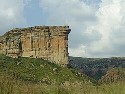
Geologically, the province sits upon the Karoo Sequence, consisting of shales, mudstones, and sandstones, capped by Drakensberg Basalt. This geological makeup provides the rich soil necessary for farming and the mineral deposits—specifically gold and diamonds—found primarily in the north and west.
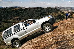
The climate varies by region. Bloemfontein experiences hot Januarys (max 31°C) and cold Julys (min -2°C), with an annual precipitation of 559 mm. Bethlehem, located further east, is slightly cooler in summer (max 27°C) and receives more rainfall (680 mm).
Demographics and Culture
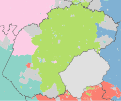
As of the 2022 census, the Free State has a population of 2,961,864. It is the second-least populous and second-least densely populated province in South Africa. The population is predominantly Black African (88.9%), followed by White (8.0%), Coloured (2.6%), and Indian/Asian (0.4%).
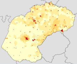
The province is the only one in South Africa where native Sotho-speakers form the majority. It also maintains a significant Afrikaans-speaking population (10.3%). Religiously, the province is overwhelmingly Christian (92.7%), with smaller percentages practicing Traditional African religions (4.9%) and Islam (0.5%).
Economy and Industry
The Free State economy is built on three primary pillars: agriculture, mining, and high-technology manufacturing.
Agriculture
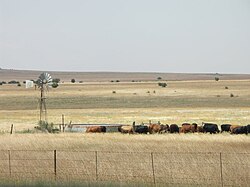
Often called the "granary of South Africa," the province leads in the production of biofuels and is a global contributor to maize production. Field crops generate nearly two-thirds of the agricultural income. Notable specialties include cherries (90% of the national crop is produced in Ficksburg) and potatoes, with 40% of the national yield coming from the province's high-lying areas.
Mining and Manufacturing
Mining is the province's largest employer. The Free State is the fifth-largest gold producer in the world, hosting 12 gold mines that produce 30% of South Africa's total output. Additionally, the province mines bituminous coal, diamonds, and bentonite. In Sasolburg, the petrochemical giant Sasol converts coal into fuels and chemicals, making the northern Free State a critical chemicals hub in the southern hemisphere.
Nature and Conservation
The province is a haven for biodiversity. The Soetdoring Nature Reserve is home to zebra, eland, and wild dogs. A major conservation milestone occurred in 2013 with the reintroduction of South African cheetahs at the Laohu Valley Reserve, leading to the first wild-born cheetah cubs in the region in over a century.
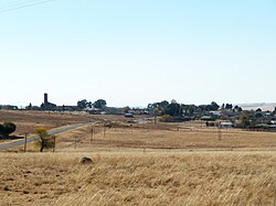
For visitors, the province offers the Golden Gate Highlands National Park and the Vredefort Dome, a UNESCO World Heritage Site. The region is also renowned for its San (Bushman) rock art, particularly around Clarens and Bethlehem.
Provincial Overview
| Category | Detail |
|---|---|
| Total Area | 129,825 km² |
| Population (2022) | 2,961,864 |
| GDP | US$ 20.0 billion |
| Dominant Language | Sotho (72.3%) |
| Highest Point | 3,291 m |
| Administrative Center | Bloemfontein |
Frequently Asked Questions
What is the significance of the Vredefort Dome?
The Vredefort Dome is a UNESCO World Heritage Site and is recognized as the oldest and largest known meteorite impact site in Earth's history.
Which language is most commonly spoken in the Free State?
Sotho is the most spoken first language, used by 72.3% of the population, making the Free State the only province where Sotho-speakers are the majority.
Why is the Free State called the "granary of South Africa"?
It earns this title because of its massive agricultural output, particularly in maize, sunflowers, and wheat, supported by rich soil and a favorable climate.
What is the role of Bloemfontein in the national government?
While it is the provincial capital of the Free State, Bloemfontein also serves as the judicial capital of the entire Republic of South Africa.
How does the Free State contribute to global gold production?
The province is the fifth-largest gold producer in the world, with its mines accounting for 20% of the world's total gold production.