Floodplains: Formation, Ecology, and Flood Management
A floodplain, also known as bottomlands, is a low-lying area of land adjacent to a river. These regions stretch from the banks of the river channel to the base of the enclosing valley. Because they are designed by nature to experience flooding during periods of high discharge, they are characterized by soils composed of clays, silts, sands, and gravels deposited by flowing water.
Due to regular flooding, floodplains often possess high soil fertility, as floodwaters deposit essential nutrients. This natural enrichment has made them prime locations for agriculture and urban development. Major agricultural hubs, including the Nile and Mississippi river basins, heavily exploit these lands. However, the inherent risk of inundation has led to extensive global efforts to control flooding and protect human settlements.
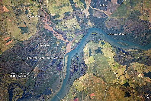
Key Facts
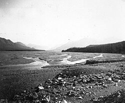
- Composition: Primarily made of silt, sand, gravel, and clay deposited during flood events.
- Fertility: High nutrient levels make them ideal for farming and agriculture.
- Dynamics: Formed through both lateral accretion (side-to-side) and vertical accretion (upward).
- Avulsion: The process where a river abandons its current channel belt for a new position, occurring every 10 to 1,000 years.
- Biodiversity: Floodplain forests serve as critical refugia for biodiversity despite significant human disturbance.
How Floodplains are Formed
Lateral Accretion and Meandering
Floodplains are largely created by the meandering nature of rivers. As a river curves, the flowing water erodes the outer bank of the meander. Simultaneously, sediments are deposited on the inner bank, forming a point bar. This process is known as lateral accretion. Because erosion on the outside usually balances deposition on the inside, the channel shifts position without significantly changing its width, creating a level floodplain of point bar deposits.
The speed of this shift varies wildly. While some are nearly static, the Kosi River in India has been reported to shift as much as 2,400 feet (730 m) per year.
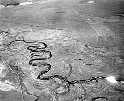
Vertical Accretion and Overbank Flow
When a river exceeds its channel capacity, overbank flow occurs. As water spills over the banks, it deposits a thin layer of sediment. This is called vertical accretion because the deposits build the land upward. In undisturbed systems, this typically happens every one to two years.
Research on the Meuse and Rhine Rivers in 1993 showed average sedimentation rates between 0.57 and 1.0 kg/m during a three-day flood, with higher concentrations (4 kg/m or more) found on the levees.
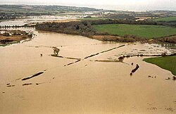
Alluvial Ridges and Avulsion
Repeated flooding builds an alluvial ridge, featuring natural levees and abandoned meander loops. Over long periods, a river may completely abandon its channel belt to build a new one elsewhere—a process called avulsion. This occurs at intervals of 10 to 1,000 years and can lead to catastrophic events, such as the 1855 Yellow River flood and the 2008 Kosi River flood.
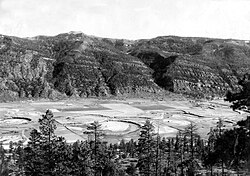
Floodplain Ecology
Floodplain ecosystems are organized into distinct biozones based on a gradient of soil moisture, oxygen, and flooding frequency. In Europe, the progression from the river outward typically follows this order: bank vegetation (annuals), sedges and reeds, willow shrubs, willow-poplar forest, oak-ash forest, and finally broadleaf forest.
Historically, European primeval floodplain forests were dominated by oak (60%), elm (20%), and hornbeam (13%). However, human activity has shifted this composition toward ash (49%) and maple (14%), while oak has decreased to 25%.
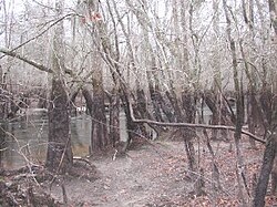
Though they once constituted 1% of the European landscape in the 1800s, many have been cleared for agriculture, hydroelectric reservoirs, or transportation. These forests are vital because they protect waterways from pollution and erosion while mitigating the impact of floodwaters.
Flood Control and Risk Management
River floods have been among the deadliest natural disasters in history. The 1931 China floods are estimated to have killed millions, and the 1887 Yellow River flood killed approximately one million people.
In the United States, the Federal Emergency Management Agency (FEMA) manages the National Flood Insurance Program (NFIP). This program uses the Flood Insurance Rate Map (FIRM) to identify the Special Flood Hazard Area, which is land subject to inundation by a 100-year flood.
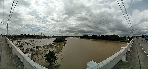
Mitigation Strategies
To qualify for government-subsidized insurance, communities must adopt ordinances to protect the floodway—the critical portion of the floodplain that must remain free of encroachments to allow water flow. Mitigation efforts include:
- Elevating new residential structures to the 100-year flood level.
- Floodproofing commercial buildings.
- Acquiring and demolishing flood-prone structures.
- Relocating entire towns, such as English, Indiana.
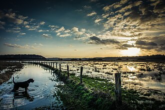
Summary of Floodplain Characteristics
| Process | Mechanism | Direction of Growth | Primary Result |
|---|---|---|---|
| Lateral Accretion | Meander erosion and point bar deposition | Horizontal / Sideways | Level floodplain surface |
| Vertical Accretion | Overbank flow during floods | Vertical / Upward | Thin sediment veneers and levees |
Frequently Asked Questions
What is the difference between lateral and vertical accretion?
Lateral accretion occurs when a river meanders, eroding the outer bank and depositing sediment on the inner bank (point bar), moving the channel sideways. Vertical accretion occurs when a river overflows its banks, depositing sediment layers on top of the existing land, building it upward.
Why are floodplains so fertile for agriculture?
Floodplains are fertile because periodic flooding brings in fresh deposits of nutrient-rich silts and clays from upstream, naturally fertilizing the soil.
What is a 100-year flood?
A 100-year flood is a flood event that has a 1% probability of occurring in any given year. It is used by agencies like FEMA to delineate Special Flood Hazard Areas for insurance and construction purposes.
What is avulsion?
Avulsion is the process by which a river abruptly abandons its existing channel belt and establishes a new course on the floodplain, typically occurring every 10 to 1,000 years.
How do humans impact floodplain ecosystems?
Human impact includes clearing forests for agriculture, building hydroelectric reservoirs, and constructing flood control systems. These activities fragment ecosystems, reduce biodiversity, and create sharper, less natural boundaries between land and water.