Crimea: Geography, History, and Political Status
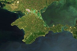
Crimea is a strategic peninsula in Eastern Europe, bordered by the Black Sea and the Sea of Azov. Spanning approximately 27,000 square kilometers, it is a region defined by its diverse landscapes—ranging from rugged mountains to sweeping steppes—and a complex history of conquest and cultural intersection.
Internationally, Crimea is recognized as Ukrainian territory that is currently occupied by Russia. This political tension is rooted in centuries of shifting control, making the peninsula one of the most geopolitically sensitive areas in the world.
Key Facts
- Area: 27,000 km² (10,000 sq mi).
- Highest Point: Roman-Kosh, reaching 1,545 meters (5,069 ft).
- Largest City: Sevastopol.
- Population: Approximately 2,416,856 (as of 2021).
- Strategic Value: Critical naval access to the Black Sea.
Geography and Climate
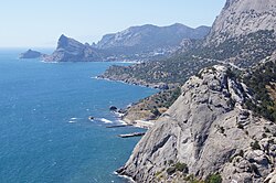
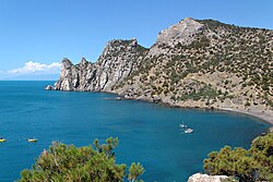
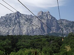
The peninsula's geography is divided into several distinct zones. The Crimean Mountains dominate the southern region, providing a dramatic backdrop to the coastline. In contrast, the northern areas are characterized by the Steppe, a vast, open grassland.
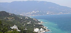
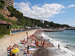
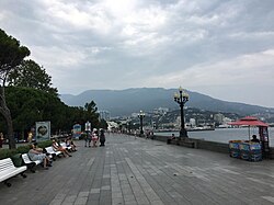
The Southern Coast is particularly noted for its subtropical climate, which supports lush vegetation and has historically made the region a favorite retreat for royalty and artists.
Hydrography is a critical issue for the region. The North Crimean Canal was historically the primary source of water, providing 85% of the peninsula's drinking and agricultural water before being blocked following the 2014 annexation.
![Following Russia's annexation of Crimea, Ukraine blocked the North Crimean Canal, which provided 85% of Crimea's drinking and agriculture water.[48]](/images/36/fe/36fe247054c88777a0992f15cfe55c1242eb84c4483edd83e61f3becd5b8aaa1.png)
A Complex Historical Timeline
Crimea's history is a tapestry of various civilizations, each leaving a permanent mark on the land.
Ancient and Medieval Eras
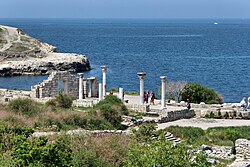
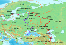
In antiquity, the peninsula hosted Greek colonies, such as Chersonesus, which served as vital hubs for trade between the north and south.
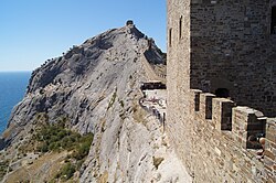
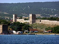
During the medieval period, the region saw the influence of the Republic of Genoa, which established fortified towns like Sudak and Caffa to control trade routes.
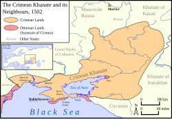
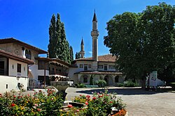
From 1443 to 1783, the Crimean Khanate ruled the peninsula, maintaining a distinct political and cultural identity centered around the Khan Palace in Bakhchisaray.
The Russian Empire and Soviet Era
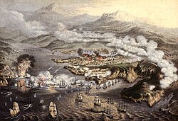
The Russian Empire annexed Crimea in 1783. This era saw the rise of Sevastopol as a major naval base and the region's involvement in the Crimean War (1853–1856), highlighted by the grueling 11-month siege of Sevastopol.
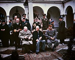
Under the Soviet Union, Crimea underwent significant demographic shifts. In 1944, the Soviet government deported the Crimean Tatars, along with Greeks, Bulgarians, and Italians, to other parts of the USSR. In 1954, the peninsula was transferred from the Russian SFSR to the Ukrainian SSR.
Modern Political Conflict
Following the dissolution of the Soviet Union in 1991, Crimea became the Autonomous Republic of Crimea within independent Ukraine. A 1997 treaty allowed Russia to maintain its fleet in Sevastopol.
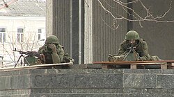
In 2014, Russian forces occupied the peninsula, an event marked by the appearance of unmarked soldiers known as "Little Green Men." While Russia annexed the territory, the majority of the international community continues to recognize it as part of Ukraine.
Economy and Infrastructure
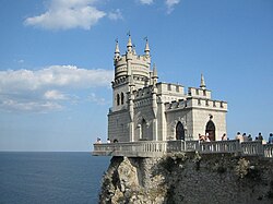
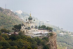
Crimea's economy relies heavily on tourism, agriculture, and energy. The region is famous for its palaces, such as the Livadia and Vorontsov palaces, and the iconic Swallow's Nest.
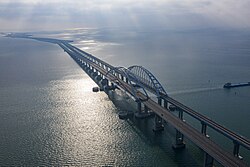
Infrastructure has seen significant changes, most notably the construction of the Crimean Bridge, which connects the peninsula to the Russian mainland.
The energy sector includes several gas fields, such as the Odeske field in the Black Sea, which holds approximately 21 billion cubic meters of reserves.
| Field Name | Type | Location | Reserves/Notes |
|---|---|---|---|
| Odeske | Offshore | Black Sea | 21 billion m³ |
| Dzhankoi | Onshore | Dzhankoi | - |
| Krym | Offshore | Black Sea | - |
| Strilkove | Offshore | Sea of Azov | - |
Demographics and Culture
The ethnic composition of Crimea has shifted dramatically over two centuries. While Crimean Tatars were the majority in the early 19th century (over 80%), the 2014 Russian census indicated that 84% of inhabitants named Russian as their native language.
Religion is predominantly Orthodox (58%), followed by Islam (15%). The cultural heritage of the region is celebrated through art, music, and architecture, from the works of Ivan Aivazovsky to the Eurovision-winning song "1944" by Jamala, which commemorates the deportation of the Crimean Tatars.

Frequently Asked Questions
![Catholic Church of Santa Maria Assunta in Kerch, reference[clarification needed] for the Italians of Crimea](/images/62/c4/62c4b5c83d3e56887bf606b64056a99d15c673f1fa70bd5744e1a0a9525db53d.jpg)
What is the current political status of Crimea?
Crimea is de facto controlled by Russia following its 2014 annexation, but it is recognized de jure by most of the international community as part of Ukraine.
Who are the Crimean Tatars?
The Crimean Tatars are an indigenous Turkic ethnic group of the peninsula. They suffered mass deportation by the Soviet government in 1944 before returning in later decades.
What is the significance of Sevastopol?
Sevastopol is the largest settlement in Crimea and serves as a critical strategic naval base for the Black Sea Fleet.
How does the climate vary across the peninsula?
The northern part of Crimea consists of steppes with a more continental climate, while the Southern Coast enjoys a subtropical climate, making it ideal for tourism and specific types of agriculture.
What is the Crimean Bridge?
The Crimean Bridge is a major infrastructure project that provides a direct road and rail link between the Crimean Peninsula and the Russian mainland.