Bayou St. John: A Historic Gem of New Orleans
Nestled within the Mid-City area of New Orleans, Bayou St. John (also known as Faubourg St. John) is a neighborhood defined by its serene waterway, lush parks, and deep historical roots. Built along the Esplanade Ridge, this district is celebrated for its architecturally significant homes and a vibrant community atmosphere that blends old-world charm with modern city life.
The neighborhood is bounded by Esplanade Avenue to the north, North Broad Street to the east, St. Louis Street to the south, and the Bayou St. John waterway to the west. Much of the area is preserved within the Esplanade Ridge Historic District, which was added to the National Register of Historic Places in 1980.
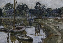
Key Facts
- Location: District 4, Mid-City District, New Orleans, Louisiana.
- Historic Status: Home to the Esplanade Ridge Historic District (National Register of Historic Places since 1980).
- Key Landmarks: Pitot House, Dufour Plassan House, and the New Orleans Fair Grounds.
- Total Area: 0.42 square miles.
- Population: 3,529 (as of the 2010 Census).
A Legacy of Trade and Celebration
Long before the official founding of New Orleans, the area near the navigable end of Bayou St. John served as a vital trade route for Native Americans. By the late 17th century, French trappers and traders began settling in the region, leading to the establishment of the community of Port Bayou Saint-Jean in 1708. While it predated the city of New Orleans, it was not formally incorporated into the city boundaries until the early 19th century.
The neighborhood has always been a center for social activity. Records from 1730 already mention Mardi Gras celebrations in the area. By the early 1800s, visitors described the neighborhood as a hub of excitement, featuring billiard parlors, cafes, and dance halls that attracted the local youth. Connectivity improved in 1794 with the creation of the Carondelet Canal, which linked the neighborhood directly to the French Quarter.
Geography and Community Life
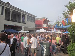
Covering approximately 0.42 square miles, Bayou St. John is bordered by the Fairgrounds to the north, Tremé to the east, and Mid-City and City Park to the west. Today, the neighborhood is known for its eclectic mix of museums, restaurants, and shops, particularly along Broad and Ponce de Leon Streets.
Community spirit is spearheaded by the Faubourg St. John Neighborhood Association (FSJNA). Active since the 1920s and officially registered in 1977, the FSJNA focuses on beautification, public space improvements, and community outreach. One of their primary current initiatives is the revitalization of the Desmare Playground at 3456 Esplanade Avenue, aiming to provide better equipment and a more welcoming environment for children.
Education in the Neighborhood
The area is home to several educational institutions, including Cabrini High School, a Catholic school for girls founded in 1905 by Mother Francesca Cabrini, and the McDonough City Park Academy, which serves students in grades K-5.
Architectural and Cultural Landmarks
Bayou St. John is a treasure trove of New Orleans architecture and history. From colonial residences to historic cemeteries, the neighborhood offers a glimpse into the city's evolution.
- Pitot House: The only Creole colonial house in New Orleans open to the public. It was the residence of James Pitot, the city's second mayor, from 1810 to 1819.
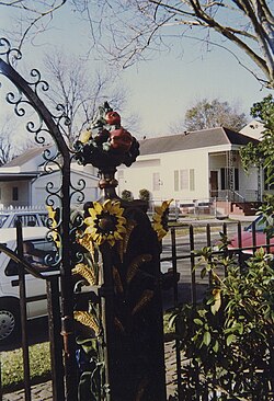
- Dufour Plassan House: Built in 1870, this home is famous for its striking white columns and an intricate iron fence decorated with cornstalks and sunflowers.
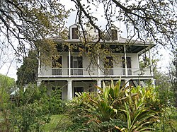
- Lorreins Plantation House: Also known as the Old Spanish Customs House, located at the intersection of Moss Street and Grand Route St. John.
- New Orleans Fair Grounds: Established in 1852 as the Union Race Course, this venue is renowned for horse racing and has hosted the New Orleans Jazz & Heritage Festival since 1972.
- Saint Louis Cemetery #3: A historic burial ground established in 1854.
Neighborhood Summary
| Category | Details |
|---|---|
| Planning District | District 4, Mid-City District |
| Total Area | 0.42 sq mi (1.1 km) |
| Population (2010) | 3,529 |
| Key Waterway | Bayou St. John |
| Notable Event Venue | New Orleans Fair Grounds |
Frequently Asked Questions
What is the difference between Bayou St. John the neighborhood and the waterway?
Bayou St. John refers to both the physical waterway and the surrounding neighborhood (also called Faubourg St. John) that was developed along its banks.
What is the significance of the Pitot House?
The Pitot House is historically significant as the only Creole colonial house in New Orleans open to the public, providing insight into early settlement life in the area.
Which major festival is hosted at the New Orleans Fair Grounds?
The New Orleans Jazz & Heritage Festival has been held at the Fair Grounds since 1972.
What makes the Dufour Plassan House unique?
The house is well-known for its distinctive architectural features, specifically its tall white columns and its elaborate "cornstalk fence" decorated with sunflowers.
When was the Esplanade Ridge Historic District recognized?
The district was added to the National Register of Historic Places in 1980.