Ashton-under-LyneTamesideGreater ManchesterIndustrial RevolutionPortland Basin

Ashton-under-Lyne: A Journey Through Industrial Heritage and Modern Growth

Ashton-under-Lyne: A Journey Through Industrial Heritage and Modern Growth Located in the heart of the Tameside metropolitan borough within Greater Manchester, Ashton-under-Lyne is a town...

Ashton-under-Lyne: A Journey Through Industrial Heritage and Modern Growth

Located in the heart of the Tameside metropolitan borough within Greater Manchester, Ashton-under-Lyne is a town defined by its resilience and transformation. Once a pivotal hub of the Industrial Revolution, it has evolved from a network of cotton mills and canals into a modern urban center that balances its rich historical legacy with contemporary commercial development.

With a population of 48,604 as of the 2021 census, the town serves as a key residential and economic node in the North West of England. Its identity is deeply rooted in the labor and ambition of the workers who built its infrastructure, from the sprawling canal basins to the public parks that define its green spaces.
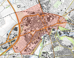
An OS map of the area, a rough cuboid of which is shaded red to show roughly the boundaries of Ashton. To the left this is a large road, and to the bottom a river.
Approximate boundaries of Ashton-under-Lyne based on the St Peter's Ward and the Ashton Regeneration Zone; as Ashton is contiguous with many surrounding towns, precise boundaries are not possible.

Key Facts

A silver shield with a black five-pointed star with a red crescent in the top left hand corner. Above the shield are the battlements of a tower surmounted by a red griffin's head. Below the shield is the motto "LABOR OMNIA VINCIT", which means "Persistent Works Triumphs".
The coat of arms of the former Ashton-under-Lyne Municipal Borough Council
  • Population: 48,604 (2021 Census).
  • Location: Tameside, Greater Manchester, England.
  • Industrial Legacy: Historically a major mill town centered on cotton production.
  • Key Landmarks: Portland Basin, Ashton Town Hall, and St Michael and All Angels' Church.
  • Transport: Served by a comprehensive network of rail, tram (Metrolink), and road links.

Historical Evolution
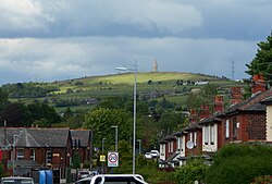
A hill in the background. The photo is taken on a street with the camera facing down the street and terraced houses on both sides. Cars, streetlights, and a 20mph speed limit sign are all visible in the foreground.
Hartshead Pike seen from Ashton

Pre-Industrial and Industrial Growth

Before the rise of the factories, Ashton was a smaller settlement, with a population of only 550 in 1700. However, the Industrial Revolution triggered an explosive growth period. By 1851, the population had surged to 29,790 as the town became a center for the textile industry.

This growth was fueled by a sophisticated network of canals and railways that allowed for the efficient transport of raw materials and finished goods. The town's layout was reshaped to accommodate massive mills and the workers who manned them.
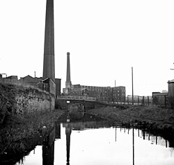
A black-and-white photograph of a canal taken from a boat on it. On the left-hand side is a small building with a massive chimney stretching above the top of the photo. To the right of the canal is a much bigger building, itself also with a massive chimney, all of which is in the photo. The right-hand building appears directly in front due to the curvature of the canal, and a bridge goes over the canal between the two buildings.
Following the Industrial Revolution, Ashton became a mill town at the centre of a network of canals and railways.

Civic Pride and Public Spaces

The late 19th century saw a rise in civic investment. A notable example is Stamford Park, which opened in 1873. The park was the result of 17 years of dedicated campaigning and fundraising by local cotton workers, demonstrating the community's commitment to improving urban living conditions. Over 60,000 people attended its opening day.
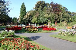
Pathway leading towards a circular flowerbed where the path splits. Flowerbeds also flank the path on each side. The flowerbeds are decorated by various red and yellow flowers. Trees are in the background.
Over 60,000 people turned out to the opening of Stamford Park in 1873; it had taken 17 years of campaigning and fundraising by local cotton workers.

Geography and Demographics

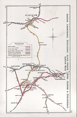
A railway clearing house map, which looks like a rectangular sheet of a paper with coloured lines showing different railway companies' lines. They converge in Oldham at the top, and Ashton at the bottom, with a key showing the colours' corresponding companies.
1912 Railway Clearing House map of the Ashton area

Ashton-under-Lyne is characterized by a high population density of 12,374 people per square mile. The town's demographic profile is diverse, reflecting its history as a place of migration and industry.

Demographic Composition (2021 Census)
Ethnic Group Ashton Central (%) Tameside (%) England & Wales (%)
White 52.2 85.5 81.7
Asian 37.8 9.2 9.3
Black 5.1 2.3 4.0
Other 4.9 3.0 5.0

Landmarks and Culture

Architectural Heritage

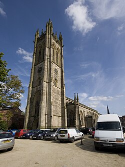
The town boasts several significant structures. St Michael and All Angels' Church is a Grade I listed building, representing the town's ecclesiastical history. The Ashton Town Hall is noted for its impressive Corinthian columns, while the Ashton Town Library stands as a testament to 19th-century civic architecture.
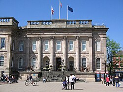
A panoramic shot of a town. In the foreground a modern-looking bus station in front of a red-brick building with large sash windows; in the background a church spire and a hill with houses on the hillside.
The Corinthian columns on the facade of Ashton Town Hall

A church built in Gothic style with the tower in the centre of the picture and the main body of the church extending to the right
St Michael and All Angels' Church is a Grade I listed building.

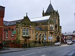
The façade of Ashton town library, constructed from stone and built in Gothic revival style. The photo is a colour modern photo taken from across the road.
Ashton Town Library was built in the second half of the 19th century.

Commerce and Community

The Ashton Market Hall remains a focal point of local trade. Despite facing challenges, including a significant fire, the hall was rebuilt and has been recognized as one of the best markets in the country. In the modern era, the town has attracted major retailers; IKEA opened its first-ever town center store in Ashton-under-Lyne in 2006.
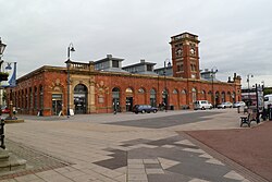

A red-brick, mostly single-storey building as photographed from across a pedestrianised square. There are frequent floor-to-ceiling windows (thus spanning the whole height of the building), with a single cuboidal spire at the centre of one façade extending upwards.
Ashton Market Hall in October 2011

A blue building with "Ikea" written on the side in large yellow letters. Trees in the foreground.
IKEA's store in Ashton-under-Lyne, which opened in 2006, was their first in a town centre.

Faith and Remembrance

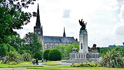
The town's spiritual landscape is diverse, featuring the Masjid Hamza Mosque in the West End and the historic Albion Church. The Ashton-under-Lyne War Memorial, located in the Memorial Gardens, serves as a solemn reminder of the town's sacrifices during global conflicts.
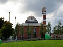
A mosque viewed from across a green. The mosque is fairly cubic with a central dome and a spire-like dome on one edge.
Masjid Hamza Mosque in West End on Katherine Street

A church in the background-centre with its steeple on the left-hand side. On the right hand foreground a grand war memorial with a bronze statue on top of a large pillar. The foreground is set in a park with trees and paths
Albion Church photographed from the War Memorial in 2018

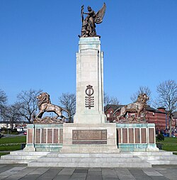
A column flanked by two lions and surmounted by a statue of Peace and a soldier. There are bronze plaques on the base of the monument.
Ashton-under-Lyne War Memorial, in Memorial Gardens

Infrastructure and Transport

Ashton's connectivity is a cornerstone of its economy. The Portland Basin, once a bustling industrial port, now houses a museum that preserves the town's maritime and industrial history.
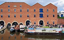
A brick-built warehouse with a canal in the foreground. There are barges on the canal and people sitting outside the warehouse.
The Portland Basin warehouse is now a museum.

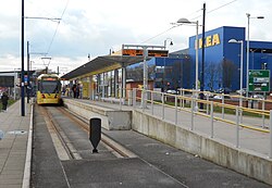
Modern transport is facilitated by the Ashton-under-Lyne railway station and the Metrolink tram stop, providing seamless access to the wider Greater Manchester area. This infrastructure continues to support the town's role as a regional hub.
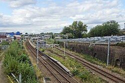
An electrified railway station which has two tracks with an island platform in the middle. The station is quite overgrown both on the platform and on the other sides of the tracks, and there is a steep cutting wall on the right-hand side
Ashton-under-Lyne railway station in 2024

A tram terminus consisting of an island platform with a tram on the left hand side and a buffer just in front of the camera. The IKEA is visible in the background. The station is mostly built from clean concrete
Ashton-under-Lyne tram stop

Frequently Asked Questions

What is the significance of Portland Basin?

Portland Basin was a critical junction for the canal network during the Industrial Revolution, facilitating the movement of goods. Today, it is home to a museum that documents this industrial heritage.

How did Stamford Park come to be created?

Stamford Park was created through 17 years of fundraising and campaigning by local cotton workers, highlighting the grassroots effort to provide green space for the industrial community.

What is the current population of Ashton-under-Lyne?

According to the 2021 census, the population of Ashton-under-Lyne is 48,604.

Which major retailer opened its first town center store here?

IKEA opened its first store located within a town center in Ashton-under-Lyne in 2006.

What are the primary transport links in the town?

The town is served by a railway station, a Metrolink tram stop, and a network of roads and canals, ensuring strong connectivity to the rest of Greater Manchester.