Westons Mills: A Glimpse into this Middlesex County Community
Nestled along the border of two prominent townships in New Jersey, Westons Mills (also referred to as Westons Mill) is a quiet, unincorporated community. An unincorporated community is a settlement that does not have its own separate municipal government, instead falling under the jurisdiction of surrounding townships.
Located within Middlesex County, this area serves as a geographic point of intersection between the cities of New Brunswick and East Brunswick. Its landscape is defined by its low elevation and proximity to local waterways.
Key Facts
- Location: Border of East Brunswick and New Brunswick, Middlesex County, New Jersey.
- Coordinates: 40°29′07″N 74°24′45″W.
- Elevation: Approximately 39 feet (12 meters) above sea level.
- Primary Landmark: Westons Mill Pond.
- GNIS Feature ID: 881750.
Geography and Landmarks
The community is situated at a relatively low elevation of 39 feet, making it part of the coastal plain geography typical of this region of New Jersey. The most notable physical feature of the area is the Westons Mill Pond, which remains a central landmark for the community.
Historically, the area's development was tied to its water resources, specifically the bend in the Lawrence Brook which provided the necessary power for early industry.
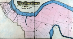
Regional Overview
Westons Mills occupies a unique position, straddling the line between the urban influence of New Brunswick and the suburban landscape of East Brunswick. This placement puts it within the heart of Middlesex County, a central hub of the state of New Jersey.
| Attribute | Detail |
|---|---|
| State | New Jersey |
| County | Middlesex |
| Townships | New Brunswick and East Brunswick |
| Elevation | 39 ft (12 m) |
| Feature ID | GNIS 881750 |
Frequently Asked Questions
Where exactly is Westons Mills located?
Westons Mills is located in Middlesex County, New Jersey, situated along the border that divides East Brunswick and New Brunswick.
What is the most prominent landmark in Westons Mills?
The most prominent landmark in the community is the Westons Mill Pond.
What is the elevation of the area?
The community sits at an elevation of approximately 39 feet (12 meters) above sea level.
Is Westons Mills an independent city?
No, it is an unincorporated community, meaning it does not have its own independent municipal government and is part of the surrounding townships.
What is the GNIS feature ID for Westons Mills?
The Geographic Names Information System (GNIS) feature ID for Westons Mills is 881750.