Route 27: A Journey Through New Jersey's Historic Lincoln Highway
Route 27 is a significant state highway in New Jersey, stretching 38.53 miles (62.01 km) across the heart of the Garden State. From its southern terminus at U.S. Route 206 in Princeton to its northern end at Route 21 in Newark, this road serves as a vital artery connecting several major urban and suburban hubs, including New Brunswick, Edison, and Elizabeth.
More than just a commuter route, Route 27 is a living piece of American history. It follows the path of the Lincoln Highway, the first transcontinental highway established in 1913. Today, the road is maintained by the New Jersey Department of Transportation (NJDOT) and Middlesex County, offering a diverse driving experience that ranges from quaint university town streets to bustling city avenues.
Key Facts
- Total Length: 38.53 miles (62.01 km).
- Route Span: From Princeton (Mercer County) to Newark (Essex County).
- Historical Significance: Former alignment of the Lincoln Highway and early US 1.
- Scenic Designation: Part of the Millstone Valley Scenic Byway.
- Major Water Crossing: The Albany Street Bridge over the Raritan River.
Route Path and Regional Breakdown
Mercer County and the Princeton Corridor
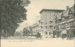
The journey begins in downtown Princeton at a traffic light with US 206. Here, Route 27 is known as Nassau Street, the primary thoroughfare lining the northern edge of Princeton University. This section is a hub of activity, featuring numerous shops and restaurants with a daily traffic volume between 10,000 and 20,000 vehicles.
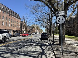
As the road leaves the downtown area, it passes through residential zones and runs parallel to Carnegie Lake. It crosses the Millstone River just north of the historic Kingston Bridge, a segment that is recognized as part of the King's Highway Historic District.
The Middlesex–Somerset Border and New Brunswick
Upon crossing the Millstone River, the highway straddles the border of Franklin Township (Somerset County) and South Brunswick (Middlesex County). It passes through the historic community of Kingston and continues northeast through a mix of woodlands and suburban developments, including Kendall Park and Franklin Park.
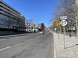
As it enters New Brunswick, the route transitions through various designations. It becomes Somerset Street and later French Street. In the heart of New Brunswick, it passes south of the Rutgers University main campus and crosses under the Northeast Corridor rail line. A key landmark here is the Albany Street Bridge, which carries the highway over the Raritan River, connecting New Brunswick to Highland Park.
Edison, Metuchen, and Woodbridge
In Highland Park, the road is known as Raritan Avenue. Upon entering Edison, the name changes to Lincoln Highway. This section is historically rich, passing near the Thomas Alva Edison Memorial Tower and Museum at the site of his Menlo Park laboratory.
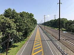
The route continues through Metuchen as Essex Avenue and Lake Avenue before returning to Edison. In Woodbridge Township, the road widens to four lanes and passes the Metropark station, providing an interchange with the Garden State Parkway.
Union and Essex Counties: Rahway to Newark
Entering Union County, Route 27 becomes St. Georges Avenue in Rahway. It continues through Linden and Elizabeth, where it utilizes a one-way pair system (Rahway Avenue and Westfield Avenue) to manage urban traffic. In Elizabeth, the route intersects with Route 28 and Route 439.
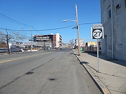
The final leg of the journey enters Newark, Essex County, as Frelinghuysen Avenue. It passes through the Dayton neighborhood and Weequahic Park, interchanging with US 22 and passing under I-78. The route concludes at an interchange with McCarter Highway (Route 21) and Broad Street.
Historical Evolution
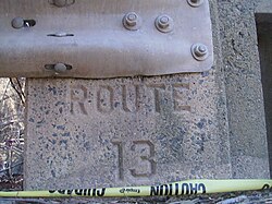
The origins of Route 27 date back to colonial times. The southern portion follows the Lenape Assunpink Trail, later known as the Old Dutch Trail and the King's Highway. In the north, the road evolved from Queen Anne's Road into the Post Road and eventually St. Georges Avenue.
During the 19th century, the route incorporated several turnpikes, including the Essex and Middlesex Turnpike (1806) and the Princeton and Kingston Branch Turnpike (1807). Its modern identity began in 1913 as part of the Lincoln Highway. While it was designated as Route 27 in 1927, it also carried the US 1 designation until the 1940s. In 1953, the southern terminus was moved to Princeton to eliminate a concurrency with US 206.
Route Summary Table
| Region/City | Local Name | Major Junctions |
|---|---|---|
| Princeton | Nassau Street | US 206 |
| New Brunswick | Somerset St / Albany St | Route 18 |
| Edison | Lincoln Highway | I-287 |
| Woodbridge | Lincoln Highway | Garden State Parkway |
| Rahway | St. Georges Avenue | Route 35 |
| Elizabeth | Westfield Avenue | Route 28, Route 439 |
| Newark | Frelinghuysen Avenue | US 22, Route 21 |
Frequently Asked Questions
What is the historical significance of Route 27?
Route 27 is historically significant as it follows the alignment of the Lincoln Highway, the first transcontinental highway in the United States, established in 1913. It also incorporates several colonial-era trails and 19th-century turnpikes.
Where does Route 27 begin and end?
The highway begins at a junction with US 206 in Princeton, Mercer County, and ends at an interchange with Route 21 (McCarter Highway) and Broad Street in Newark, Essex County.
Which major river does Route 27 cross?
Route 27 crosses the Raritan River via the Albany Street Bridge, which serves as a connection between New Brunswick and Highland Park.
Is Route 27 part of any scenic byways?
Yes, Route 27 is part of the Millstone Valley Scenic Byway.
How has the southern terminus of Route 27 changed over time?
Originally, the route extended further south toward Trenton. However, during the 1953 New Jersey state highway renumbering, the southern terminus was cut back to Princeton to avoid a concurrency with US 206.