Wenchuan Earthquake 2008: Impact, Geology, and Recovery

Wenchuan Earthquake 2008: Impact, Geology, and Recovery

On May 12, 2008, a catastrophic seismic event struck the Sichuan province of China, leaving a lasting mark on the region's landscape and population. Known as the Wenchuan earthquake, this disaster was characterized by its immense power and the devastating structural failure of buildings, particularly schools, in the affected mountainous terrain.

The earthquake occurred at 14:28:01 local time (CST), with a duration exceeding two minutes. The tremors were felt far beyond the epicenter, reaching as far as Taiwan, Hong Kong, and Macau, where residents in high-rise buildings reported dizziness and shaking.
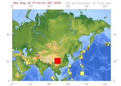
The USGS provided a map of Asia in May 2008, which showed a total of 122 earthquakes occurring on the continent. The large red square near the center of the map depicts the 7.9 magnitude Chengdu quake in the Sichuan province.

Key Facts

ภาพประกอบบทความ
ภาพประกอบจากบทความต้นฉบับ
  • Magnitude: Revised to 8.0 (range of 7.9–8.3).
  • Epicenter: 31°01′16″N 103°22′01″E, at a depth of 19 km.
  • Casualties: 69,196 dead, 374,643 injured, and 18,379 missing.
  • Economic Loss: Approximately US$130 billion.
  • Fault Line: The Yingxiu-Beichuan fault.
  • Intensity: Reached MMI XI (Extreme) on the Modified Mercalli Intensity scale.

Geology and Tectonics
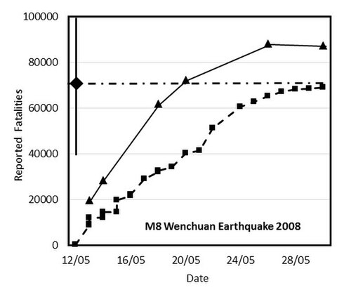
Figure 1: Official fatality reports for the Wenchuan M8 earthquake as a function of time. Squares show fatalities, triangles show the sum of fatalities plus missing persons, which equaled the number of fatalities in the end. The diamond is the QLARM estimate 100 minutes after the earthquake, with the range of possible values given by the solid, vertical line through the diamond. The horizontal dash-dotted line indicates the average value of fatalities calculated by QLARM.

The disaster was caused by a thrust fault—a type of fault where one block of earth is pushed upward over another—specifically along the Yingxiu-Beichuan fault. This movement released a massive amount of energy, resulting in a rupture that extended across the region.
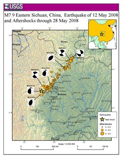
Map showing the location of the 2008 Sichuan earthquake and all the aftershocks following it through May 28, 2008

Following the main shock, the region experienced a prolonged period of seismic instability. Records indicate between 149 and 284 major aftershocks, with a total exceeding 42,719 events. These aftershocks continued to threaten rescue workers and destabilize already damaged structures.
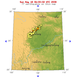
A USGS map shows that dozens of aftershocks occurred in a small region following the quake.

Human and Structural Impact

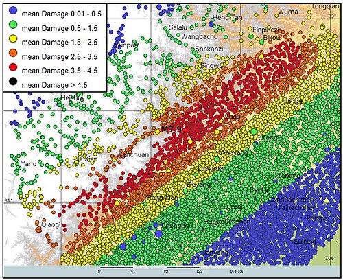
Figure 2: Map of settlements with the estimated mean damage due to the Wenchuan earthquake modeled as a line rupture extending as far as the aftershocks.

The earthquake caused widespread devastation across several provinces, though Sichuan bore the brunt of the damage. The most severe losses occurred in Mianyang, Ngawa, and Deyang.

Death Toll by Province and Major Prefecture (Sichuan)
Region/Prefecture Deaths
Mianyang (Sichuan) 21,963
Ngawa (Sichuan) 20,258
Deyang (Sichuan) 17,121
Guangyuan (Sichuan) 4,822
Chengdu (Sichuan) 4,276
Gansu Province 365
Shaanxi Province 122
Total 69,196

A significant point of controversy and tragedy was the collapse of schoolhouses. Official reports indicated that over 5,000 students perished, leading to widespread public outcry and investigations into the structural quality of school buildings in the region.
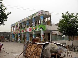
This kindergarten was among the many schools in the disaster region that suffered heavy structural damage.

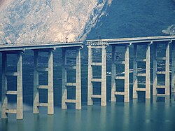
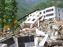
Infrastructure damage was total in many areas. Bridges, such as the Miaoziping Bridge on the Dujiangyan-Wenchuan Expressway, were destroyed, and warehouses and banks were reduced to rubble.
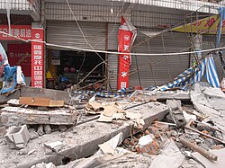
The outside of a warehouse in disarray following the earthquake.
The Miaoziping Bridge of Dujiangyan –Wenchuan Expressway was damaged in the earthquake.
A bank building in Beichuan after the earthquake. A girl was found alive in the ruins 102 hours (4 days, 6 hours) after the earthquake.[66]
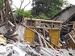
A single door frame bearing a portrait of Mao Zedong remained standing in a pile of debris.

Rescue and Immediate Aftermath

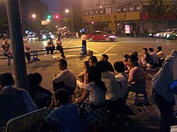
On the night of May 12, residents of Chengdu worried about potential aftershocks gathered in the street to avoid staying in buildings.

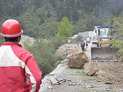
Rescue efforts were severely hindered by the geography of the region. Persistent rain, mudslides, and rock slides blocked main roads, making it difficult for officials to reach the target zones. Rescue workers had to contend with falling debris and treacherous mountain passes.
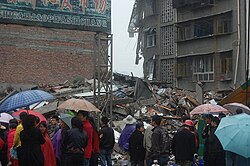
Rain was among the many problems affecting the area in the aftermath of the earthquake. Here, a group of onlookers examine a collapsed building in the rain.
Persistent rain, as well as rock slides and a layer of mud coating on the main roads, such as the one above, hindered rescue officials' efforts to enter the target region.
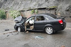
Falling debris, such as the object that landed on this vehicle, hindered rescue workers' progress as they attempted to cross the mountain.

Despite these challenges, heroic efforts led to several miracles, including the rescue of a girl found alive in the ruins of Beichuan 102 hours after the quake, and an elderly woman rescued after being trapped for over 50 hours.
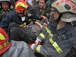
This elderly woman was rescued and placed on a stretcher after being trapped for over 50 hours.

The disaster also created quake lakes—natural dams formed by landslides that blocked rivers, creating a secondary risk of flash flooding for downstream communities.

Global Response and Recovery
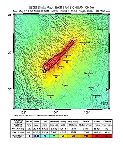
USGS ShakeMap
USGS ShakeMap

The response was a massive domestic and international effort. China deployed 50,000 troops for search and rescue. International aid arrived from various sources, including the United States, which provided satellite imagery and relief supplies, and South Korea, which dispatched the Central 119 Rescue Team.

Senior Capt. Guan Youfei greeted the first of two U.S. aircrews delivering earthquake relief supplies
South Korean dispatch of the Central 119 Rescue Team to Sichuan following the earthquake

Public mourning was observed nationwide, with the flag flown at half-mast at Tiananmen Square in Beijing. Donations poured in from across the globe, including from Macao and other regions.
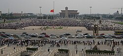
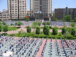
On May 19, 2008, people mourned for the earthquake victims at Tiananmen Square, Beijing, with the flag at half mast throughout the mourning period.
Students paying tribute for earthquake victims in Urumqi
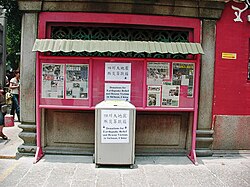
Donation box for Sichuan earthquake victims, A-Ma Temple, Macao, May 2008.

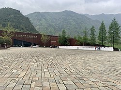
By 2012, the Chinese government announced that the restoration and reconstruction process was complete. The scale and speed of the recovery were later noted in a World Bank report. Today, the Wenchuan Earthquake Memorial Museum serves as a place of remembrance for the victims.

A retired China Fire Services [zh] Chengdu department fire truck which responded to the 2008 earthquake in the Jianchuan Museum Cluster 2008 Earthquake exhibit.[209]
Wenchuan Earthquake Memorial Museum

Frequently Asked Questions

What was the exact magnitude of the Wenchuan earthquake?

While initial reports varied, the magnitude was revised by the China Earthquake Administration and other agencies to 8.0, though estimates ranged between 7.9 and 8.3.

What caused the earthquake geologically?

The earthquake was caused by a thrust fault along the Yingxiu-Beichuan fault line, where tectonic plates pushed upward, creating intense seismic energy.

Why were school buildings specifically mentioned in the aftermath?

There was significant concern and public outrage regarding the high number of student deaths (over 5,000), which led to probes into the poor structural quality of schoolhouses compared to other buildings.

What are "quake lakes"?

Quake lakes are bodies of water formed when landslides triggered by an earthquake block a river, creating a natural dam that can potentially burst and cause flooding.

How much did the total damage cost?

The total economic damage was estimated at US$130 billion, which is equivalent to approximately $194.4 billion in 2025 values.

References

  1. "2008年5月12 日汶川特大地震震源特性分析报告" (PDF). China Earthquake Administration. May 27, 2008. Archived from the original (PDF) on May 27, 2008. Retrieved May 22, 2024.
  2. "Seismic intensity map of the M8.0 Wenchuan earthquake (汶川8.0级地震烈度分布图)". China Earthquake Administration. August 29, 2008. Archived from the original on September 8, 2008. Retrieved October 9, 2003.
  3. Watts, Jonathan (August 14, 2008). "Sichuan quake: China's earthquake reconstruction to cost $150bn". The Guardian. Archived from the original on October 8, 2017. Retrieved October 8, 2017.
  4. "Massive quake kills nearly 10,000 in China". NBC News. May 12, 2008. Archived from the original on July 20, 2013. Retrieved May 20, 2008.
  5. "Magnitude of SW China earthquake revised to 8.0". Xinhua News Agency. May 18, 2008. Archived from the original on February 29, 2012. Retrieved May 18, 2008.