Sub-Antarctic Zone: Geography, Islands, and Glacial Retreat
The sub-Antarctic zone is a distinct physiographic region in the Southern Hemisphere, serving as the transition between the temperate latitudes and the frozen expanse of the Antarctic region. Roughly situated between 46° and 60° south of the Equator, this region encompasses a vast array of islands across the Atlantic, Indian, and Pacific oceans. It is defined not just by coordinates, but by complex oceanic boundaries and currents that dictate the climate and ecology of the far south.
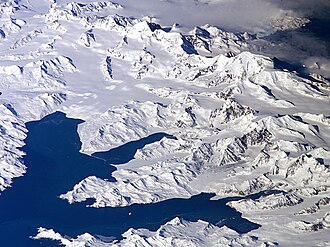
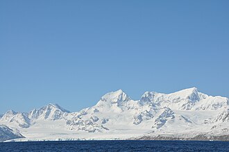
A critical distinction in polar science is the definition of glaciers: any glacier located on the continent of Antarctica is an Antarctic glacier, whereas those found on islands within this specific region are classified as subantarctic glaciers.
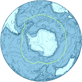
Geography and Oceanic Boundaries
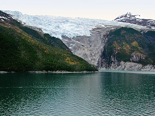
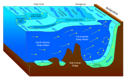
The sub-Antarctic region is structured by two primary geographic zones and three distinct oceanic fronts. These boundaries are essential for understanding how water masses move and how heat is distributed across the Southern Ocean.
- Subtropical Front (STF): Also known as the Subtropical Convergence, this serves as the northernmost, though somewhat ill-defined, boundary of the region.
- Subantarctic Zone (SAZ): The marine zone located immediately south of the STF.
- Subantarctic Front (SAF): The boundary separating the SAZ from the zone further south.
- Polar Frontal Zone (PFZ): The marine zone located south of the SAF.
Together, the SAZ and the PFZ constitute the sub-Antarctic region. The southernmost limit is marked by the Antarctic Convergence, which is located approximately 200 kilometers south of the Antarctic Polar Front (APF).
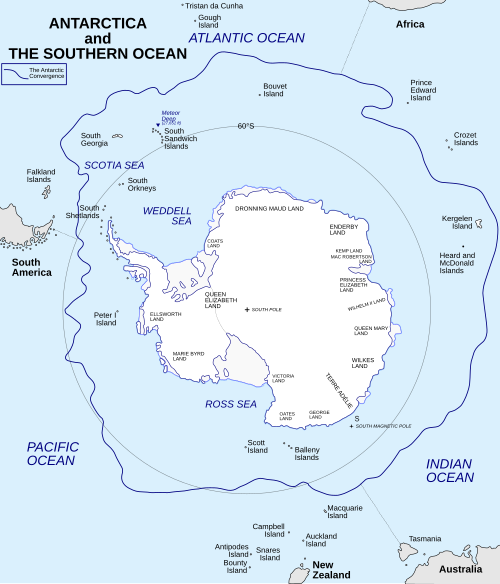
The Role of Ocean Currents
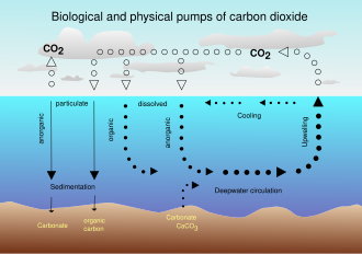
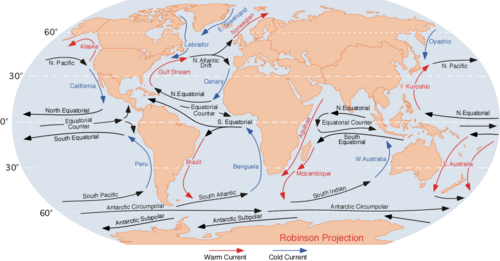
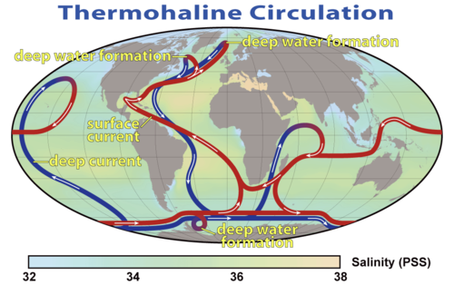
The region is heavily influenced by the Antarctic Circumpolar Current (ACC) and the global thermohaline circulation—the large-scale ocean circulation that is driven by global density gradients created by surface heat and freshwater fluxes. These systems are primary drivers of both regional and global climate patterns.
Sub-Antarctic Islands
Islands are classified as sub-Antarctic based on three primary scientific criteria: they must be located south of the Antarctic Convergence, situated within the Southern (or Antarctic) Ocean, and located south of the 60th parallel south.
| Island Name | Ocean | Administered By |
|---|---|---|
| Antipodes, Auckland, Bounty, Campbell, Snares | Pacific | New Zealand |
| Crozet, Kerguelen | Indian | France |
| Heard Island and McDonald Islands, Macquarie Island | Indian/Pacific | Australia |
| Bouvet Island | Atlantic | Norway |
| Prince Edward Islands | Indian | South Africa |
| South Georgia, South Sandwich Islands | Atlantic | United Kingdom |
Key Facts
- Latitude: Roughly between 46° and 60° south.
- Southern Boundary: Defined by the Antarctic Convergence.
- Glacial Distinction: Subantarctic glaciers are island-based; Antarctic glaciers are continental.
- Climate Driver: The Antarctic Circumpolar Current strongly influences global climate.
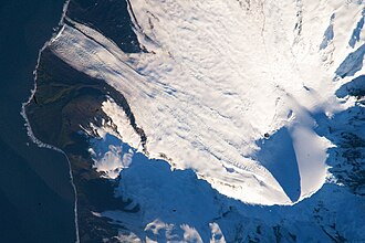
- Heard Island Ice: Approximately 80% of Heard Island is covered by ice.
Sub-Antarctic Glaciers and Climate Change
Sub-Antarctic glaciers are highly sensitive indicators of global temperature shifts. Because they are often smaller and lower in elevation than continental ice sheets, they respond more rapidly to climatic changes.
Case Study: Heard Island
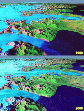
Heard Island, a volcanic island 4,000 kilometers southwest of Australia, provides a critical laboratory for measuring glacial retreat. With glaciers descending from 2,400 meters to sea level, the island's steep topography results in relatively thin ice, averaging about 55 meters in depth.
Data comparing aerial photographs from December 1947 to the early 1980s reveals a dramatic retreat, particularly on the eastern section where tidewater glaciers have moved inland. Between 1947 and 1988, the total glacial area decreased by 11%, shrinking from 288 km² to 257 km².
Specific observations include:
- Brown Glacier: The terminus has retreated approximately 1.1 kilometers since 1950, with a total ice area decrease of roughly 29% between 1947 and 2004.
- Laurens Peninsula: Due to a lower maximum elevation of 500 meters, glaciers here are more sensitive; their total area has decreased by over 30%.
- Jacka Glacier: Receded about 700 meters from the coastline by 1997.
This mass loss correlates with a measured temperature increase of +0.9 °C over the study period. Scientists attribute this recession to a combination of climatic change and volcanic activity.
Frequently Asked Questions
What is the difference between an Antarctic glacier and a subantarctic glacier?
The distinction is based on location: Antarctic glaciers are found on the continent of Antarctica, while subantarctic glaciers are located on islands within the sub-Antarctic region.
What defines the southern boundary of the sub-Antarctic zone?
The southern border is the Antarctic Convergence, which is located approximately 200 kilometers south of the Antarctic Polar Front (APF).
Why are glaciers on the Laurens Peninsula retreating faster than others?
Because the Laurens Peninsula has a lower maximum elevation (500 meters), its glaciers are smaller and shorter, making them significantly more sensitive to increases in temperature.
What are the primary causes of glacier recession on Heard Island?
The recession is attributed to two main factors: volcanic activity and broader climatic change.
Which ocean currents most influence this region?
The Antarctic Circumpolar Current (ACC) and the global thermohaline circulation are the primary drivers of the region's climate and water movement.