South-West Region, Ireland: Nature, Governance, and Economy
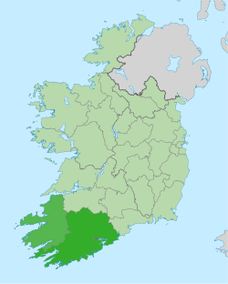
The South-West of Ireland is more than just a scenic destination; it is a strategic planning area and a vital economic engine for the state. Defined as a NUTS Level III statistical region (coded IE053)—a standardized system used by the European Union for the collection and analysis of regional statistics—the South-West encompasses the city of Cork and the counties of Cork and Kerry. Covering 12,120 km², the region represents approximately 16% of Ireland's total land area.
Governance and Administration
The administrative landscape of the region has evolved over the last few decades. From 1994 to 2014, the area was managed by the South-West Regional Authority. This body consisted of 24 elected representatives nominated from three administrative councils: Cork City Council (7), Cork County Council (9), and Kerry County Council (8). These representatives met monthly and included the region's voice on the EU Committee of the Regions.
In 2014, the Regional Authorities were dissolved and subsequently replaced in 2015 by the Southern Regional Assembly, which now oversees the area's strategic development.
Geography and Natural Wonders
Characterized by a mild climate and breathtaking landscapes, the South-West is home to some of Ireland's most iconic geographical features. The region boasts the highest mountain range in the country, MacGillycuddy's Reeks, and the twelve highest mountains in Ireland are all located within County Kerry.
The coastline is equally impressive, totaling 1,778 km including its islands. The region marks the extreme edges of the island: Tearaght Island is the westernmost point (12.5 km west of the Dingle Peninsula), while Fastnet Rock is the southernmost point (11.3 km south of mainland Cork). On the mainland, the southernmost point is Brow Head in County Cork, and the westernmost is Dunmore Head in County Kerry.
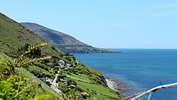
Nature enthusiasts are drawn to the Iveragh Peninsula, Mizen Head, and the Dingle Peninsula. Additionally, Killarney National Park preserves the most extensive remaining native forest in Ireland and is the only place in the country where a native herd of Red Deer can be found. The region's commitment to greenery is evident in its 132,274 hectares of forest and woodland, an area larger than six different Irish counties.
Demographics and Cultural Heritage
The South-West has seen steady population growth, driven by a high quality of life, a strong educational infrastructure, and the appeal of its natural environment. According to the 2022 census, the population reached 736,489. Earlier 2016 data showed a population of 689,750, with a density of 52.5 persons per km. The population is distributed with 78.6% residing in County Cork and 21.4% in County Kerry.
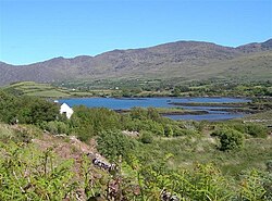
Culturally, the region is a bastion of the Irish language. It is the home of Munster Irish and contains several Gaeltacht areas—regions where Irish is the primary community language—including Muskerry, Cape Clear Island, and Dingle. Approximately 14% of Ireland's total Gaeltacht population lives here, and 2016 census data indicates that 45% of people in Cork and 43% in Kerry are able to speak Irish.
Economic Powerhouse and Infrastructure
The economy of the South-West is diverse, blending traditional industries with high-tech innovation. The region is a hub for multinational companies specializing in pharmaceuticals and electronics, while the food industry and tourism remain cornerstone sectors.
The region's financial growth has been significant. In 2012, the GDP stood at €32.4 billion with a GDP per capita of €48,500 (the second highest on the island after Dublin). By 2014, GDP rose to €33.8 billion, and by 2020, the region contributed a substantial €103.2 billion to the Irish GDP.
Employment trends also reflect this stability. In 2003, the workforce of 255,800 saw an employment rate of 95.58%, split between services (59.9%), industrial sectors (31.2%), and agriculture (8.9%). Notably, the 2016 unemployment rate of 5.7% was the lowest of any Irish NUTS region.
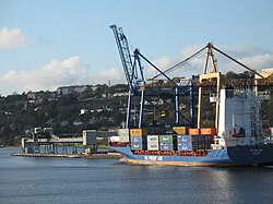
Supporting this economic activity is a robust transport network. The region is served by Cork International Airport and Kerry International Airport, providing extensive European connectivity. Furthermore, ferry services link Cork with France and the United Kingdom.
Major Settlements
The region's population is centered around several key urban hubs, with Cork City serving as the primary metropolitan center. Including its suburbs, the population of Cork City was 208,669.
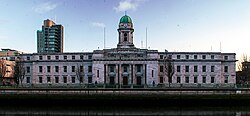
Other significant towns include Tralee, the capital of County Kerry, and various growing hubs across County Cork.
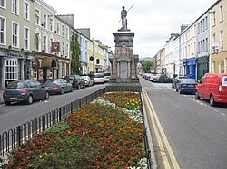
| Rank | Town | County | Population |
|---|---|---|---|
| 1 | Cork | Cork | 208,669 |
| 2 | Tralee | Kerry | 23,691 |
| 3 | Ballincollig | Cork | 18,621 |
| 4 | Carrigaline | Cork | 15,770 |
| 5 | Killarney | Kerry | 14,504 |
| 6 | Cobh | Cork | 12,800 |
| 7 | Midleton | Cork | 12,496 |
| 8 | Mallow | Cork | 12,459 |
| 9 | Youghal | Cork | 7,963 |
| 10 | Bandon | Cork | 6,957 |