Salta: The Vibrant Heart of Northwest Argentina
Known affectionately as La Linda ("The Pretty"), Salta is a province in northwest Argentina that captivates visitors with its dramatic landscapes, colonial charm, and deep historical roots. Bordering Bolivia, Paraguay, and Chile, Salta serves as a gateway to the Andes, blending high-altitude plateaus with lush jungles and fertile valleys.
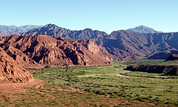
From the red-rock formations of the Calchaquí Valleys to the sophisticated wineries of Cafayate, the province offers a diverse experience that reflects both its indigenous heritage and its Spanish colonial past.
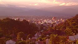
Key Facts
- Capital: Salta City.
- Area: 155,488 km², the 6th largest province in Argentina.
- Population: 1,440,672 (2022 census).
- HDI: 0.844 (Very High).
- Economy: Driven by manufacturing, mining (uranium and silver), and agriculture (tobacco, sugar cane, and viticulture).
- Geography: Ranges from the low eastern plains to the high Altiplano plateau.
History and Heritage
The exploration of the region began in 1535 with Diego de Almagro, followed by Diego de Rojas. The city of San Felipe de Salta was founded in 1582 by Hernando de Lerma. Over the centuries, the region grew in importance, eventually becoming the capital of the intendency of Salta del Tucumán in 1783.
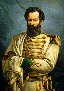
Salta played a pivotal role in the Argentine War of Independence. The Battle of Salta in 1813 was a decisive moment in freeing the territory from Spanish rule. The province was formally created in 1814 by Gervasio de Posadas, though its borders shifted over time due to internal conflicts and territorial losses to Bolivia and the separation of Jujuy in 1834.
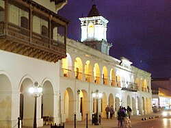
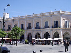
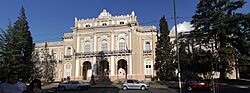
The city of Salta remains a bastion of colonial architecture, featuring the historic Cabildo and the Legislature of Salta, which stand as reminders of the province's administrative and political evolution.
Geography and Diverse Climates
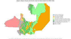
Salta's geography is defined by its extreme variation in altitude, which creates a wide array of orography (the study of the formation and relief of mountains). This variation results in several distinct climate zones.
The Eastern Plains and Yungas
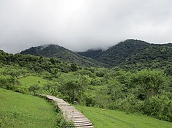
The east features a hot semi-arid climate. However, as moist winds hit the first slopes of the Andes, they create orographic precipitation—rain caused by moist air being forced upward by mountains. This results in the Southern Andean Yungas, a thick, biodiverse jungle strip.
The Valleys and Altiplano
Between the mountains and the plains lie the valleys, which enjoy a humid subtropical or subtropical highland climate. These areas are ideal for human settlement and farming. Further west is the Altiplano, a high plateau sitting between 3,000 and 4,000 meters above sea level, characterized by a cool semi-arid climate and vast salt flats.
High Peaks and Arid Zones
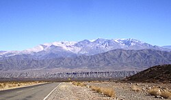
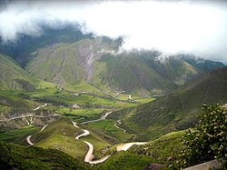
The highest western reaches of the province experience a cool arid climate with extreme temperature swings between day and night. This rugged terrain includes landmarks like the Nevado de Cachi and the winding Cuesta del Obispo.
Economy and Industry
While relatively underdeveloped compared to the national average, Salta possesses a diverse economic base. Manufacturing accounts for 20% of the economy, with significant petroleum and gas extraction in centers like Campo Durán, where a refinery is also located. Mining efforts focus on uranium in Iruya and La Poma, and silver at the Diablillos mine.
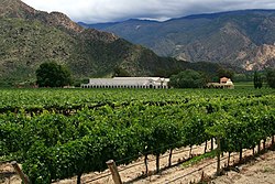
Agriculture contributes over 10% of the output. The province is renowned for its sugar cane—processed largely in San Martín de Tabacal—and its tobacco. Viticulture is a crown jewel of the region, particularly in the Valles Calchaquíes near Cafayate, where Torrontés, Malbec, and Cabernet Sauvignon grapes are grown.
Tourism and Landmarks
Salta is a premier destination for those seeking a blend of nature and culture. The capital city, Salta, is the primary hub, featuring the Museum of High Altitude Archaeology, which houses the "Children of Llullaillaco"—three remarkably preserved Inca mummies.
For adventure seekers, the Tren a las Nubes (Train to the Clouds) is a world-famous railway that climbs to 3,775 meters, crossing breathtaking canyons and cliffs to reach San Antonio de los Cobres.
![The Train to the Clouds one of the highest railways in the world, taking its way across the high peaks of the Cordillera de los Andes.[15]](/images/82/8e/828e2c34d4445bae9a67ea47e828fdd3e576b3b25b7fcd618b82d02ce06a491b.jpg)
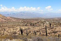
Nature lovers can explore three national parks: El Rey (Yungas jungle), Baritú, and Los Cardones, the latter of which showcases the unique High Monte landscape.
Demographics and Culture
The population of Salta is a rich tapestry of ethnicities. According to the 2010 census, approximately 6.5% of the population identified as having Indigenous background, with the Wichí, Kolla, and Guaraní being the most prominent groups. The province also has a notable Afro-Argentine community.
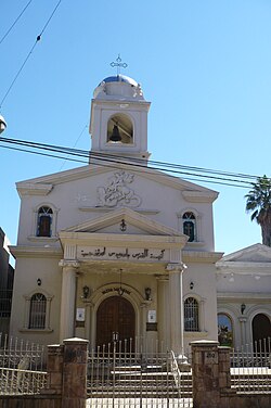
Salta is also home to diverse immigrant communities, including Syrian-Lebanese, Spanish, Italian, and a Sikh community in Rosario de la Frontera. This multiculturalism is reflected in the city's religious diversity, with the presence of the Antiochian Orthodox Saint George Church, as well as synagogues and mosques.
Provincial Overview
| Category | Detail |
|---|---|
| Total Area | 155,488 km² |
| Population (2022) | 1,440,672 |
| Administrative Divisions | 23 Departments / 58 Municipalities |
| Main Exports | Tobacco, Sugar Cane, Wine |
| Key Minerals | Uranium, Silver, Petroleum, Gas |
| Human Development Index | 0.844 (Very High) |
Frequently Asked Questions
What is the "Train to the Clouds"?
The Tren a las Nubes is one of the highest railways in the world, transporting passengers across the high peaks of the Cordillera de los Andes to an altitude of 3,775 meters at San Antonio de los Cobres.
What are the most famous wines produced in Salta?
The Valles Calchaquíes region, particularly around Cafayate, is famous for producing high-quality Torrontés, Malbec, and Cabernet Sauvignon wines.
What is the significance of the Children of Llullaillaco?
They are three frozen Inca mummies discovered on the Llullaillaco volcano, currently housed in the Museum of High Altitude Archaeology in Salta.
How does the geography affect Salta's climate?
The variation in altitude and the presence of the Andes create multiple climate zones, ranging from hot semi-arid plains in the east to humid jungles on the mountain slopes and a cool arid climate in the high western peaks.
Which indigenous groups are most prevalent in Salta?
The most populous indigenous groups in the province are the Wichí (24.9% of the indigenous population), followed by the Kolla (21.6%) and the Guaraní (13.7%).