Rosario: Argentina's Vibrant Hub on the Paraná River
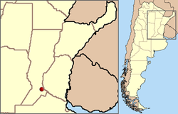
Located on the western shore of the Paraná River, Rosario is the largest city in the province of Santa Fe and the third most populous city in Argentina, trailing only Buenos Aires and Córdoba. With a city population of approximately 910,000 and a broader metropolitan area—known as Greater Rosario—of about 1.2 million people, it serves as a critical urban center roughly 300 km north of the national capital.
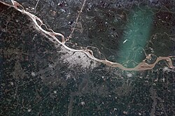
The city is situated on the smoothly undulated plains of the Pampas, resting between 22.5 and 24.6 meters above mean sea level. Its strategic position opposite the Paraná Delta islands makes it a vital link in the region, notably connected to the city of Victoria in Entre Ríos via the impressive Rosario-Victoria Bridge.
Key Facts
- Population: ~910,000 (City); ~1.2 million (Greater Rosario).
- Location: Western shore of the Paraná River, Santa Fe Province, Argentina.
- Climate: Pampean temperate climate with high year-round humidity.
- Landmark: The National Flag Memorial is the city's most recognizable site.
- Geography: Located on a plain between 22.5 and 24.6 meters above sea level.
Geography and Climate
The municipality of Rosario covers 178.69 square kilometers. The city's landscape is defined by its proximity to the river and the natural ravine that historically shaped its access to the port, specifically through the Bajada Sargento Cabral.
Rosario experiences a Pampean temperate climate. This is characterized by a hot season from November to March (averaging 18 to 32 °C) and a cold season from June to mid-August (averaging 5 to 16 °C). While summer is generally rainier than winter, residents frequently note high humidity levels throughout the year.
Natural hazards are relatively low. While some areas are prone to flooding, major events are rare. Serious earthquakes, hurricanes, and volcanic eruptions are considered virtually impossible in this region. Snow is an exceptional rarity, with the last recorded instance occurring in 1973.
| Metric | Summer (Jan) | Winter (Jul) | Annual Average |
|---|---|---|---|
| Mean Daily Max (°C) | 30.8 | 16.2 | 23.7 |
| Mean Daily Min (°C) | 18.4 | 4.8 | 11.8 |
| Avg Precipitation (mm) | 111.8 | 24.7 | 1,021.6 |
| Avg Relative Humidity (%) | 68.2 | 79.6 | 74.4 |
Urban Structure and Landmarks
The Central District
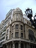
The heart of the city radiates from Plaza 25 de Mayo, which is surrounded by key civic buildings including the Palacio de los Leones (Municipality), the Basilica Cathedral of Our Lady of the Rosary, and the unique "La Bola de Nieve" building. Most of the center follows a damero (checkerboard grid) pattern.
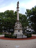
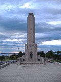
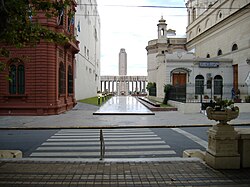
Two primary arteries define the center: Oroño Boulevard, known for its distinguished mansions and pedestrian paths, and Pellegrini Avenue, a bustling commercial hub filled with restaurants and ice-cream shops. The city's most iconic landmark, the National Flag Memorial, is located near Córdoba Street, which serves as the main downtown thoroughfare and includes a seven-block pedestrian walk.
The Periphery and Neighborhoods
Rosario has expanded significantly over time. To the south, the city extends through boulevards like 27 de Febrero and Seguí. To the west, neighborhoods such as Fisherton—originally home to English railroad personnel—mark the city's edge.
The northeast is home to Pichincha, once a red-light district and now a center for antiquities, as well as the Lisandro de la Torre neighborhood (often called Arroyito), where the Rosario Central football club is based. This area is influenced by the Ludueña Stream, which was piped underground in the 1980s to mitigate flooding.
The Waterfront
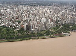
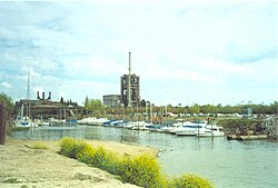
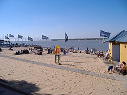
The coastline is a defining feature of Rosario's modern identity. After reclaiming land from the port and railroad systems, the city developed a series of scenic parks, including the Parque de España (funded by the Spanish government) and the Parque Nacional a la Bandera. These spaces connect the city's high ravine to the river's edge.
Naming Traditions
Many of Rosario's streets and plazas honor Argentine history. Presidents such as Carlos Pellegrini, Nicolás Avellaneda, and Domingo Faustino Sarmiento have avenues and plazas named after them. Belgrano Avenue honors Manuel Belgrano, the creator of the Argentine flag, while other streets are named after provinces (e.g., Mendoza, Corrientes) or significant dates, such as 9 de Julio (Independence Day).
Frequently Asked Questions
What is the population of Greater Rosario?
According to the 2001 census by INDEC, the metropolitan area of Greater Rosario has a population of approximately 1.2 million people.
What is the most recognizable landmark in Rosario?
The National Flag Memorial is widely considered the single most recognizable landmark in the city.
How does the climate in Rosario behave?
Rosario has a Pampean temperate climate with hot, rainier summers (November to March) and cooler winters (June to mid-August), characterized by high humidity throughout the year.
What is the "damero" pattern mentioned in the urban structure?
The damero is a checkerboard grid layout used for the city's streets, providing a regular and organized urban pattern, except in areas where terrain features like the ravine caused irregularities.
How is Rosario connected to the province of Entre Ríos?
Rosario is linked to the city of Victoria in Entre Ríos via the Rosario-Victoria Bridge, crossing the Paraná River's flood plain.