River Nene Navigation: A History of Engineering and Trade
The River Nene serves as a vital artery through the English landscape, connecting the industrial heart of Northampton to the coastal reaches of the Wash. The transformation of this river from a meandering natural stream into a managed navigation system is a saga of legislative struggle, ambitious engineering, and the constant battle against silt and flood.
Key Facts
- Primary Route: Extends from Northampton through Peterborough to the Wash.
- Key Infrastructure: Features a series of pound locks and guillotine gates to manage water levels.
- Major Port: Wisbech remains a commercial port capable of handling ships up to 260 feet in length.
- Modern Authority: The Environment Agency currently serves as the navigation authority.
- Critical Link: A 5-mile navigable link connecting the river to the Grand Junction Canal was completed in 1815.
The Upper River: Northampton to Peterborough
Efforts to make the upper Nene navigable began as early as 1567, but formal progress required the intervention of Parliament. The River Nene (Northampton to Peterborough) Navigation Act 1713 initially attempted to organize the project, but it failed to attract contractors. It wasn't until the 1724 Act that work proceeded in stages, funded by contractors who recouped costs through tolls.
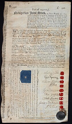
By 1737, the section from Peterborough to Thrapston, known as the Eastern Division, was complete. However, the Western Division (Thrapston to Northampton) remained a challenge until the 1756 Act allowed commissioners to borrow money. Under contractor John Smith Jnr, 20 pound locks and 20 horse haling bridges were constructed, officially opening the full route to Northampton in August 1761.
Connecting to the Canal Network
The desire to link the Nene to the Grand Junction Canal led to a complex dispute. After an initial attempt resulted in a railway link in 1805, a navigable canal link was finally built between 1812 and 1815. Supervised by Benjamin Bevan, this 5-mile stretch dropped 107 feet through 17 locks, costing £35,000.
The Lower River: Peterborough to the Wash
Below Peterborough, the river's history is defined by the struggle to maintain an efficient outfall to the sea. Early improvements included Morton's Leam in the 1470s and later Smith's Leam in 1728. The mouth of the river was particularly problematic, characterized by salt marshes and a tortuous route.
The Nene Outfall Act 1827 marked a turning point, funding a new cut below Wisbech for £149,259. This engineering feat utilized tidal scour to remove silt, leading to a dramatic increase in trade. Tonnage at the Port of Wisbech rose from 63,180 long tons in 1830 to 159,678 long tons by 1845.
Drainage and Conflict
The mid-19th century was marked by administrative complexity and legal battles. The Nene Valley Drainage and Navigation Improvement Act 1852 sought to address severe flooding, but the resulting structure was too complex to be effective. Tensions peaked in 1859 when the Wisbech Corporation successfully sued the commissioners, leading to the destruction of dams at Waldersea and the removal of the Wisbech weir.
Modern Reconstruction and Operation
By 1930, the river had fallen into a state of "unparalleled decay." The Nene Catchment Board undertook a massive restoration project, rebuilding all locks and replacing staunches (primitive water-control structures) with modern locks. They also used dynamite to clear the Northey Gravel shoal and installed piling for two miles along the Wisbech banks.
These improvements were validated during the floods of 1947, which failed to inundate the bordering lands. Today, the river supports both commercial shipping at Wisbech and leisure craft on the upper reaches.
Technical Specifications of Navigation
The river utilizes a specific lock design to handle flood conditions. Most locks feature mitre gates (V-shaped gates) at the upstream end and a guillotine gate (a vertical lifting gate) at the downstream end. During floods, the mitre gates are chained open and guillotines lifted, allowing the lock to act as a weir.
| Section | Max Boat Length | Max Boat Width | Max Draught |
|---|---|---|---|
| Upper River (Canal Locks) | 78 ft | 13 ft | 4 ft |
| Dog-in-a-Doublet Lock | 130 ft | 20 ft | 6.7 ft |
| Port of Wisbech | 260 ft | 40 ft | 17 ft |
Frequently Asked Questions
What is a guillotine gate and why is it used on the Nene?
A guillotine gate is a vertically lifting gate. On the River Nene, these are used at the downstream end of locks to allow the structure to function as a weir during floods, letting water flow straight through when the gates are lifted.
How did the Port of Wisbech improve its tonnage in the 19th century?
The construction of a new cut below Wisbech, authorized by the Nene Outfall Act 1827, used tidal scour to remove silt deposits, making the port more accessible for larger vessels.
What happened to the link between Northampton and the Grand Junction Canal?
After an initial railway link was built in 1805, a navigable canal link was eventually constructed between 1812 and 1815, spanning nearly 5 miles with 17 locks.
Who currently manages the navigation of the River Nene?
The Environment Agency is the current navigation authority responsible for the river's operation and the maintenance of its locks.
Why was the Northey Gravel shoal significant?
The shoal, combined with a sluice, prevented salt water from entering the Thorney River. It remained a point of contention until it was eventually blown up with dynamite during the 20th-century reconstruction.