Río Negro: The Lifeline of Argentine Patagonia
The Río Negro (Black River) stands as the most significant river in Patagonia in terms of its drainage basin size, population density along its banks, and agricultural output. Flowing through the Argentine province that shares its name, the river is a vital artery for the region's economy and ecology. While its name suggests a dark hue, the waters are actually more green than black.
The river's name is a literal translation of the Mapuche term Curú Leuvú. Historically, it was also referred to as the "river of the willows" due to the abundance of weeping willows lining its banks.
Key Facts
- Total Length: 635 km (approximately 394 mi).
- Basin Size: 102,000 km².
- Agricultural Impact: Produces 70% of Argentina's pears and 72% of its apples.
- Global Significance: Approximately 48% of the Southern Hemisphere's pears are grown here.
- Navigability: The lower 400 km of the river are navigable.
- Major Sources: Formed by the confluence of the Limay and Neuquén rivers.
Geography and Physical Characteristics
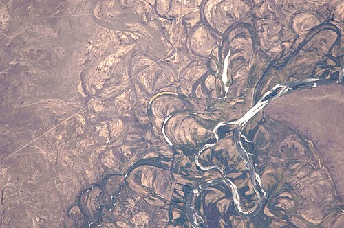
The Río Negro begins at the junction of the Limay River (originating at Nahuel Huapi Lake) and the Neuquén River (originating near Laguna Fea). This confluence occurs in the city of Neuquén at an elevation of 250 meters. From there, the river flows southeast, cutting through the Patagonian steppes before emptying into the Atlantic Ocean near the beach resort of El Cóndor, roughly 30 km downstream from the provincial capital, Viedma.
The river's flow varies significantly, with an average discharge of 762.5 m³/s at Primera Angostura, ranging from a minimum of 181 m³/s to a maximum of 2,068 m³/s.
Basin Summary Table
| Feature | Detail |
|---|---|
| Source Confluence | Neuquén, Río Negro (Limay & Neuquén Rivers) |
| Mouth | Atlantic Ocean (El Cóndor) |
| Length | 635 km |
| Basin Area | 102,000 km² |
| Provinces Crossed | Neuquén, Río Negro, Buenos Aires |
Regional Divisions and Economy
The river is geographically and economically divided into three distinct valleys. The surrounding forest width expands as the river progresses, starting at roughly 3 km in the upper reaches and widening to 20 km toward the mouth.
Alto Valle (High Valley)
Located near the river's origin, the Alto Valle is one of the most prosperous areas of the province. Major cities include General Roca, Cipolletti, and Cinco Saltos. This region is the primary hub for pear and apple plantations.
Valle Medio (Medium Valley)
Centered around Choele Choel, this region includes the towns of Lamarque, Luis Beltrán, and Pomona. While fruit cultivation continues here, the area is also famous for tomato production, with Lamarque serving as the National Capital of the Tomato. In the more arid outskirts, such as Chimpay and Darwin, cattle ranching is prevalent.
Valle Inferior (Lower Valley)
This section encompasses Viedma and the coastal cities. While fruit is still grown, the primary economic activities shift toward cattle ranching and the cultivation of alfalfa, maize, onions, and various cereals.
History and Culture
Spanish explorers first reached the inland areas of the river in 1604 while searching for the mythical City of the Caesars. In the late 19th century, during the Conquest of the Desert, the river acted as a natural boundary between indigenous territories and colonial settlements. In the 1900s, the region of Choele Choel became home to Welsh settlers arriving from Chubut.
Today, the river is also a site of athletic endurance. The Regata del Río Negro is the world's longest kayak boat-race, spanning 653 km over eight days. The competition features various categories, including Senior, Junior, and Maxi (for those over 36), as well as a non-professional Touring category.
Frequently Asked Questions
Why is it called the "Black River" if the water is green?
The name is a literal translation of the Mapuche name Curú Leuvú, though the actual color of the water is more greenish than black.
What is the economic importance of the Río Negro?
The river is crucial for irrigation and hydroelectricity. It enables the production of the vast majority of Argentina's apples and pears, including nearly half of the Southern Hemisphere's pear supply.
Which rivers form the Río Negro?
The Río Negro is formed by the confluence of the Limay River and the Neuquén River.
What is the Regata del Río Negro?
It is the longest kayak race in the world, covering 653 km in six stages over a period of eight days.
Is the Río Negro navigable?
Yes, the lower 400 km of the river are navigable.