Río Negro: The Heart of Northern Patagonia
Río Negro (Spanish for "Black River") is a stunning province located in the northern region of Argentine Patagonia. Stretching from the rugged peaks of the Andes mountains in the west to the shores of the Atlantic Ocean in the east, it is a land of dramatic contrasts. From the alpine beauty of the lake district to the arid expanses of the central plateau, Río Negro offers a diverse landscape that supports a variety of industries and a rich cultural heritage.
The province is bounded to the north by the Colorado River, which separates it from La Pampa, and to the west by the Limay River, which forms the natural border with Neuquén. Its capital, Viedma, is situated in the east near the Atlantic outlet of the province's namesake river, while its largest city, Bariloche, serves as a gateway to the Andean foothills.
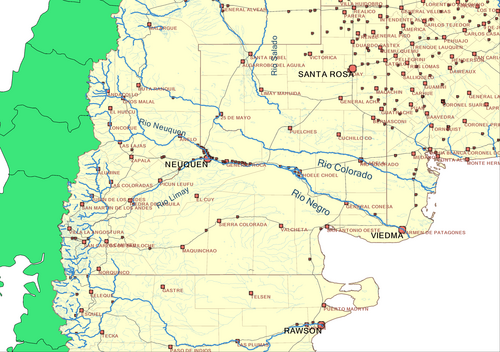
Key Facts
- Capital: Viedma
- Largest City: Bariloche
- Total Area: 203,013 km² (4th largest in Argentina)
- Population: 750,768 (2022 Census)
- HDI: 0.844 (Very High)
- Economy: Diversified service-based economy with strong agriculture and light manufacturing.
History and Heritage
The European discovery of the region began in 1520 with the voyages of Ferdinand Magellan. Later, in 1670, the Italian priest Nicolás Mascardi established the Jesuit mission Nuestra Señora de Nahuel Huapi on the shores of Lake Nahuel Huapi.
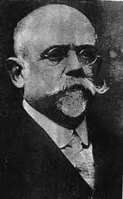
Administratively, the region was part of the Gobernación de la Patagonia in 1878 before becoming the Territorio Nacional del Río Negro in 1884, with General Lorenzo Vintter serving as the first governor. It wasn't until 1957 that Río Negro officially achieved province status, with Edgardo Castello of the Radical Civic Union (UCR) becoming its first provincial governor.
Indigenous Peoples and Immigration
Río Negro is the ancestral home of four indigenous groups: the Tehuelches, Puelches, Pehuenches, and Mapuches. While the Mapuches are now the most prominent group, archaeological evidence confirms their presence in the region long before European arrival. Originally agriculturalists, the Mapuches adopted a nomadic lifestyle upon the introduction of horses.
During the late 19th and early 20th centuries, the province saw a wave of immigration primarily from Italy, Switzerland, Spain, Germany, the United Kingdom, and Chile, contributing to the diverse cultural fabric of the region.
Geography and Climate
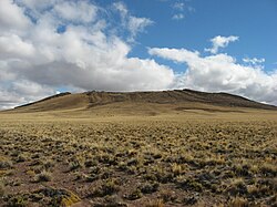
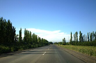
Río Negro's geography is defined by its extreme variation. The province is one of five that comprise Argentine Patagonia. The western region is dominated by the Andes, while the center consists of the Somuncurá Plateau, a high-altitude volcanic plateau.
Climate Patterns
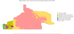
The climate is generally temperate at low elevations and very cold in the high Andean peaks. Due to marine currents in the east and high altitudes in the west, mean annual temperatures are relatively low for the latitude. The northern regions are the warmest (above 15°C), while the Cordillera often sees mean temperatures below 10°C, with peaks remaining below freezing.
Precipitation and Wind
The Andes act as a barrier to Pacific moisture, creating a strong precipitation gradient. Most of the province is dry, averaging 200 mm of annual rainfall. However, the Andean region can receive between 200 and 1,000 mm, with some areas exceeding 3,000 mm. This region typically follows a Mediterranean-like pattern with wet winters and dry summers.
Strong winds are a defining characteristic of the province, particularly in the summer. Westerly, southwesterly, and northwesterly winds are most common, with wind speeds exceeding 4 meters per second in most areas outside the north.
Economy and Tourism
Río Negro possesses a diversified economy. While services dominate, agriculture and light manufacturing are vital. The province also engages in mining, notably the gold mine at Calcatreu owned by Pan American Silver.
The Andean Tourism Hub
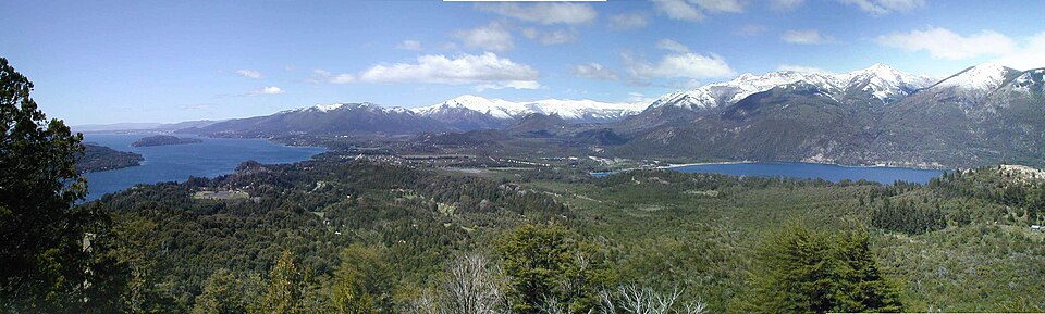
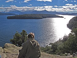
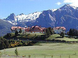
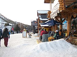
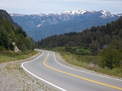
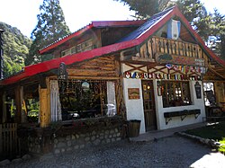
The lake district near San Carlos de Bariloche is the most visited area. Located within the Nahuel Huapi National Park, this region is famous for its trekking paths, the Camino de los Siete Lagos, and the iconic Llao Llao Hotel. Tourism is a significant economic driver, contributing at least 10% to the provincial economy.
The Atlantic Coast
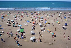
The eastern coast is a major draw for nature lovers, particularly for the sighting of Southern Right Whales. The San Matías Gulf is uniquely recognized as the only place globally where swimming with these whales is commercially permitted.
Government and Administration
The provincial government operates under three branches: executive, legislative, and judiciary. In December 2019, Arabela Carreras became the first woman elected as governor of the province.
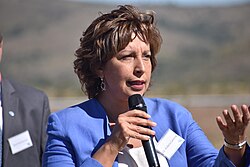
The province is divided into 13 departments, with General Roca and Bariloche being among the most populous.
| Category | Detail |
|---|---|
| Total Area | 203,013 km² |
| Population (2022) | 750,768 |
| GDP (2018) | 111 billion pesos (US$6.7 billion) |
| Human Development Index | 0.844 (Very High) |
| Administrative Divisions | 13 Departments |
Frequently Asked Questions
What is the largest city in Río Negro?
The largest city is Bariloche, located in the far west of the province within the Andean foothills.
Which indigenous groups are native to Río Negro?
The province is home to the Mapuches, Tehuelches, Puelches, and Pehuenches, with the Mapuches being the most numerous today.
What makes the Atlantic coast of Río Negro unique for tourists?
The coast is famous for Southern Right Whales, and the San Matías Gulf is the only place in the world where commercial swimming with these whales is permitted.
How does the geography affect the climate of the province?
The Andes mountains block moisture from the Pacific Ocean, resulting in a very dry central plateau and high precipitation levels concentrated on the western Andean slopes.
Who is the current governor of Río Negro?
As of December 2019, Arabela Carreras serves as the governor, making her the first woman to hold the office in the province's history.