Perth Metropolitan Region: Geography and Administrative Boundaries
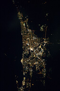
The Perth metropolitan region, also known as the Perth metropolitan area, encompasses the administrative and geographical extent of Perth, the capital city of Western Australia, and its surrounding conurbation—a continuous urban area formed by the merging of several towns and cities.
Generally, the region spans a coastal strip stretching from Two Rocks in the north to Singleton in the south, extending inland to The Lakes in the east. However, because different government bodies have different needs, the exact boundaries of the region are defined in several ways depending on the legislative or statistical context.
Defining the Metropolitan Boundaries
The most formal definition of the region is provided by the Planning and Development Act 2005. Under this act, the metropolitan region consists of 30 local government areas. This definition aligns with the Metropolitan Region Scheme and includes the following boundaries:
- North: The City of Wanneroo and the City of Swan.
- East: The Shire of Mundaring, City of Kalamunda, and the City of Armadale.
- Southeast: The Shire of Serpentine-Jarrahdale.
- Southwest: The City of Rockingham.
- Offshore: Rottnest Island and Garden Island.
The Australian Bureau of Statistics (ABS) also uses the "Perth (Major Statistical Division)" designation, which corresponds directly with the area defined by the Metropolitan Region Scheme.
Variations in Regional Classification
Not all administrative bodies agree on the exact borders of the metropolitan area. For instance, the Regional Development Commissions Act 1993 classifies the Shire of Serpentine-Jarrahdale as part of the Peel region rather than the Perth metropolitan region.
Greater Perth
To capture a broader urban footprint, the ABS uses the Greater Capital City Statistical Area, commonly referred to as Greater Perth. This area includes everything within the Metropolitan Region Scheme, but expands further south to include the City of Mandurah and the Pinjarra Level 2 Statistical Area of the Shire of Murray.
The Perth and Peel Integration
In various urban planning frameworks, such as the Western Australian Planning Commission's Directions 2031 and Beyond and the Perth and Peel@3.5 million documents, the Perth metropolitan region is grouped with the Peel region. Together, these combined regions stretch 158 kilometres (98 mi) from Two Rocks in the north to Herron in the south and currently support a population of more than two million people.
Key Facts
- Total Population: Over two million people reside in the combined Perth and Peel regions.
- North-South Span: The combined Perth and Peel area extends 158 kilometres from Two Rocks to Herron.
- Local Government: The Planning and Development Act 2005 defines the region via 30 local government areas.
- Islands: Rottnest Island and Garden Island are officially part of the metropolitan region.
| Definition Source | Key Included Areas | Notable Exclusions/Additions |
|---|---|---|
| Planning and Development Act 2005 | 30 Local Government Areas | Includes Serpentine-Jarrahdale |
| Regional Development Commissions Act 1993 | Metropolitan core | Moves Serpentine-Jarrahdale to Peel region |
| ABS Greater Perth | Metropolitan Region Scheme area | Adds City of Mandurah and Pinjarra (Shire of Murray) |
| Perth and Peel Planning | Perth and Peel regions | Extends from Two Rocks to Herron |
Frequently Asked Questions
What is the difference between the Perth metropolitan region and Greater Perth?
The Perth metropolitan region is defined by the Metropolitan Region Scheme and the Planning and Development Act 2005. Greater Perth is a broader statistical area defined by the Australian Bureau of Statistics that includes the metropolitan region plus the City of Mandurah and the Pinjarra Level 2 Statistical Area of the Shire of Murray.
Which islands are considered part of the Perth metropolitan region?
Rottnest Island and Garden Island, located off the west coast, are included in the metropolitan region's extent.
How large is the combined Perth and Peel region?
The combined Perth and Peel regions stretch 158 kilometres (98 mi) from Two Rocks in the north to Herron in the south.
How many local government areas are in the Perth metropolitan region?
According to the Planning and Development Act 2005, there are 30 local government areas within the metropolitan region.
What is the current population of the Perth and Peel regions?
The combined Perth and Peel regions are currently home to more than two million people.