Patagonian Shelf: Geography and Bathymetry of the Argentine Sea
The Patagonian Shelf, also frequently referred to as the Argentine Shelf, is a significant geological feature of the South American continental shelf. Located within the Argentine Sea on the Atlantic seaboard, this vast underwater plateau extends south from approximately 35° south latitude, bordering the coastlines of Argentina and Uruguay.
To the east, the shelf connects to a raise supporting the Falkland Islands, which eventually descends into the deeper waters of the Falklands Plateau.
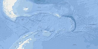
Key Facts
- Location: South American continental shelf, south of 35°S.
- Estimated Area: Between 1.2 and 2.7 million km².
- Maximum Width: Ranges from 760 to 850 km.
- Key Boundaries: Adjoins Argentina and Uruguay; separated from the Scotia Arc by the Falklands Trough.
Geological Dimensions and Structure
Defining the exact limits of the Patagonian Shelf can be challenging, leading various authorities to cite different dimensions. Depending on the criteria used, the total area is estimated to be between 1.2 and 2.7 million km² (0.46 to 1.04 million sq mi), with a maximum width spanning 760 to 850 km (470 to 530 mi).
Bathymetric Profile
The seabed of the shelf is characterized by distinct zones of slope and depth. It begins with a 100 km (62 mi) band where the seabed slopes at a rate of approximately 1 meter per kilometer. This is followed by a wide plain, ranging from 250 to 450 km (160 to 280 mi) in width, where the terrain slopes gently toward the isobath (a line connecting points of equal underwater depth) of 200 meters (660 ft).
Beyond this plain, and excluding the area of the Falklands Plateau, the seabed drops sharply. In these regions, the slope increases to as much as 10 meters per kilometer, descending to depths of 2,000 meters (6,600 ft) or more.
Regional Boundaries and the Scotia Arc
The Patagonian Shelf is geographically isolated from the Scotia Arc by the Falklands Trough. The Scotia Arc is a chain of islands extending from Tierra del Fuego to South Georgia and the South Sandwich Islands, tracing the northern edge of the Scotia Sea within the Southern Ocean.
| Feature | Measurement/Detail |
|---|---|
| Total Area | 1.2 to 2.7 million km² |
| Maximum Width | 760 to 850 km |
| Initial Slope Band | 100 km wide (1 m/km slope) |
| Central Plain Width | 250 to 450 km |
| Shelf Break Depth | 200 m isobath |
| Deep Slope Gradient | Up to 10 m/km |
Frequently Asked Questions
What is another name for the Patagonian Shelf?
The Patagonian Shelf is also commonly known as the Argentine Shelf.
Which countries' coasts does the shelf adjoin?
The shelf adjoins the coasts of Argentina and Uruguay.
What separates the Patagonian Shelf from the Scotia Arc?
The Falklands Trough serves as the geographical separator between the Patagonian Shelf and the Scotia Arc.
How deep does the seabed drop after the shelf plain?
After the gentle slope to the 200-meter isobath, the seabed can fall at a rate of 10 m/km to depths of 2,000 meters or more.
Where is the Falklands Plateau located?
The Falklands Plateau is located to the east of the Falkland Islands.