Patagonia: The Rugged Frontier of South America
Patagonia is a vast, windswept region at the southern tip of South America, shared by Argentina and Chile. Known for its dramatic landscapes, ranging from glacial fjords to arid steppes, it remains one of the most sparsely populated and wild areas on Earth. The region is defined by its extreme geography and a rich history of indigenous resilience and European exploration.
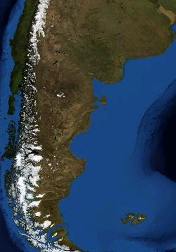
Key Facts
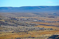
- Total Area: Approximately 1,043,076 square kilometers.
- Countries: Shared between Argentina (East) and Chile (West).
- Population Density: Extremely low, at roughly 1.92 people per square kilometer.
- Official Language: Spanish.
- Key Landmarks: The Strait of Magellan, the Patagonian Ice Sheet, and the Andes mountains.
Etymology and Origins
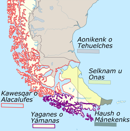
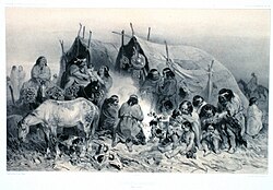
The name Patagonia originates from the word patagón. In 1520, Ferdinand Magellan used this term to describe the native tribes of the region, whom his crew perceived as giants. These people are now identified as the Tehuelche, who were generally taller than the Europeans of that era.
An alternative theory suggests the name may derive from Paphlagonia, an ancient Greek region in modern-day Turkey, which appeared in chivalric romances like Primaleon published in 1512, shortly before Magellan's arrival.
Regional Geography and Demographics
Patagonia is divided between two nations, each with distinct administrative structures and population centers.
Argentine Patagonia
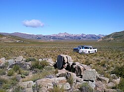
Eastern Patagonia comprises five provinces: Neuquén, Río Negro, Chubut, Santa Cruz, and Tierra del Fuego, along with the Patagones Partido of Buenos Aires Province. The population has grown steadily, reaching over 2.6 million by 2022.
Chilean Patagonia
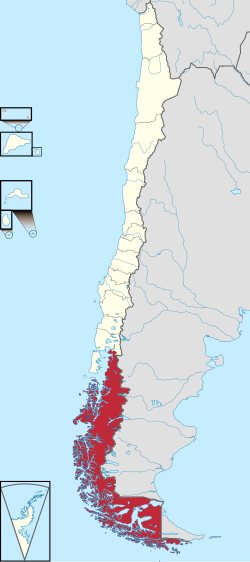
Western Patagonia consists of four regions: Los Ríos, Los Lagos, Aysén, and Magallanes. In a more restrictive definition, only the Zona Austral (Aysén and Magallanes) is considered Patagonia. The total population for these four regions was approximately 1.55 million in 2024.
Major Urban Centers
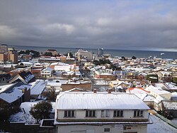
The region's population is concentrated in a few key cities. Neuquén is the largest city in Argentine Patagonia, while Puerto Montt serves as a major hub in Chile. Other significant cities include Comodoro Rivadavia, Valdivia, and Punta Arenas.
| Country | Key Provinces/Regions | Major Cities | Primary Characteristics |
|---|---|---|---|
| Argentina | Neuquén, Río Negro, Chubut, Santa Cruz, Tierra del Fuego | Neuquén, Comodoro Rivadavia, Ushuaia | Arid steppes, Atlantic coastline |
| Chile | Los Ríos, Los Lagos, Aysén, Magallanes | Puerto Montt, Punta Arenas, Coyhaique | Fjords, glaciers, Pacific coastline |
Climate and Natural Environment
![Community of jurisdictions of the Governorate of La Plata and the Captaincy General of Chile between 1570 and 1661 according to Manuel Ravest Mora[74]](/images/c9/d0/c9d0880b869a3365053d71c0c332c8936f7d27bfecb19c79af0113948729de91.webp)
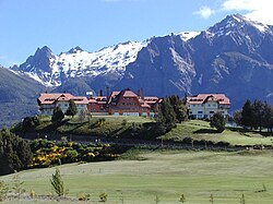
The climate of Patagonia is characterized by extreme variability and high seasonality. In the northwest, precipitation is heavily skewed toward the winter months. For instance, Villa La Angostura in Argentina is one of the rainiest cities in the country, receiving significant rain and snow from May to July.
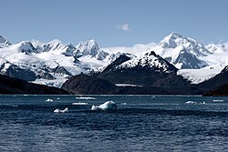
The Chilean west coast experiences a cool oceanic climate. Summer maximum temperatures range from 14°C in the south to 19°C in the north. This area is known for exceptionally high precipitation, with some local microclimates receiving over 7,000 mm of rain annually.
Fauna
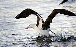
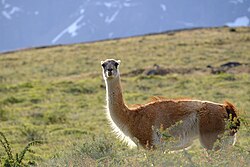
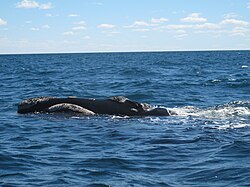
The region is home to diverse wildlife, including the Guanaco (a wild camelid) and the Black-browed albatross. The coastal waters are also prime locations for whale watching, particularly off the Valdes Peninsula.
History of the Region
Pre-Columbian Era
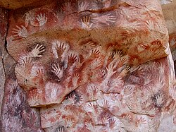
Evidence suggests continuous human habitation since 10,000 BC. Archaeological sites like the Cueva del Milodon and Tres Arroyos provide evidence of early settlers. During the late Pleistocene, "Fishtail" projectile points were used to hunt extinct megafauna, such as the Mylodon (large ground sloth) and Hippidion (native equine).
European Exploration and Colonization
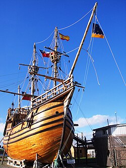
While a Portuguese voyage in 1511–1512 may have reached the San Matias Gulf, the first comprehensive exploration of the Atlantic coast was led by Ferdinand Magellan in 1520. Magellan's expedition spent a harsh winter at Puerto San Julián before continuing south.
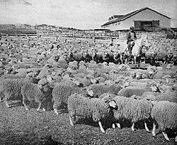
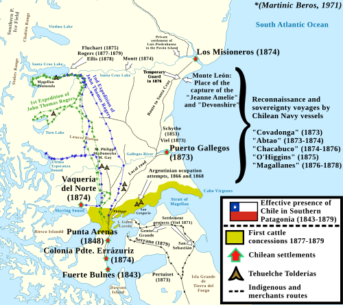
In the 19th century, Chile established a permanent presence in the south. In 1843, Fuerte Bulnes was founded, followed by the establishment of Punta Arenas in 1848, which secured Chile's claim to the Strait of Magellan. During this period, sheep farming became the dominant economic driver in the south.
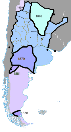
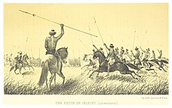
In Argentina, the Conquest of the Desert under General Roca extended national power into the Patagonian interior, displacing indigenous populations to secure the territory.
Economy and Modern Life
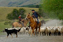
Historically, the economy relied heavily on livestock, particularly sheep ranching for wool. However, this has been eclipsed in recent decades by the extraction of petroleum and natural gas.
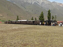
Tourism has become a vital industry. San Carlos de Bariloche is the largest tourist destination in the region, while other attractions include whale watching and historical sites like La Trochita, a former railway now used for tourism.
Frequently Asked Questions
![Map of the East Patagonia, Tierra del Fuego and Strait of Magellan Dispute. In blue and green are the boundaries claimed by Argentine[83] and Chilean[84][85][86][87] historians respectably as uti possidetis iuris in Patagonia.](/images/d3/99/d399cfd40a008196b27d9cf66d09acbb5d0e256131988f2b72b78c922d15fd86.webp)
![Territorial losses of the Republic of Chile de jure (by law) according to Chilean historiography[89]](/images/ec/31/ec31ecc3a7492305b611101dc608d9546bf73c9a741062837219396ee18dea0d.webp)
Where does the name Patagonia come from?
It comes from the word patagón, used by Ferdinand Magellan in 1520 to describe the Tehuelche people, whom he believed were giants.
Which countries share the Patagonia region?
Patagonia is shared between Argentina (Eastern Patagonia) and Chile (Western Patagonia).
What is the climate like in Chilean Patagonia?
It has a cool oceanic climate with very high precipitation, ranging from 2,000 mm to over 7,000 mm in some microclimates, and mild summer temperatures.
What were the primary economic activities in the region?
Sheep farming was the most important sector throughout the 19th century, though it has since been surpassed by energy extraction (oil and gas) and tourism.
Who were the original inhabitants of Patagonia?
The region was inhabited by various indigenous cultures, most notably the Tehuelche, as well as other groups in the southern reaches of Tierra del Fuego.