Paramaribo: The Vibrant Capital of Suriname
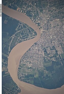
Perched on the banks of the Suriname River, Paramaribo serves as the political, financial, and cultural heart of Suriname. Known locally by the nickname "Foto" (meaning city), this coastal capital is a melting pot of ethnicities and architectural styles, housing nearly half of the nation's total population. From its colonial roots to its status as a modern business hub, Paramaribo offers a unique glimpse into the intersection of South American and European influences.
Key Facts
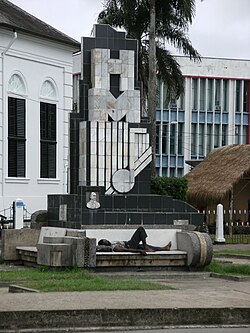
- Founded: 1613
- UNESCO Status: The Historic Inner City has been a World Heritage Site since 2002.
- Population: Approximately 252,581 (2025 estimate).
- Climate: Tropical rainforest climate (Af) with no true dry season.
- Economic Role: Consumes roughly 75% of Suriname's GDP.
The History of Paramaribo
The city takes its name from the Paramaribo tribe, derived from the Tupi–Guarani words para (large river) and maribo (inhabitants). The first Dutch trading post was established here in 1613 by Nicolaes Baliestel and Dirck Claeszoon van Sanen. While French and English traders also attempted settlements, the English eventually founded a town protected by Fort Willoughby in 1650.
The tide turned in 1667 during the Second Anglo-Dutch War when Abraham Crijnssen conquered the settlement. Under the Treaty of Breda, Paramaribo became the leading town of the Dutch colony. The fort was renamed Fort Zeelandia, honoring the Dutch province that funded the expedition.
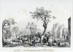
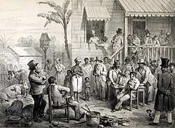
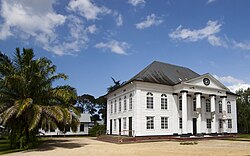
Paramaribo's social fabric was shaped by waves of migration and the legacy of slavery. The city is home to the Neveh Shalom Synagogue, one of the oldest in the Americas, reflecting the early presence of Jewish settlers. Following the abolition of slavery in 1863, the population surged after 1873 as formerly enslaved people left sugar plantations to settle in the city.
Geography and Climate
Located approximately 15 kilometers inland from the Atlantic Ocean, Paramaribo sits at a low elevation of just 3 meters. The city is characterized by an equatorial climate, meaning it is heavily influenced by the Intertropical Convergence Zone rather than trade winds, and it does not experience tropical cyclones.
Rainfall is consistent throughout the year, averaging 2,135 millimeters annually. While there is no true dry season, the period from September to November is typically the driest, while the heaviest rains fall between April and July. Temperatures remain steady, with average highs around 30°C and lows around 24°C.
Demographics and Culture
Paramaribo is celebrated for its extraordinary ethnic diversity. The population is composed of various groups, including:
- Creoles: 27% (African or mixed African-European descent)
- East Indians: 23%
- Multiracial: 18%
- Maroons: 16% (descendants of escaped enslaved Africans)
- Javanese: 10%
- Others: Indigenous (2%), Chinese (1.5%), and smaller populations of Europeans, Lebanese, and Jews.
Economy and Infrastructure
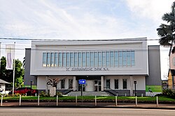
As the business center of Suriname, Paramaribo manages the revenues from the country's primary exports: gold, oil, bauxite, rice, and tropical wood. All major financial institutions and insurance corporations are headquartered here.
Transport and Connectivity
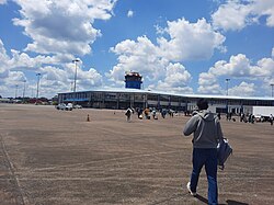
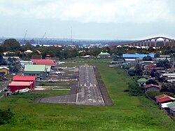
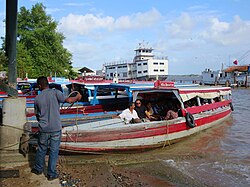
The city is served by two airports: the Johan Adolf Pengel International Airport for long-haul travel and Zorg en Hoop Airport for local flights. The Jules Wijdenbosch Bridge provides a critical link across the Suriname River to Meerzorg, while the Jules Sedney Harbour handles the bulk of the city's cargo.
Education and Healthcare
The city hosts the Anton de Kom University of Suriname, the nation's only university, alongside the national teachers academy and private institutions like AlphaMax Academy. Healthcare is provided by four major hospitals, including the Sint Vincentius Hospital and the Academic Hospital Paramaribo.
The Historic Inner City and Landmarks
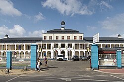
The Historic Inner City of Paramaribo is a UNESCO World Heritage Site recognized for its preserved 17th and 18th-century Dutch colonial architecture and original street plan. This area serves as a living museum of the city's colonial past.
Notable Sites to Visit
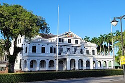
- Presidential Palace: The seat of government, featuring the adjacent Garden of Palms.
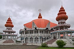
- Religious Diversity: The city showcases harmony through the side-by-side location of the Mosque Keizerstraat and the Neveh Shalom Synagogue, as well as the Arya Diwaker Hindu Temple.
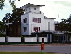
- Civic Buildings: The National Assembly of Suriname and the Roman Catholic St Peter and St Paul Cathedral.
- Fort Zeelandia: The historic fortress that marks the city's early military origins.
City Overview Summary
| Category | Details |
|---|---|
| Coordinates | 05°51′08″N 55°12′14″W |
| Area (Capital City) | 182 km² |
| HDI (2022) | 0.708 (High) |
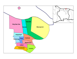
| Administrative Divisions | 12 Resorts |
| Sister Cities | Antwerp, Hangzhou, Willemstad, Yogyakarta, Miami-Dade County |
Frequently Asked Questions
Why is the inner city of Paramaribo a UNESCO World Heritage Site?
It was designated in 2002 because the original 17th and 18th-century Dutch colonial architecture and the street plan have remained largely intact and preserved.
What is the climate like in Paramaribo?
The city has a tropical rainforest climate. It is warm and humid year-round with average temperatures between 24°C and 30°C, and it receives significant rainfall (about 2,135 mm annually) with no true dry season.
What are the main economic drivers of the city?
While the city doesn't produce goods, it is the financial hub where revenues from gold, oil, bauxite, rice, and tropical wood are managed. It also sees growing importance in the tourism sector.
How diverse is the population of Paramaribo?
The city is highly diverse, with significant populations of Creoles (27%), East Indians (23%), Multiracial individuals (18%), Maroons (16%), and Javanese (10%), among other ethnic groups.
Which airports serve the city?
Paramaribo is served by the Johan Adolf Pengel International Airport for international arrivals and Zorg en Hoop Airport for local and regional flights.